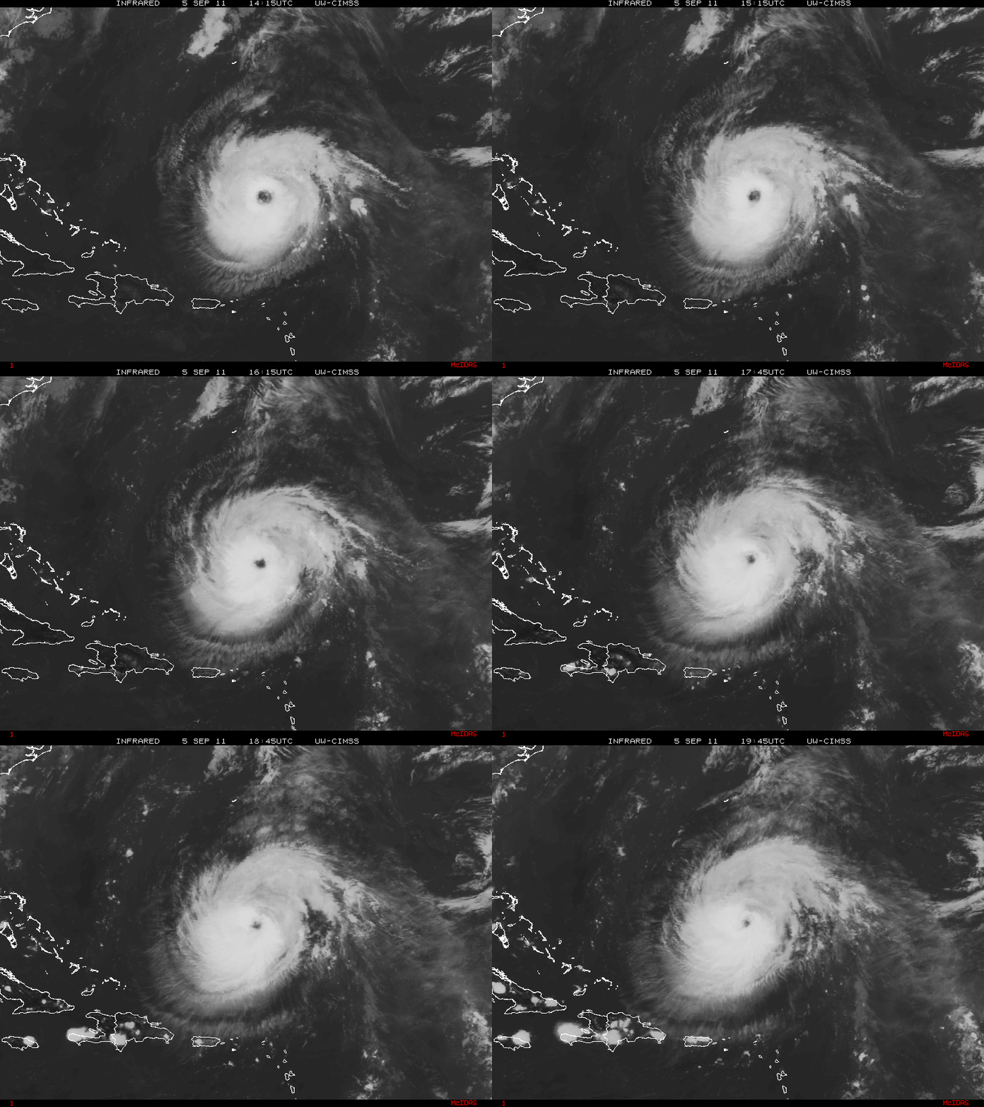
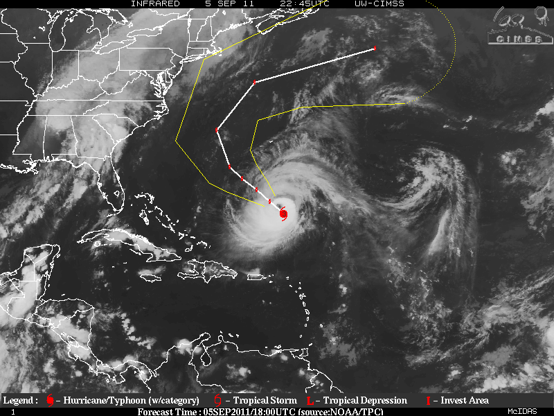
Hurricane Katia regained hurricane status again yesterday then the Rapid Intensification leveled off. Katia is a category two hurricane but the environment will be in place for Katia to intensify again to a category three storm. During the early morning hours, Katia was struggling for a short period of time as an Eyewall Replacement Cycle (ERC) was allowing some dry air to enter the inner core of the storm. This has finished and Katia started to have a very large eye but is now contracting, and the upper levels of the environment became conducive for further intensification within the next 6-12 hours and as of the 5PM advisory today, Katia became a category three hurricane. Oceanic heat will not be a factor this time so intensification will be limited for 48-72 hours or so. After that forecast period, vertical shear will be on the increase along with cooler waters. No matter where the storm goes, there will be very dangerous swells and rip tides, along the US east coast and Bermuda, please be careful!!!
EDIT: Extremely Powerful Hurricane Katia has been upgraded to category Four storm, as of the 11PM advisory for the NHC.
Katia is moving NW around the southwestern periphery of a central Atlantic high pressure system(subtropical ridge) and also a very deep trough that is in the eastern US and the western Atlantic ocean. Although there are some differences in the models, there should be a decrease is the forward speed within the next 36-48 hours. The track guidance within most of the models is very good and a very sharp recurve is forecast that hopefully will take the center of Katia between Bermuda and the the US east coast.
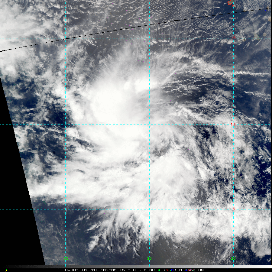
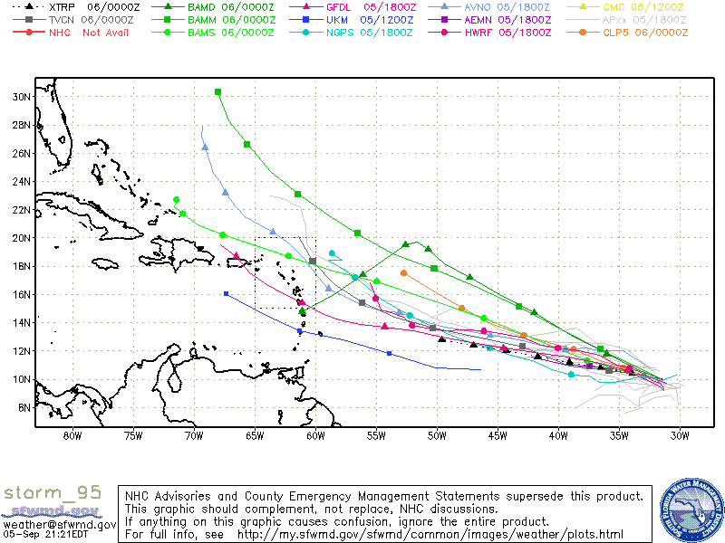
Invest 95L is a strong and very well established tropical wave with excellent cyclonic turning. The environment for Invest 95L will be conducive for further development and a tropical depression may form within the next 24-48 hours, if not sooner. Since this system has really just got started and the time the models were initiated, track guidance will not be the best in the beginning runs. Furthermore, there is no LLC as of yet and it seems at least this year, many models have had a bias too much to the north. The GFS 18z run has 95L well east of Florida at 156 hours where as the Euro (ECMWF) has it just off the coast of Florida at 216 hours. Whether or not 95L develops and if so, will it be a low rider (heads due west into the western Caribbean) or is a storm that may affect the Windward/Leeward Islands, Bahamas, Florida – is just to early to forecast at this point.
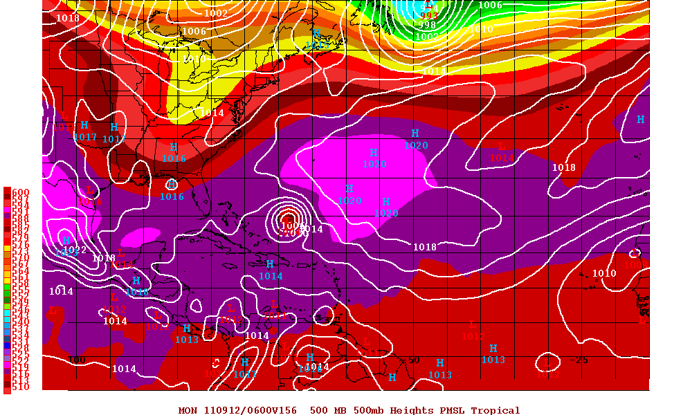
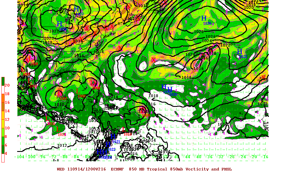
Elsewhere in the tropics, Some models are hinting that there might be some development of a system in the Bay of Campeche in the Gulf of Mexico. The GFS run has backed out for now but the ECMWF is still hinting something will form. With the Monsoonal trough near the East Pacific and especially the MJO in a upward motion in that area in 8-10 days from now, development is not far fetched.
