Categories
Science Tropical Weather

2013 Atlantic Hurricane Season: A Busted Forecast

Although the 2013 Atlantic hurricane season has not yet concluded and we still have November to contend with before the season will officially be over, all indicators are beginning to make it obvious that the end of the show is near. If you recall in my July hurricane season forecast , all signals were looking for an active season. All the criteria seemed to fit but for some unknown reason, a big piece of the puzzle has alluded forecasters as to why this years hurricane season was very, very below normal. Yes, the Atlantic basin did have a total of 13 named storms, so in one sense the season has been “active” but there were only 2 hurricanes and both were minimal category 1 hurricanes. However, 13 named storms does really cannot tell the whole story.

So, how do we get a better feel of the hurricane season activity for this year? One method called [tooltip title=”ACE” content=”Accumulated Cyclone Energy” type=”info” ]ACE[/tooltip] Index. ACE Index is using a sum of the energy accumulated with all the cyclones (tropical storms, sub-tropical storms and hurricanes) that happened to form within the hurricane season. Calculating ACE is done by using the square of the the wind speed every six hours during the storm’s lifetime. Remember, a tropical depression is below 35 knots and it is not added. Hence, a cyclone that is longer lived will have a higher ACE indices verses a shorter lived cyclone which will have a lower ACE indices.  ACE indices of a single cyclone is windspeed (35 knots or higher) every six hour intervals  (0000, 0600, 1200, 1800 [tooltip title=”UTC” content=”Coordinated Universal Time (UTC) is the primary time standard by which the world regulates clocks and time.” type=”info” ]UTC[/tooltip]) or ACE = 104 kn2.

Total ACE:

$latex \Sigma = \frac{Vmax^2}{10^4} \ &s=2\ $

* Vmax is estimated sustained wind speed in knots. *

An average seasonal ACE in the Atlantic is between 105 -115 or mean average of 110. Although technically we are in a Neutral state, this season “almost” seems more like a El Niño year. An El Niño tends to hinder tropical cyclone development in the Atlantic, due to higher amounts shear. But in a true El Niño year, you normally will have a very active season in the East Pacific (EPAC), with a few major hurricanes, and a subdued Atlantic.

2013 Atlantic ACE
Tropical Cyclone Name
Max Wind Speed (in Knots)
ACE 104 kn2
Andrea
55
1.6175
Barry
40
0.7625
Chantal
55
2.4800
Dorian
50
2.5725
Erin
40
1.5450
Fernand
50
0.6550
Gabrielle
55
1.8150
Humberto
80
8.9375
Ingrid
75
4.9000
Jerry
45
1.9450
Karen
55
2.2675
Lorenzo
45
1.6200
Melissa
55
3.4725
No-Named Storm (AL152013)
45
1.4000
——–
ACE Total:
36.1200

As part of the post-season review, the low pressure system in December(AL152013) was classified as a subtropical cyclone and the ACE Index has been updated to reflect the ACE numbers during it’s short lived status as a subtropical cyclone.

Two notes of interest: One is that of the two hurricanes this year, Humberto was just hours from beating the record for the latest first Atlantic hurricane of the season. Secondly, this will be the 8th year in a row where the Atlantic hurricane season has not had a major hurricane (category 3 or higher). In fact, 10/24/2013 was the 8th anniversary when Hurricane Wilma made landfall on the southwestern side of Florida as a Category three hurricane and headed northeastward and the areas of the Miami-Dade, Broward, and Palm Beach counties were impacted with category two winds. If by at the end of this year hurricane season with no major hurricanes, we will tie the record.

So is there a last hurrah for one or two more storms or is it time to fold the tents and call the season over? Technically, no as the hurricane season does not oficially end until November 30. This does not mean a cyclone cannot develop. It is just that a cyclone developing after the official season is over, is a somewhat rare event, but it is not impossible. Usually any late season storms develop either in the Southwestern Atlantic or more likely in the Caribbean. The two late season cyclones late that come to mind were Sandy (2012) and Mitch (1998). As of yet, it appears that the rest of November will be quiet and although there is a chance development of in the Caribbean due to the [tooltip title=”MJO” content=”Madden Julian Oscillation – lift  or upward motion into the atmosphere allows easier development of a tropical cyclone increased convection/thunderstorms activity.” type=”info” ]MJO[/tooltip], I am somewhat skeptical on that. I won’t rule it out yet but for the moment I just am not convinced this will happen, IMHO.

As always, remember to always keep an eye to the sky and to always stick with official information, either your local [tooltip title=”WFO” content=”Weather Forecast Office” type=”info” ]WFO[/tooltip] or the NHC

Categories
Miscellaneous/General Science Tropical Weather

Hurricane Katia

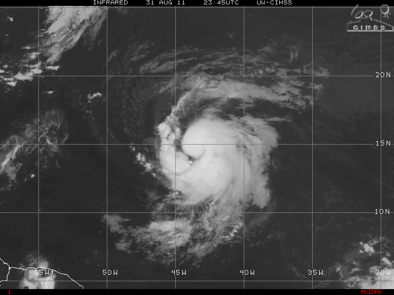
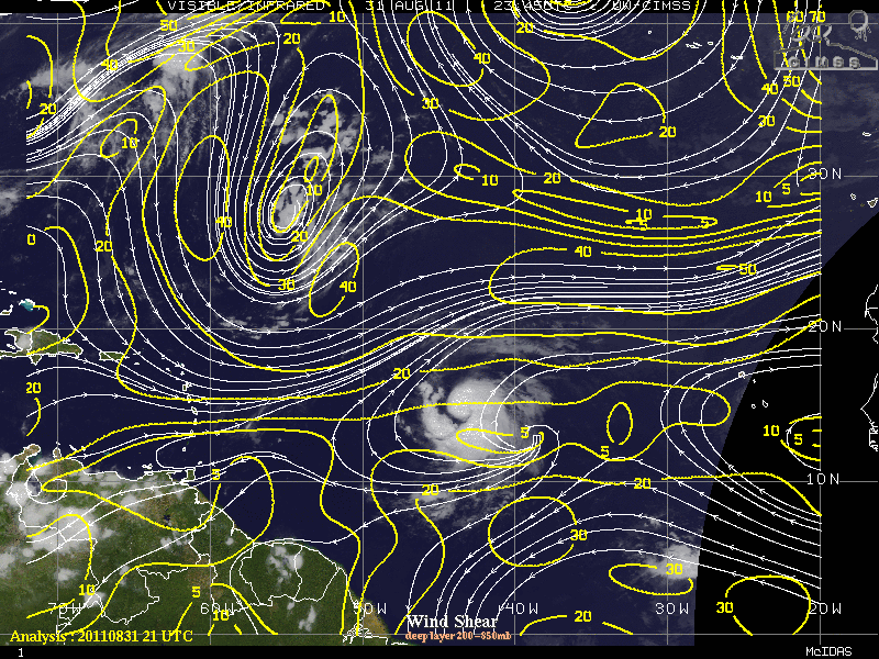
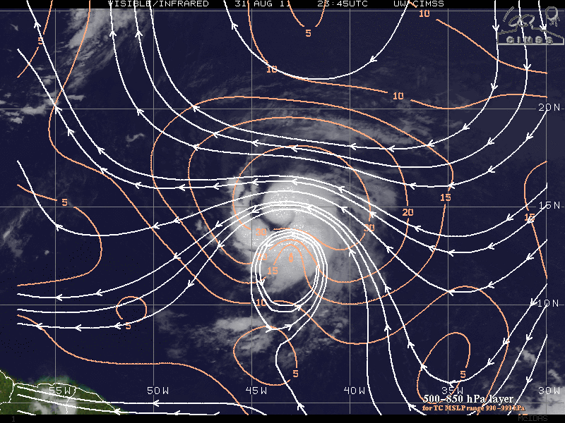
A large tropical wave near the Cape Verde Islands had been tagged as Invest 92L and upgraded to Tropical Depression Twelve and later was upgraded to Tropical Storm Katia by the NHC. Tropical Storm Katia as had excellent cyclonic turning before it even exited the coast of Africa. Katie is a well organized system, and is well is the process of developing an excellent Central Dense Overcast (CDO) and in fact is becoming more symmetrical via satellite presentation. Katia is moving at a fast clip of 20 MPH and has pretty much stayed on the 285 degree (WNW) track with a few wobbles now and then. An upper level low to the NW of Katia may, in time, become a role in the intensity of Katia, but should be a hurricane within the next 12-24 hours. The same upper level low may also induce some southwesterly shear, possibly within 96- 129 hours. At the same though, weak vertical shear and warm SST’s may be able to overcome the shear and allow further strengthening.
EDIT: As of the 11pm advisory tropical storm Katia has been upgraded to Hurricane Katia

Although it is way to early as to where Katia will be heading in the long term forecast, here are 3 trains of thought.

  1.  Katia stays west and heads into the Caribbean and is a threat to the western Caribbean and possibly later into the GOM.
  2.  Katia continues its WNW and either is a threat to the Lesser Antilles or is north of the Antilles and later turns NW toward the US coastline.
  3. Katia continues its WNW track, then NW, and eventually heads north possibly threatening Bermuda and even possibly heading into the Canadian maritimes or even recurves out to sea threatening no one.

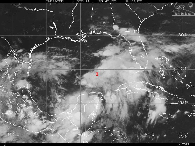
Another fly in the ointment is an area of low pressure near western Cuba (now tagged as Invest 93L). That area possibly may develop into a tropical cyclone. This may have implications as to where Katia may head later in the forecast period.

Scenario 1 where Katia stays in the Caribbean, has a very low chance, maybe 10% and thats being generous. Katie is already at 14.4 °N latitude and slowly gaining. Unless something drastic happens, I just can’t see that scenario 1 will ever play out, but I don’t want to rule it out.

Scenario 2 where Katia possibly threatens the Lesser Antilles or is 100 miles north of the islands, this has maximum of a 30% chance. If Katie has not made the turn from WNW to NW then this scenario might happen. The trough that is forecast is either to weak or pulls out early, this may allow Katia to head a little further west than forecast. It also is dependent on that area of low pressure in the southern GOM has developed into a tropical cyclone or not (I will allude to that later).

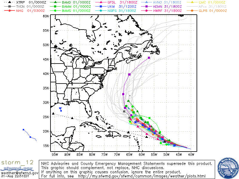
Scenario 3 – recurving and not hitting the eastern coast of the US but possible impacting Bermuda. This scenario has the highest chance – 60% chance. At this moment, most of the models are very much in agreement. Katia should begin to turn to the northwest and eventually turn north because of the trough that will situated over the eastern US by Monday of next week.

Assuming that scenario 1 is out of the picture , lets visit the area of low pressure in the southern Gulf (93L).

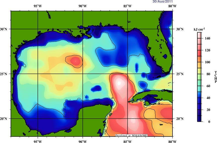
In the Eastern Pacific, the western Caribbean and into the southern GOM, along with an old frontal boundary that runs along Florida to the western GOM, a surface low may be trying to form possibly to the north of the Yucatan. Some models are supporting this and this may head NW toward the Texas area. The oceanic heat is very warm in this area (in some areas, 30°-31° Celsius) and a depression or tropical storm (Lee) most likely will develop. The ridge over Texas is still strong but a shortwave trough might have enough punch to create a weakness in that ridge in a few days. As the trough gets closer to Texas, this may cause the 93L to stall or drift for a few days. Even if this system does not have “landfall” in Texas, this may create enough rainfall to help the relief in that area.

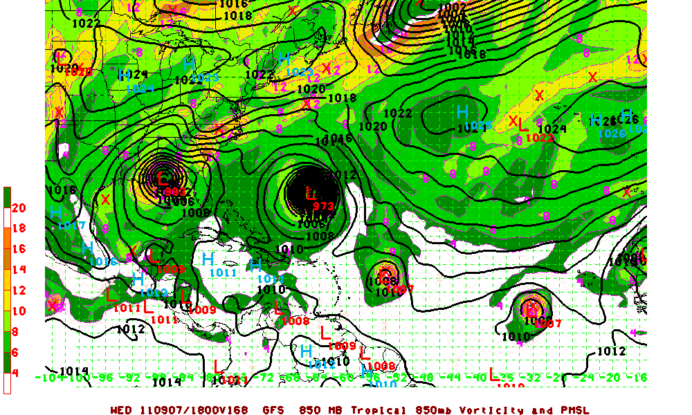
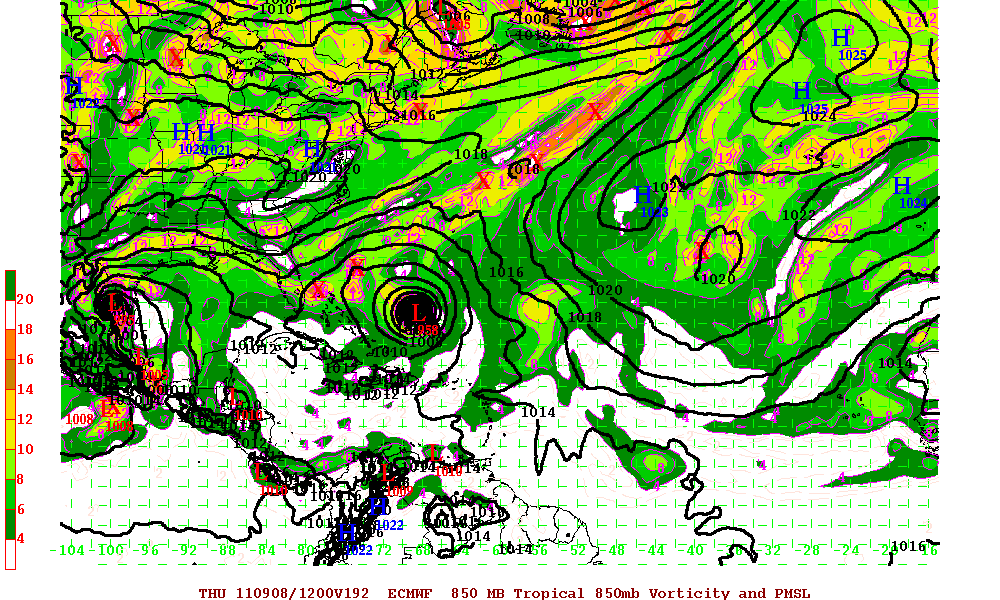
Back to Katia, and scenarios 2 and 3. If 93L develops to become a named storm “Lee”, then a ridge would be in place in the west central Caribbean. With 93L in the Gulf, Katia in the Atlantic and the ridge between the two, this would be enough to force Katia northwest and should keep Katia from the eastern coast of the US or at least the southeast coast.

GFS Model at 168 hours

ECMWF Model at 192 hours

Again, this is just a long term forecast – which ever scenario plays out – all of them will have changes in them. As always, remember to always use the official information from your local NWS and the NHC.

Categories
Science Tropical Weather

Hurricane Specialists

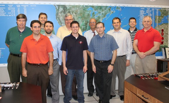
Have you ever wondered who the hurricane specialists (forecasters) are at the National Hurricane Center (NHC) other than just their names you might see on the reports they produce during the hurricane season?

These people are the very best in their field. Not anyone can work as a specialist at the NHC. Only the best of the best were chosen. Although there will be those people who criticize every aspect of what the NHC does, thankfully those people are in the minority. These specialists do more than just view different satellite views and use some of the fantastic software they have (NAWIPS, ATCF, etc.) before they they write up the advisories, forecasts, warnings and other public products – there is a lot more behind the scenes. One thing the general public may not understand is that the specialist when writing up any of these advisory products, there are specific guidelines in how the report is written although there a few qualifiers that do allow some “freehand text” in a few of the reports. The forecaster will check on the latest model runs as this allows the specialist to help forecast where the storm might be heading. The data from the recon aircraft comes from the folks in the CARCAH (Chief Aerial Reconnaissance Coordination, All Hurricanes) office. The forecaster will have many conversations with whoever is staffing that office during the course of a recon mission – as that person is their link to the aircraft crew. The forecaster will also be checking with the TAFB (Tropical Analysis and Forecast Branch) as they provide a storm intensity estimate. The Hurricane Specialist uses the TAFB estimate as guidance but the Specialist will consider all available data in determining the intensity for the advisories.

A normal 6 hour forecast cycle;
The cycle begins, and 45 minutes later there is the reception of the fix data although that is the deadline time. The vast majority are in specialists hands 15 to 30 minutes after synoptic time. Aircraft fixes usually come right at synoptic time or even a bit earlier. An hour after the cycle started – the models are initialized. Again, that is the deadline time, usually the initialization of the models start a bit earlier. A few minutes later, the forecaster receives model guidance and starts the preparation for writing up the forecast. The primary text products in the forecast are the tropical advisory, forecast/advisory, and discussion. The second hour after the cycle started, the hotline call to both the (NWS) National Weather Service and the (DOD) Department of Defense is made. On the third hour, the forecaster has a deadline to release the tropical advisory products. Hours four and five are for possible media interviews. On hour six, the next cycle begins.

When storm watches or warnings are activated or during a landfall event the media is in the NHC building, but usually it’s the Director (Bill Read), Deputy Director (Ed Rappaport, PhD), or the Branch Chief (James Franklin) doing those interviews, not the Specialist on duty. There are a few times after the the advisory has been posted someone from the media may call and the forecaster on duty may answer any questions they may might have. When landfall is imminent within a stretch of shoreline, Federal and state level Emergency Managers, the NHC has someone who acts as a liaison between the EM’s and the NHC. Local EM’s are supposed to be in touch with their local WFO (Weather Forecast Office), who in turn relay their concerns to the NHC.

When hurricane season ends (officially) November 30th, the hurricane specialists remain busy outside the hurricane season. Occasionally, storms form before the official beginning of the hurricane season and also after the official end of the season, so specialists still have the responsibility with that storm too. They also have to attend some national and international hurricane conferences. The specialists do help the CPC (Climate Prediction Center), basically to prepare for the annual seasonal hurricane forecast. The specialists must also write seasonal summary articles and also participate in some applied research projects.

So each hurricane season these specialists (and who get little recognition) are the ones that have to deal with criticism when their forecast might be off, but more times they are very close in their forecast. Maybe it’s time for people to really thank the specialists for all the hard work they do.

Photo credit – Dennis Feltgen

Categories
Tropical Weather

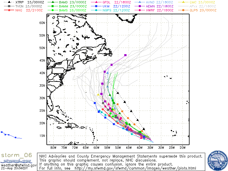
Tropical Storm Danielle

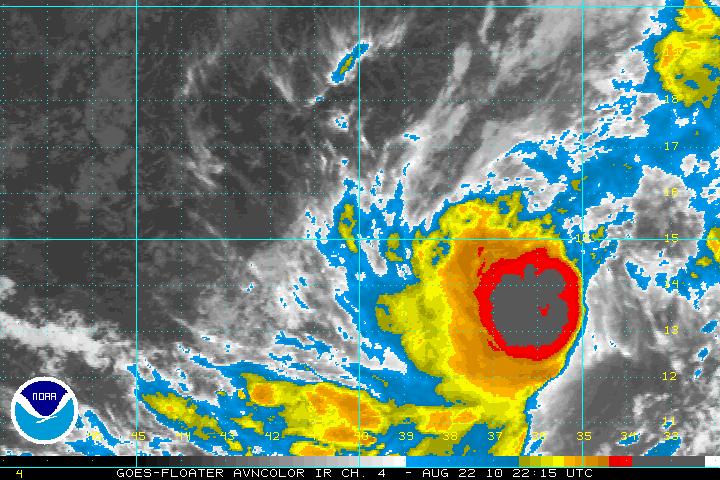
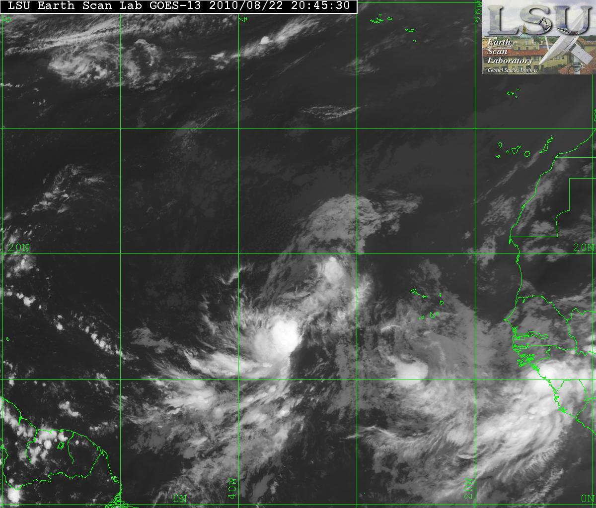
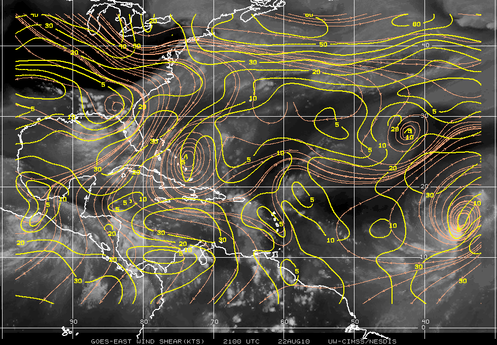
The expectations of what was TD Six has now been upgraded to TS Danielle at 5:00PM. During the day today, a lot of strong thunderstorms with some very cold cloud tops…some down to -85°C, made the forecasters at the NHC to make the upgrade. The colder the cloud tops – the better for storm development. The visible satellite shows that Danielle is continuing to experience the moderate shear from the east and southeast. This will be relaxing within 24-48 hours and this will allow Danielle to intensify to at least minimal hurricane status. Later, some of the models want to bring Danielle to a major hurricane. This will only be for a short period of time as the forecast is for vertical shear will begin to erode the intensification.

AVN Satellite image
Visible Satellite image
Wind Shear

Although during the day today Danielle the movement was a bit northward, it has returned back to WNW and should stay that way for 48-72 hours. After that a break in the subtropical ridge will allow Danielle to head NW and away from the US coast. Depending upon how long Danielle continues the WNW movement, Bermuda may be affected.

Models for Danielle
Categories
Tropical Weather

Invest 93L

Starting yesterday, a system was beginning to catch the eyes of those who are interested in the tropical weather. A modest to strong region of very intense thunderstorms that are in the Caribbean are beginning to look like that we may soon have the first tropical depression (at least in the Atlantic basin). Wind shear in the area is very low, the SST’s are very warm – 29 to 30 degrees Celsius. The MJO (Madden-Julian Oscillation) also does seem to favor tropical development. It is now in the wet-phase over that region. One negative side is there has not been a lot of spin according to the University of Wisconsin 850 mb relative vorticity analysis. 93L will probably begin to get an increased inflow from low level air and help the development of the spin soon.

At this time the NHC is calling for a 40% chance of developing of into a tropical depression. I wouldn’t see that until at least Wednesday maybe even Thursday. The GFS, NOGAPS, and UKMET models have been very reluctant to develop 93L for the time being. The GFDL model is expecting 93L to be a weak tropical storm in the next 5 days. At this time – the GFDL has been flip-flopping so lets just see what happens.

One worry is the possible flooding in Haiti. Any mudslides then there will be some unfortunate deaths. Lets just pray this will not be the case. Haiti has had enough over the past couple years.

As always – please use the NHC or your local weather for official information.