Categories
Science Tropical Weather

Invest 96L / Pouch P17L

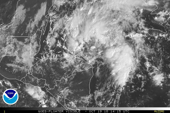
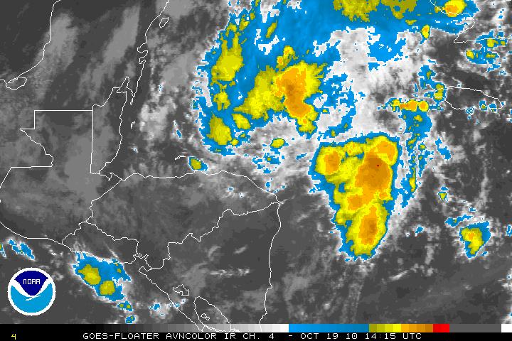
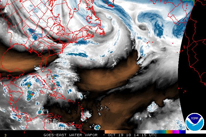
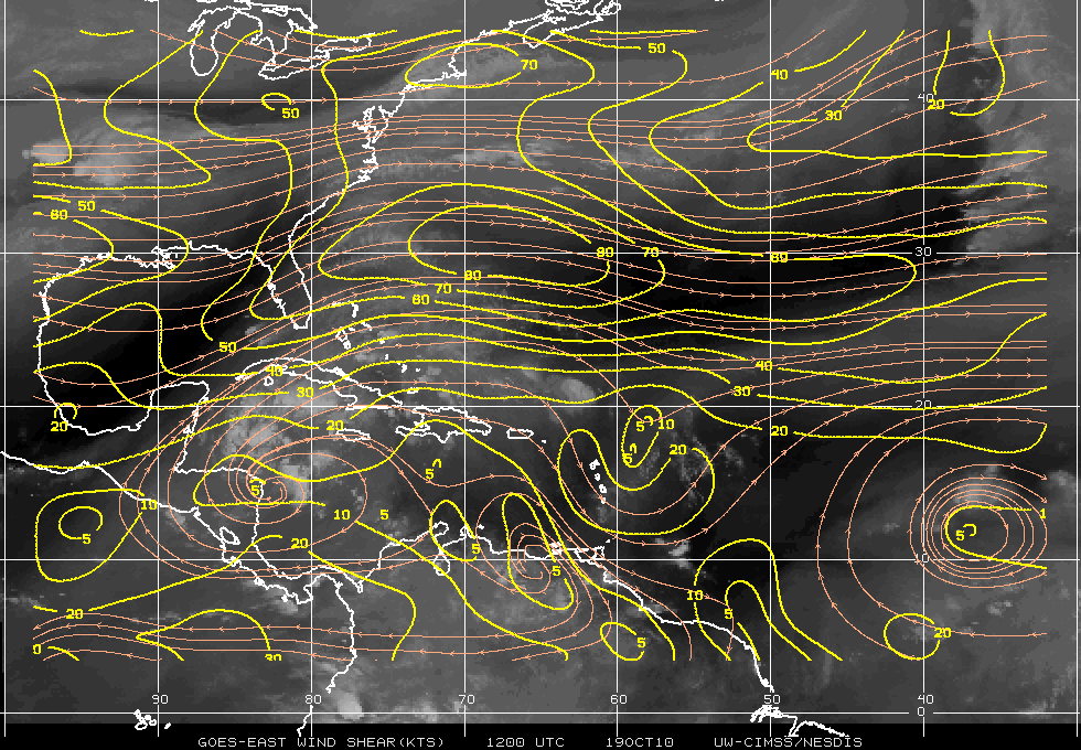
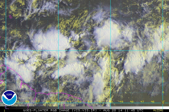
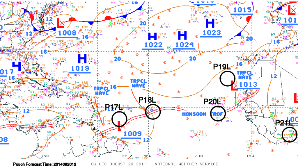
The tropical disturbance that has been slowly moving westward and heading toward the Caribbean has been designated by the [tooltip title=”NHC” content=”National Hurricane Center” type=”info” ]NHC[/tooltip] as Invest 96L as of 08_19/1800Z. This tropical disturbance was one of the waves that came of the edge of Africa but due to the very very air and some vertical shear, 96L never had a chance to try to develop into something tropical. The dry air and shear are abating and with an ULL to the NW of 96L, increased upper divergence is now allowing 96L to ventilate and possibly have an outflow for further development. I want to make it extremely clear that although 96L is looking much better, it is still way to early to determine exactly what the track and intensity of 96L will be. There has also been some discussion as to whether or not Invest 96L(pouch P17L) and Pouch 18L which is just east of Invest 96L and will the two be two separate entities or merge into one system. Again it is still too early as both disturbances are still somewhat disorganized right at the moment albeit 96L is slowly getting organized.
96L
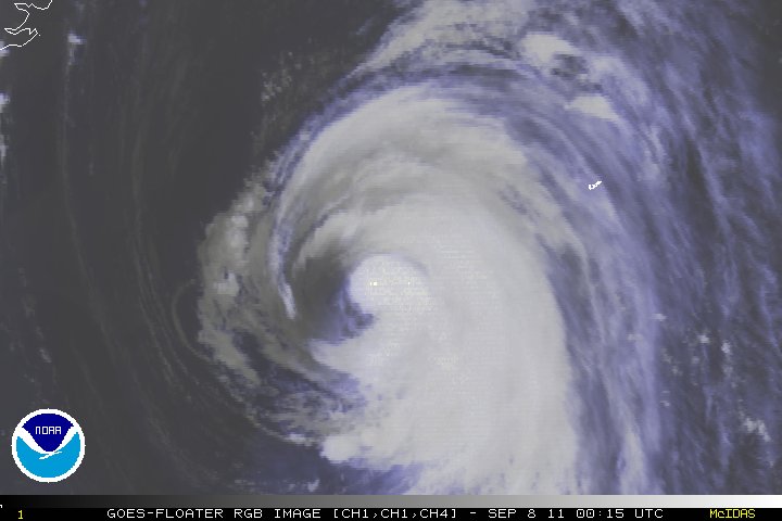
Satellite imagery of 96L

Credit: NOAA Satellite Services Division
Pouch Map
Pouch Map


Invest 96L is presently heading westward at around 15 MPH, and is being steered in the region of southern periphery of the subtropical ridge. If 96L continues the same speed, within 72-84 hours 96L should begin the feel a weakness in the ridge and head slightly WSW. This weakness in the ridge should be near or around the edge of the Bahamas or possibly a little later. Since 96L is still a tropical disturbance and has not even become a tropical depression, there are still too many variables so I want to exercise caution and not get ahead of ourselves and not make assumptions in what the forecast holds in the during the next 48-72 hours. If 96L continues to organize during the next day or so, an upper level anticyclone may park itself over 96L which should allow further intensification.

It would be unwise and irresposible for me to post any of the model forecasts, both track and intensity of 96L, at least for the time being. The different models are nothing but a tool for the hurricane specialists, nothing more, nothing less. I understand many want to see the different models, but the models change, sometimes with major shifts. People need to understand that the models have to taken with a grain of salt. Unless you have the skills in meteorology, be very careful as this inaccurate information has a snowball effect and causes a major headache for the NHC. When it looks as if the models begin to have a consensus, then I may post them. For now, will only post satellite imagery and any other graphics that might be useful.

Although care has been taken in preparing the information supplied through the Weather or Knot blog, Weather or Knot does not and cannot guarantee the accuracy of it. If you require an official forecast please contact your local National Weather Service Office or the National Hurricane Center.
Categories
Science Tropical Weather

Tropical Storm Ophelia – A Little Stronger??

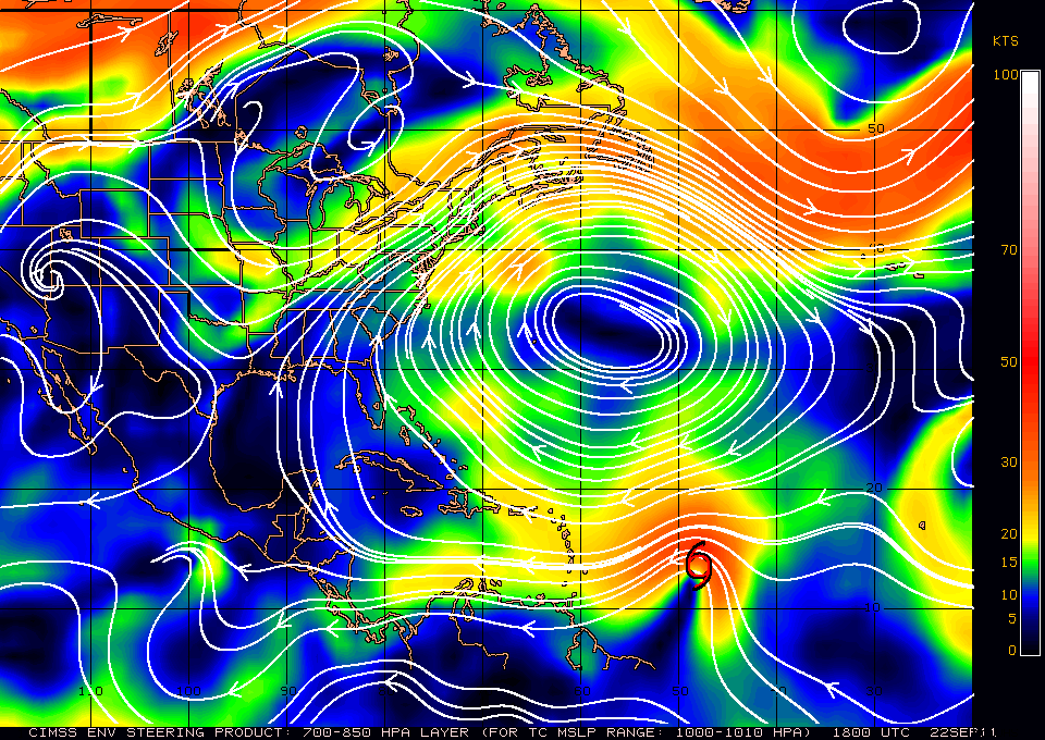
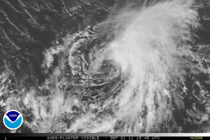
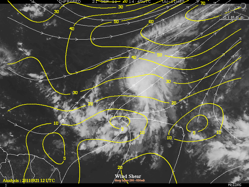
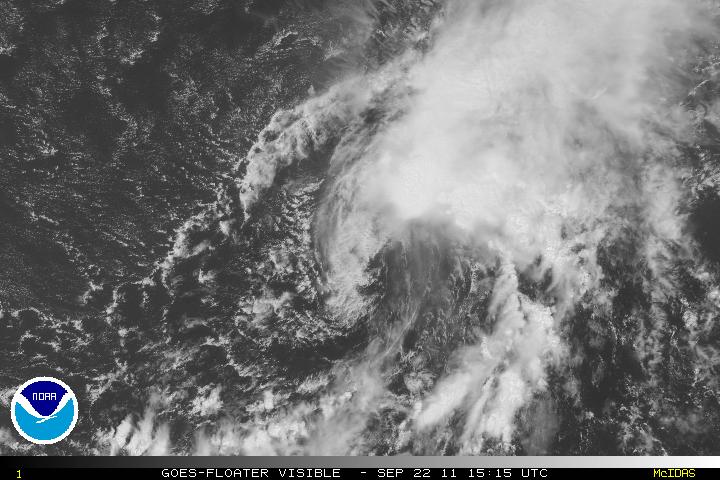
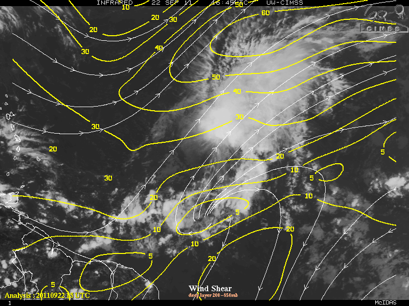
Tropical Storm Ophelia overnight intensified slightly to 65 MPH. The intensity was basically due to a reporting NOAA Buoy 41041 that had peak (one minute) sustained winds of 54 knots and a gust of 68 knots. Whether this is indicative of a trend or not, it is still impressive how tenacious some the storms this season has been so far. Strong 25-35 knots of southwesterly shear along with some dry air that is wrapping around the outer core continues to keep the convection well east and northeast of the center of circulation. The center of circulation again is visible from satellite presentation due to the strong shear will be present for the next 36-48 hours.

Visible Satellite Image


Wind Shear

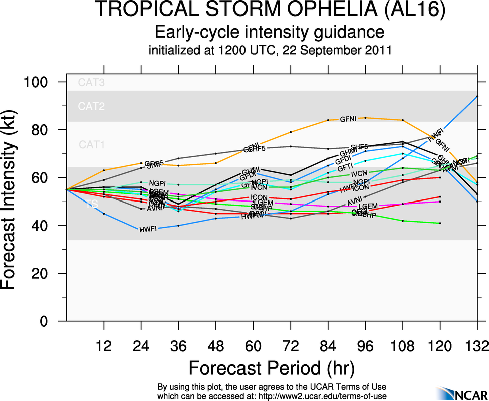
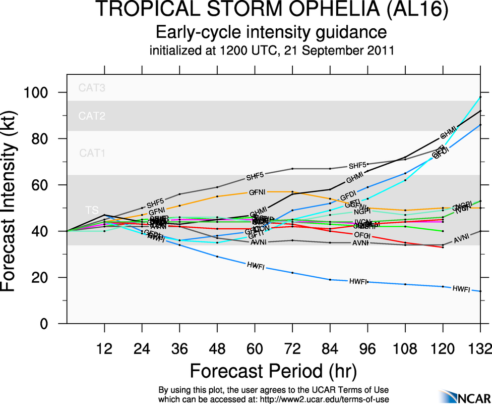
Assuming Ophelia can continue tropical storm status, most of the global models are in agreement of an upper level trough later in the forecast period that might weaken the ridge slightly which might allow the environment for Ophelia to a bit more conducive and allow some strengthening. For me, I am not convinced that strengthening will occur even with the weakening of the ridge, at least not in the short term.

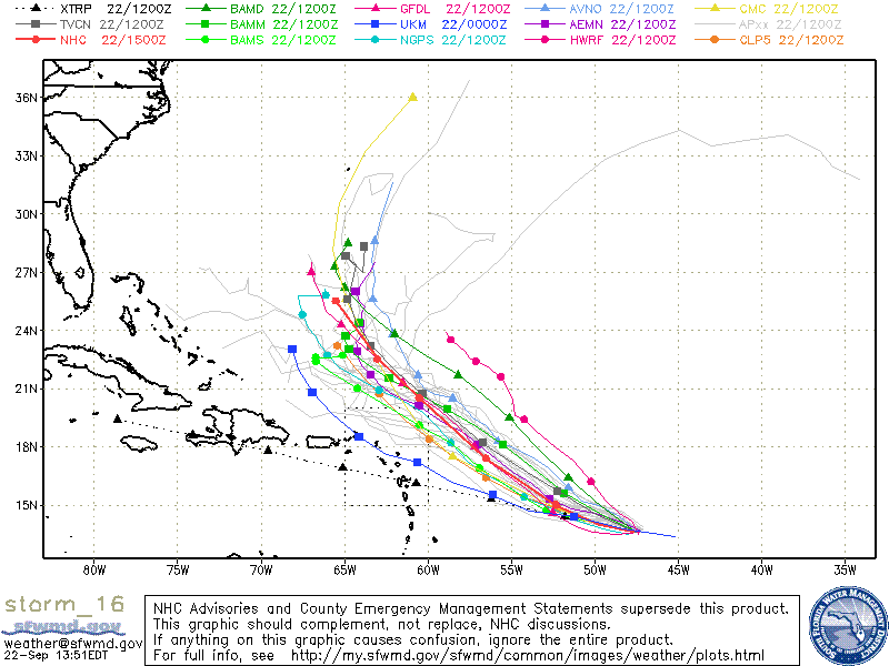
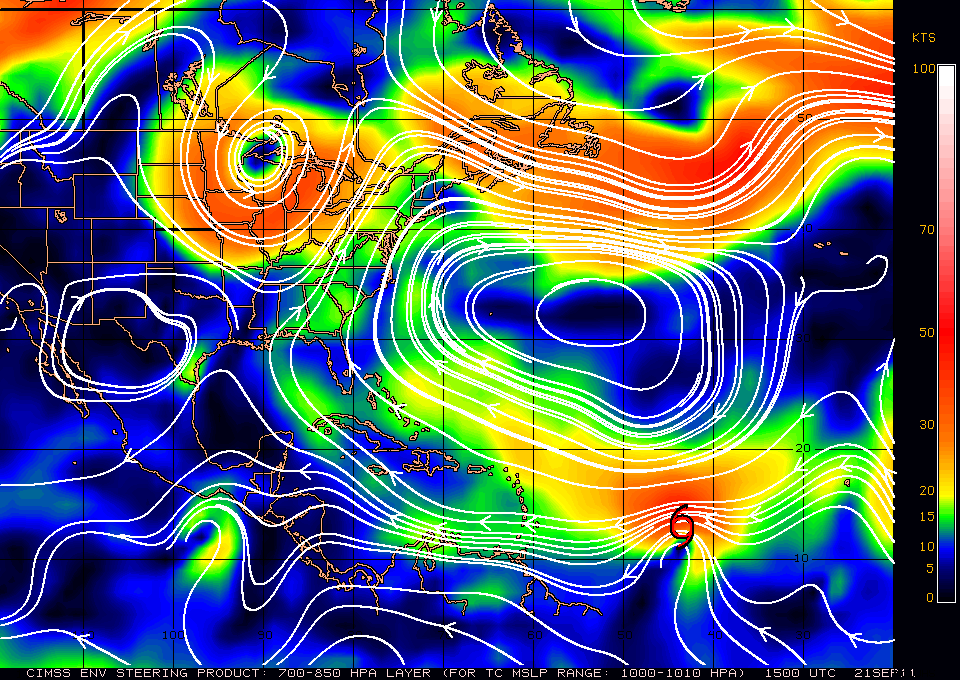
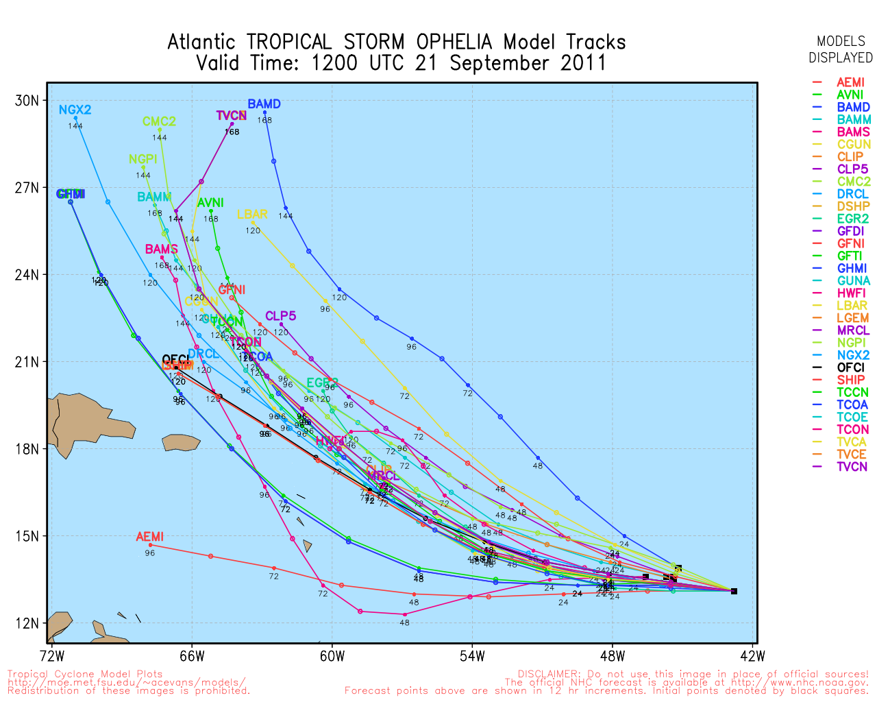
Guidance is in good agreement for Ophelia to begin the turn west-northwest, probably tomorrow afternoon or sooner, and the turn to the northwest sometime late Sunday. Ophelia will be near the southwestern edge of the subtropical ridge and the turn to the north is forecast sometime early next week. Intensity is always difficult to determine, but I do not believe Ophelia will make hurricane status.

Steering Current


Ophelia Models


Elsewhere in the tropics, at the moment there is nothing to report about but there is the possibility of development later on in the Western Caribbean and the southern GOM. The MJO has continued to forecast that the strong upward motion and the environment in those areas will be conducive for some type of development sometime in the first week of October. The GFS and Euro models have been off and on for any development so we will just have to see…

Categories
Miscellaneous/General Science Tropical Weather

Tropical Storm Ophelia

Invest 98L has been upgraded to Tropical Storm Ophelia as of the 11PM advisory last night from the NHC. Due to strong westerly and southwesterly shear, Ophelia will struggle and any increase in intensity will be gradual. At the moment, the LLC is exposed and all the convection is to the east of the center due to the strong westerly shear. Ophelia is south of a subtropical high pressure ridge. For the next 36-48 hours Ophelia will be heading westward or just north of due west, after that the forecast is for a deep layer trough to dig down as it heads off the eastern coast of the US. Ophelia will be on the southwestern periphery of the ridge and the trough will turn west-northwest then northwest. Eventually, the trough will turn Ophelia north and then northeast.

Visible Satellite Image


Wind Shear


Steering Current

Before Ophelia gets close or near the northern Lesser Antilles, shear may relax a little and allow some strengthening. Once Ophelia begins to get close to 60°W longitude, shear is forecast to strengthen significantly and at that point, further intensity will be difficult, if not impossible. Once Ophelia begins the northern turn, the upper level winds may begin to ease and allow some more strengthening, but that is part of the long term forecast – so the dynamics may change.


12z GFS Model


00z Euro Model

Categories
Miscellaneous/General Science Tropical Weather

Hurricane Katia, Tropical Storm Maria & Tropical Storm Nate

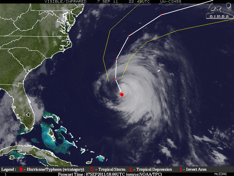
As Hurricane Katia traverse’s through cooler waters it appears that Katia is also having serious problems with dry air entrainment that is wrapping around from the southwest and into the inner eyewall along with moderate shearing. Katia is now a mid-category one storm and intensification is not indicated, in fact, the weakening process will continue for at least the next 24 hours. Due to the cooler SST’s any attempt to intensify with the shear decrease later in the forecast will be nullified by the SST’s. Once Katia begins the transformation to extra-tropical, Katia may slightly intensify, in 72- 96 hours during the transformation. Katia is heading NW at the moment but will be making the turn to the north within the next 24 hours and later turn to the NE while also accelerating and into the westerlies.


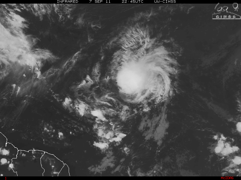
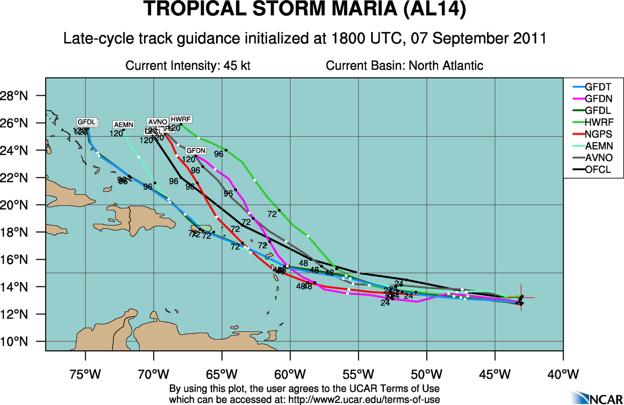
Tropical Depression Fourteen was upgraded to Tropical Storm Maria the 11am advisory from the NHC. As Hurricane Specialist Lixion Avila stated “…and yet another tropical storm in the Atlantic…” in the NHC Tropical Weather Outlook, it seems we are definitely in the peak of the hurricane season.
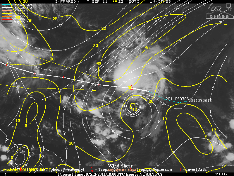
Tropical Storm Maria is heading just west of due west-northwest and the forward motion is currently at 23 MPH. If this continues, the Low-Level Circulation may out run the mid to upper levels of the convection. If so, Maria will have a very difficult time organizing and trying to intensify or at least it would be gradual. At the moment, the environment is not that conducive for further development as upper level winds in the 20-30 knot range may affect Maria but the overall pattern should allow for slow strengthening.

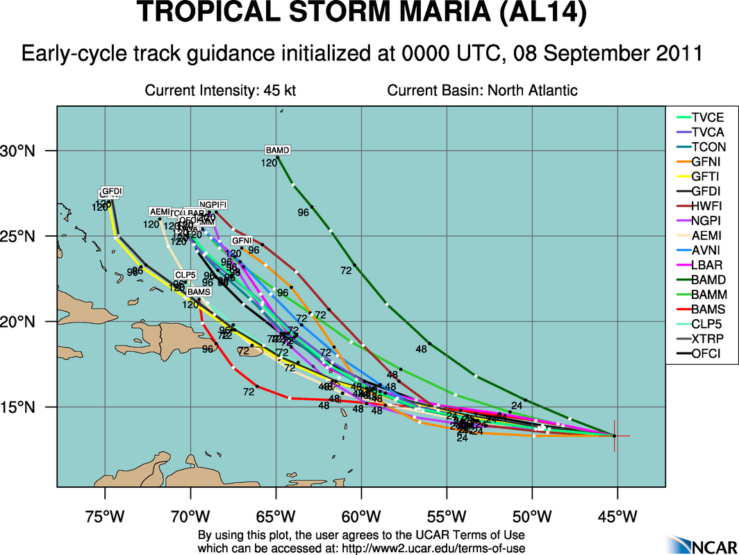
Although it is a little to early where Maria may head, the latest model runs with the exception of the BAMM (Shallow) tend to have Maria north of the Leeward Islands in several days. For what it’s worth, my own opinion is that the model are still a little biased to the north and although I believe the more turn to the WNW will happen, the more “western” track will happen before making the turn, thus this might be a much closer to the islands than forecast. As Katia leaves the scene, the sub-tropical ridge will want to build and keep Maria on that western track until finally heading on a more west-northwest track along the periphery of the southwestern edge of the ridge. A deep layered trough is forecasted by some of the models by 72 hours to be near the East coast of the US about the time Maria will be close or near the Leewards Islands. This trough should make Maria turn toward the NW and later to the north.


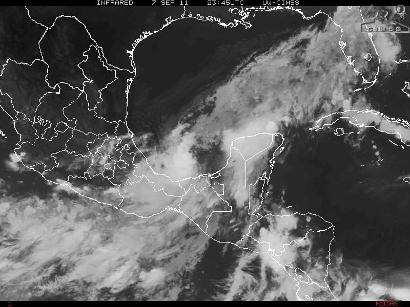
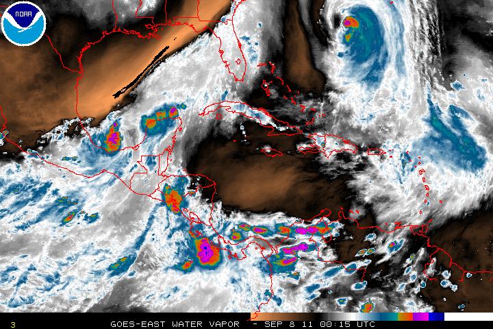
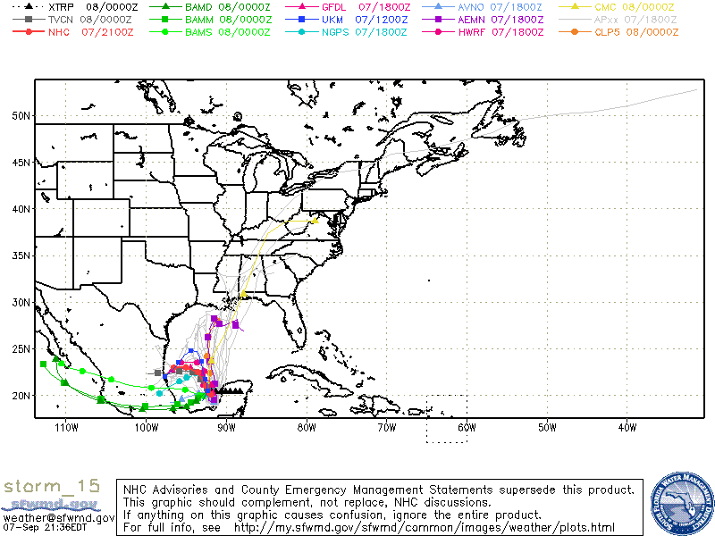
Invest 96L has been upgraded to Tropical Storm Nate as of the 5pm advisory from the NHC. Although Tropical Storm Nate had been “suggested” that it would develop to a at least a tropical depression, recon flew into the storm and found winds at flight level of 53 knots (un-flagged) or about 42 MPH at the surface, thus the storm was initiated as Tropical Storm Nate. As has been noted earlier, Nate has been drifting somewhat as the steering currents are quite weak. With the weak steering currents which may hang around for a few days, Nate will be in warm waters but there is vert dry air to the NW of Nate and this dry air (as been with many of the storms this year) may impact Nate later in the forecast period. Models at this time feel that Nate, in time, will be influenced by a developing ridge in the western Caribbean and making Nate turn to the west and into Mexico. Although this scenario may play out, if Nate moves further north, Nate will be north of the developing ridge and would then head toward the Gulf states or the Florida panhandle. It is just to early to say how this will play out with Nate.

Categories
Tropical Weather

Weakening Tropical Storm Tomas

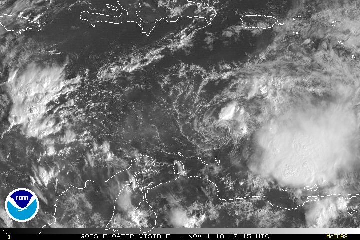
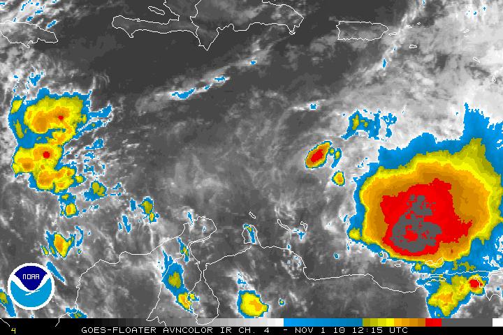
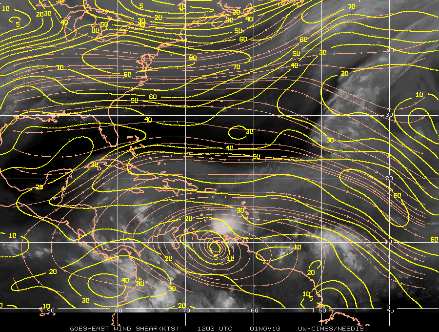
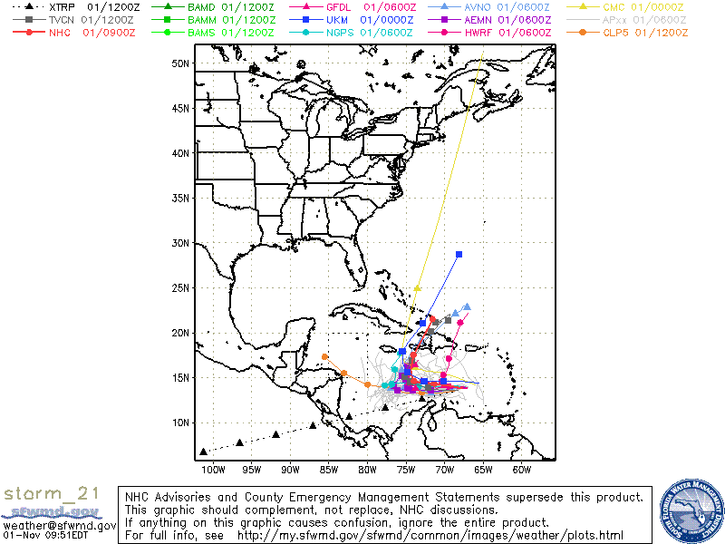
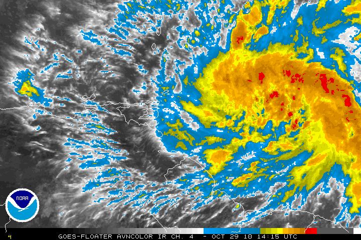
Tropical Storm Tomas, once a category 2 storm, has been downgraded to a weak Tropical Storm and there is about another 24 hours before Tomas has any chance to restrengthen again. Tomas has been decoupled as the convection is about 100 miles to the east of the center. Westerly vertical shear is the main factor that is impacting Tomas. There is also a little dry air, but it is not as much as a factor. Both the Ships and LGEM model are forecasting that Tomas will strengthen again to a hurricane. A weakening low-mid level ridge to the north of Tomas will keep the storm on westward motion. In about 72-96 hours a large mid-tropospheric trough will be heading eastward into the Gulf of Mexico. The flow from the trough will turn Tomas north and northeast with an increase in forward speed.
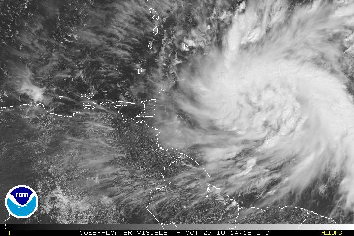
Visible Satellite image of Tropical Storm Tomas
AVN Satellite image of Tropical Storm Tomas
Shear Map
Models for Tropical Storm Tomas
Categories
Tropical Weather

Dangerous Hurricane Tomas

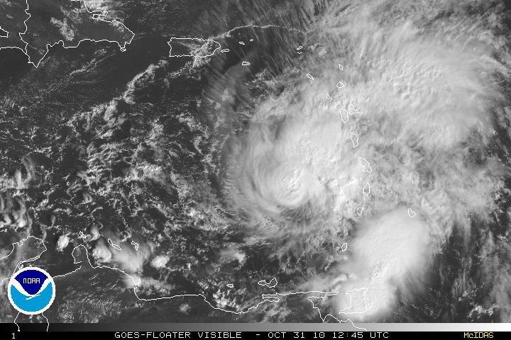
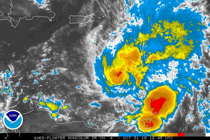
Hurricane Tomas in the early morning hours was found to have winds of 100MPH and Tomas is now a category 2 hurricane. With data from the reconnaissance plane and satellite imagery, Tomas is better organized but it was noted that the vertical stack of the storm is tilted northeastward with height. The tilting is probably due to the Southwesterly shear that is beginning to impact Hurricane Tomas. The shear has been forecast and further intensification will stop for about 48- 72 hours. There is the possibility Tomas may lose some strength during that forecast period. After that period, the shear will relax and further strengthening is forecast. Intensity guidance in at least the LGEM model does have Tomas strengthening and possibly be a major hurricane of at least a category 3 storm.

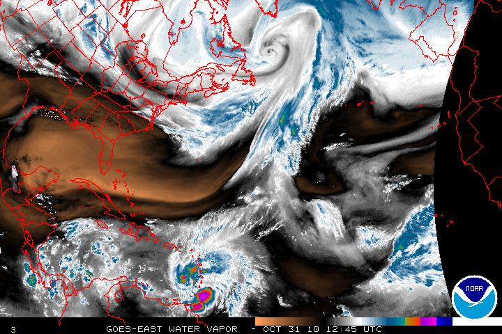
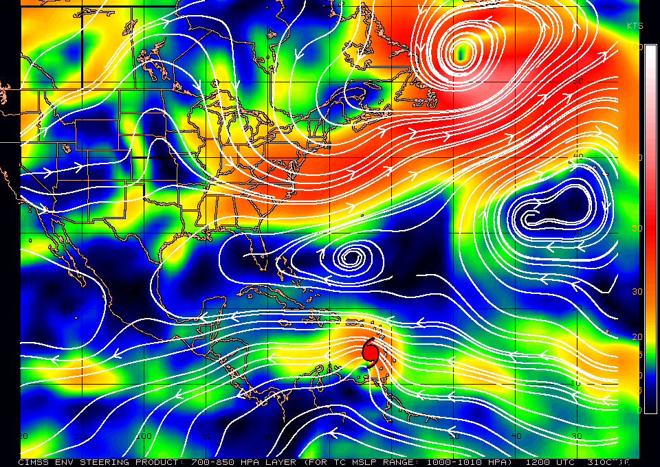
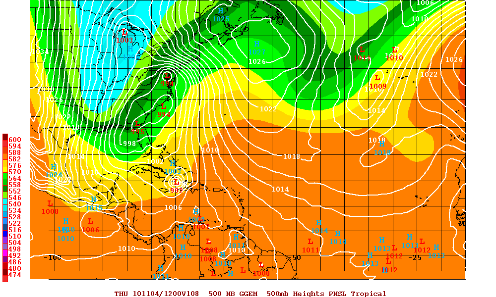
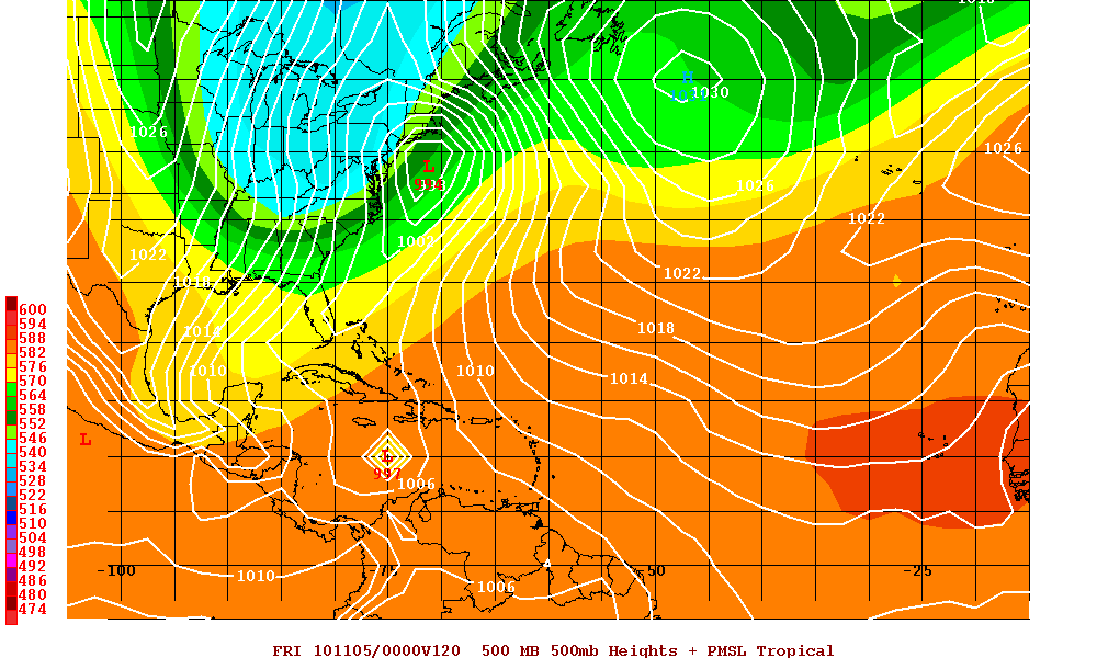
Hurricane Tomas is currently located south of a mid-level trough that is over the southwestern Atlantic. As this trough continues to move eastward a mid level ridge will build just north of Tomas and this will turn Tomas on a westward track for the next 2 or 3 days. Later in the forecast period, that ridge breaks down as a very large deep layer trough moves into the eastern U.S. and also digs southward. This will slow the forward speed of Tomas and also allow Tomas to gain latitude. Model guidance at days 4 and 5 is poor as far as the timing and the the sharpness of the turn to the north but there is a consensus that there will be the northern turn as Tomas will be forced north by the trough.

Visible Satellite image of Hurricane Tomas
AVN Satellite image of Hurricane Tomas
Water Vapor Satellite image of US and Western Atlantic/Tomas
Steering Layer
Models for Hurricane Tomas
Canadian Model at 108 hours
UKMET Model at 120 hours
Categories
Tropical Weather

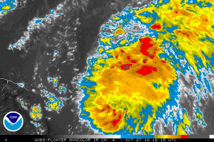
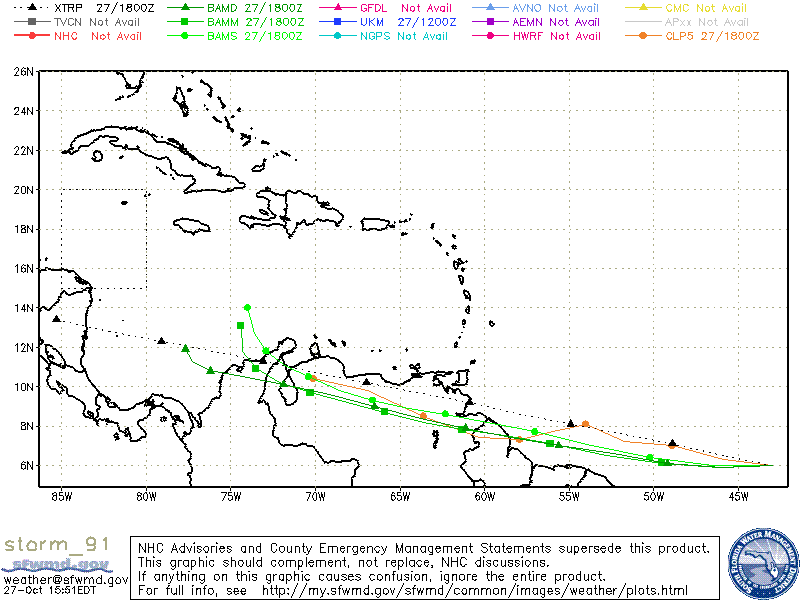
Invest91L

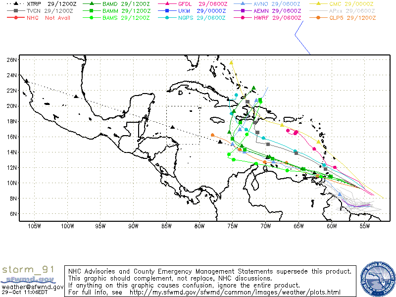
Invest 91L located about 350 miles East – Southeast of the southern Windward Islands has been slowly getting better organized and is forecast to become a Tropical Depression or Tropical Storm in the next day or two. The overall environment and conditions are conducive for continuing development as the system heads W-WNW. A reconnaissance flight is scheduled later today (2pm). Most models are forecasting that Invest 91L will eventually turn N or NNE but the timing between the models makes things a little unclear. The latest models have it tracking between eastern Cuba and Hispaniola as a frontal system picks it up in a few days. Until we have the data from recon I would not begin to estimate what intensity will be.

Visible Satellite image of Invest 91L
AVN Satellite image of Invest 91L
Models for Invest 91L
Categories
Tropical Weather

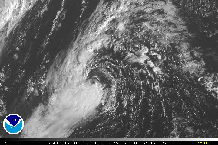
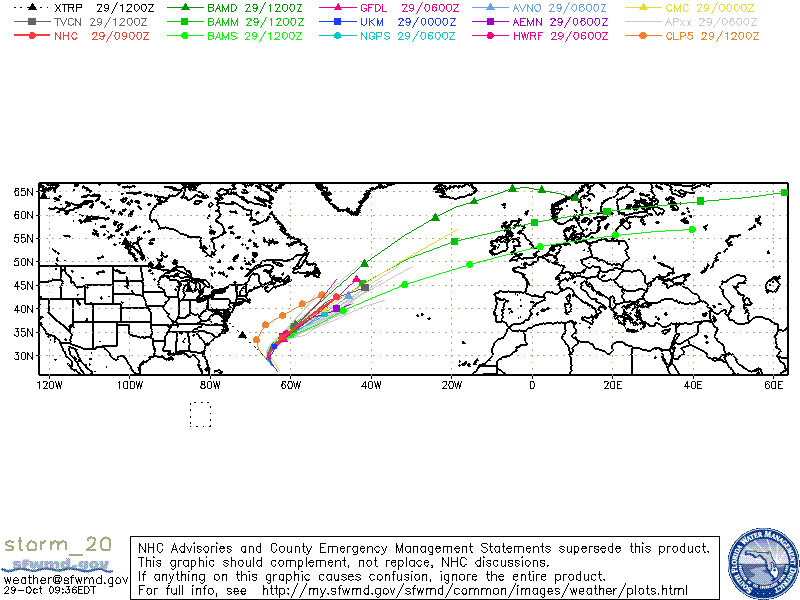
Tropical Storm Shary

Invest 92L was upgraded to Tropical Storm Shary as of the 11pm advisory last night. As of this morning, the center of TS Shary is exposed with convection to the west and south of the center. Shary has little chance to develop to hurricane status due to the forecast of cooler waters (SST’s) and in increasing vertical shear although the GFDL and HWRF want to forecast it to hurricane status. TS Shary is expected to become extratropical in 36 hours and it should dissipate as it is absorbed into a frontal boundary. Bermuda may be some effects from TS Shary in the next day or two.
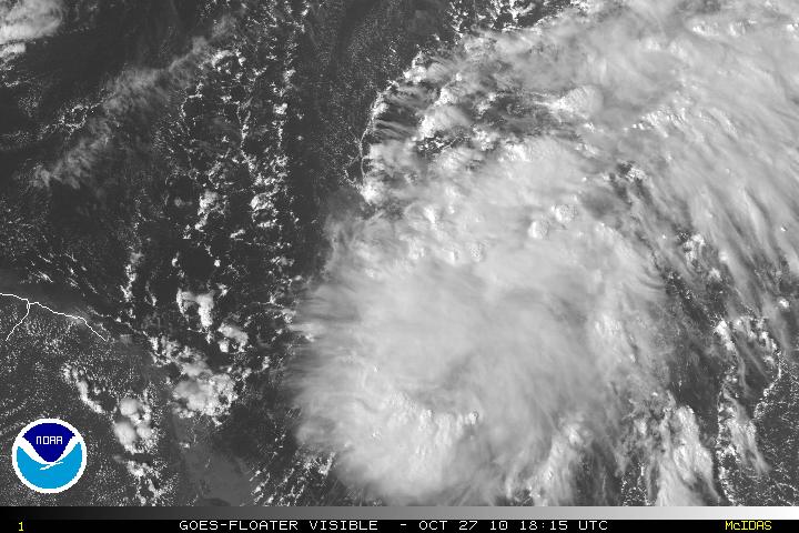
Visible Satellite image of TS Shary
Models for TS Shary
Categories
Tropical Weather

Invests 91L & 92L

Although the hurricane season is slowly winding down, there are three Invests in the Atlantic. 90L way out in the eastern Atlantic and is no threat.

Invest 91L is located 1200 miles E-SE of the Windward Islands. 91L is a vigorous wave and upper level winds will soon be conducive for possible slow development in the next few days. One possible problem for 91L that is very low in latitude and land interaction will hinder development as it heads W-WNW. One model (the Canadian) has it going right into South America where as the GFS model has it clipping the South American coastline.

Visible Satellite image of Invest 91L
AVN Satellite image of Invest 91L
Models for Invest 91L

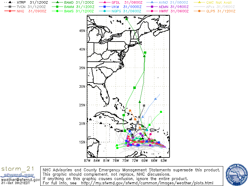
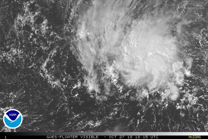
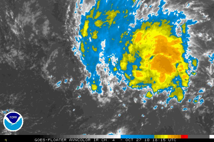
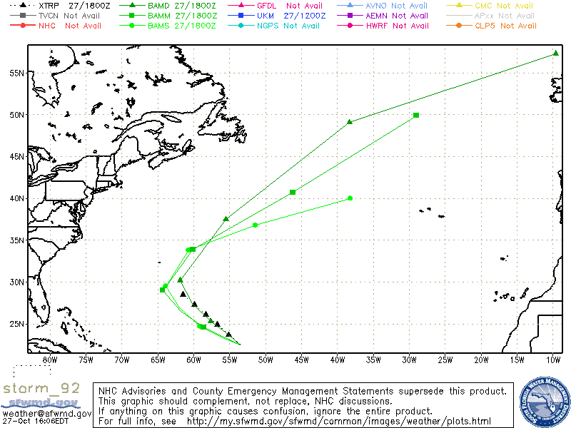
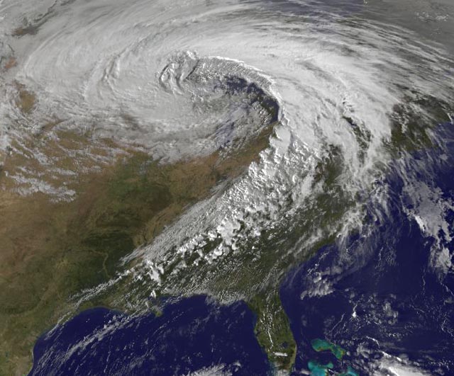
Invest 92L is located about 650 miles East – Northeast of the Northern Leeward Islands. 92L has the potential in the next few days to become a tropical or sub tropical storm. There is no threat to the US mainland as the system will be forced to head N then NE due to the long wave trough (the Super Storm that is located along the Eastern Coast of the US).

Visible Satellite image of Invest 92L
AVN Satellite image of Invest 92L
Models for Invest 92L

I am posting an GOES13 Satellite image from earlier today showing the large “Super Storm”.

Categories
Tropical Weather

Invest 99L – A Possible Florida Threat??

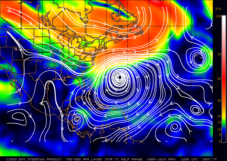
Invest 99L which has been lingering around the Southwestern Caribbean is finally beginning to move away from the coasts of Nicaragua & Honduras. With landfall interaction, it was impossible for 99L to even try to develop. Now that it has been been heading N or NNW it has a much better chance of developing. This is the time of the year where the models have problems and this may be the case with 99L. Many of the models at this time are not seeing any type development but the GFDL and HWRF does favor development. Whether 99L will be a Florida threat or not is a forecast that is so very difficult to answer, at least for the next few days. Hopefully, with a few hours or so we may have a better idea of what might happen as the reconnaissance flight is on it’s way. Just looking at the satellite presentation, it does look like there is circulation at the mid and upper levels but not yet at the surface. I am sure this is what recon will find.

Visible Satellite image of Invest 99L
AVN Satellite image of Invest 99L
Water Vapor Satellite image of US and Invest 99L
Shear Map
Steering Layer Map
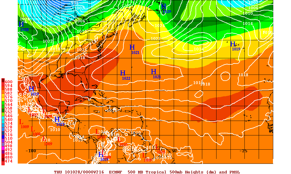
Euro Model for Invest 99L at 216 hours
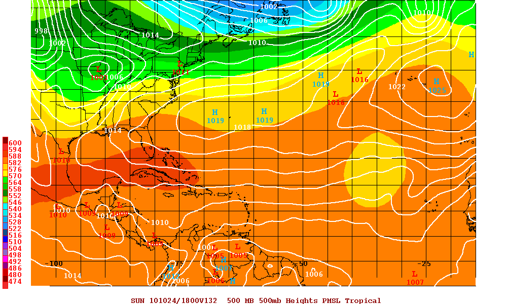
GFS Model for Invest 99L at 132 hours

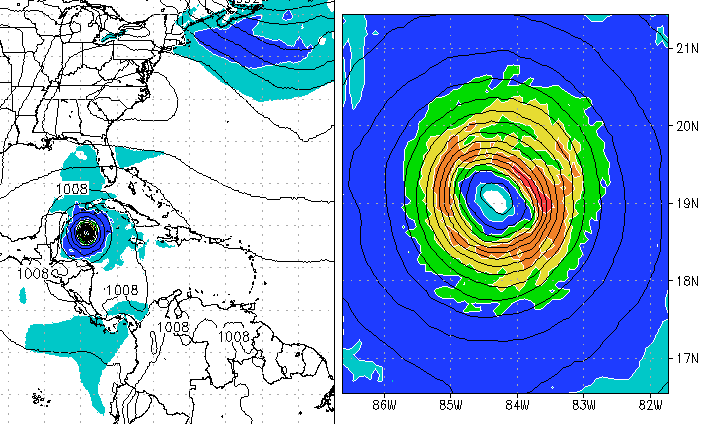
Below are the two models GFDL & HWRF which develop 99L into a hurricane. Only if shear abates, the high pressure system that will build after the trough has gone through and the high heads east and 99L lingers into the Southern Gulf of Mexico, then the chances for 99L to head to Florida as a tropical cyclone may increase but I doubt this will happen as there a just too many variables that have to work in unison.

GFDL Model at 144 hours
HWRF Model at 216 hours