Categories
Science Tropical Weather

Tropical Storm Ophelia – A Little Stronger??

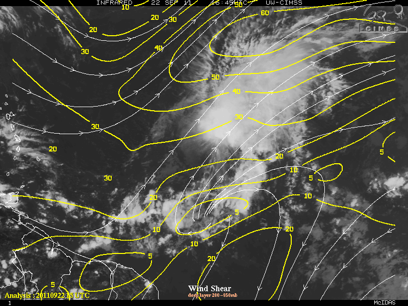
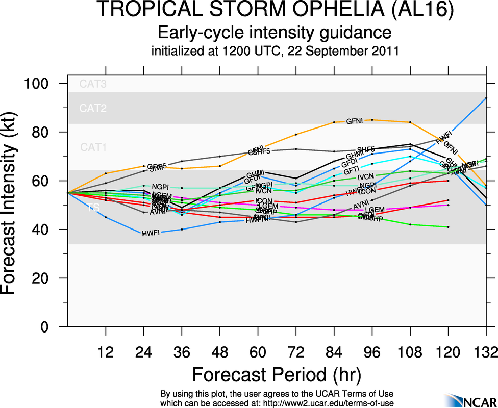
Tropical Storm Ophelia overnight intensified slightly to 65 MPH. The intensity was basically due to a reporting NOAA Buoy 41041 that had peak (one minute) sustained winds of 54 knots and a gust of 68 knots. Whether this is indicative of a trend or not, it is still impressive how tenacious some the storms this season has been so far. Strong 25-35 knots of southwesterly shear along with some dry air that is wrapping around the outer core continues to keep the convection well east and northeast of the center of circulation. The center of circulation again is visible from satellite presentation due to the strong shear will be present for the next 36-48 hours.
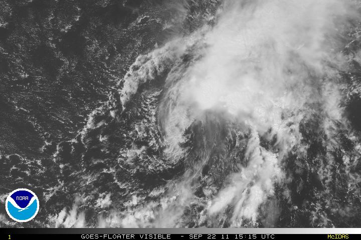
Visible Satellite Image


Wind Shear

Assuming Ophelia can continue tropical storm status, most of the global models are in agreement of an upper level trough later in the forecast period that might weaken the ridge slightly which might allow the environment for Ophelia to a bit more conducive and allow some strengthening. For me, I am not convinced that strengthening will occur even with the weakening of the ridge, at least not in the short term.

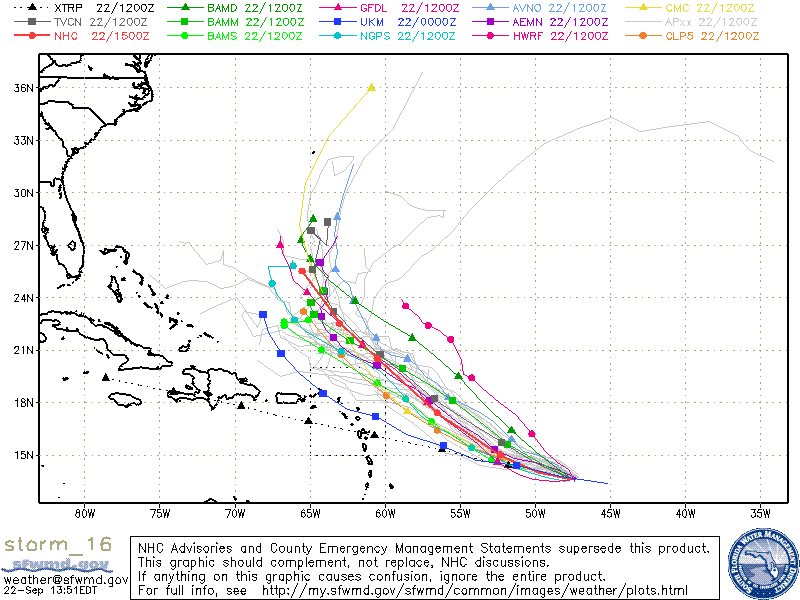
Guidance is in good agreement for Ophelia to begin the turn west-northwest, probably tomorrow afternoon or sooner, and the turn to the northwest sometime late Sunday. Ophelia will be near the southwestern edge of the subtropical ridge and the turn to the north is forecast sometime early next week. Intensity is always difficult to determine, but I do not believe Ophelia will make hurricane status.
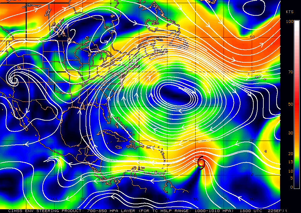
Steering Current


Ophelia Models


Elsewhere in the tropics, at the moment there is nothing to report about but there is the possibility of development later on in the Western Caribbean and the southern GOM. The MJO has continued to forecast that the strong upward motion and the environment in those areas will be conducive for some type of development sometime in the first week of October. The GFS and Euro models have been off and on for any development so we will just have to see…
Categories
Tropical Weather

Dangerous Hurricane Tomas

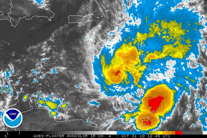
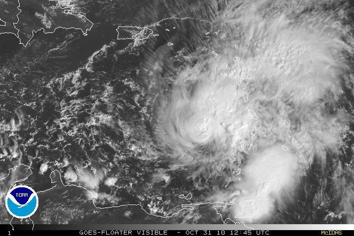
Hurricane Tomas in the early morning hours was found to have winds of 100MPH and Tomas is now a category 2 hurricane. With data from the reconnaissance plane and satellite imagery, Tomas is better organized but it was noted that the vertical stack of the storm is tilted northeastward with height. The tilting is probably due to the Southwesterly shear that is beginning to impact Hurricane Tomas. The shear has been forecast and further intensification will stop for about 48- 72 hours. There is the possibility Tomas may lose some strength during that forecast period. After that period, the shear will relax and further strengthening is forecast. Intensity guidance in at least the LGEM model does have Tomas strengthening and possibly be a major hurricane of at least a category 3 storm.

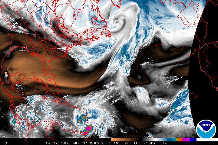
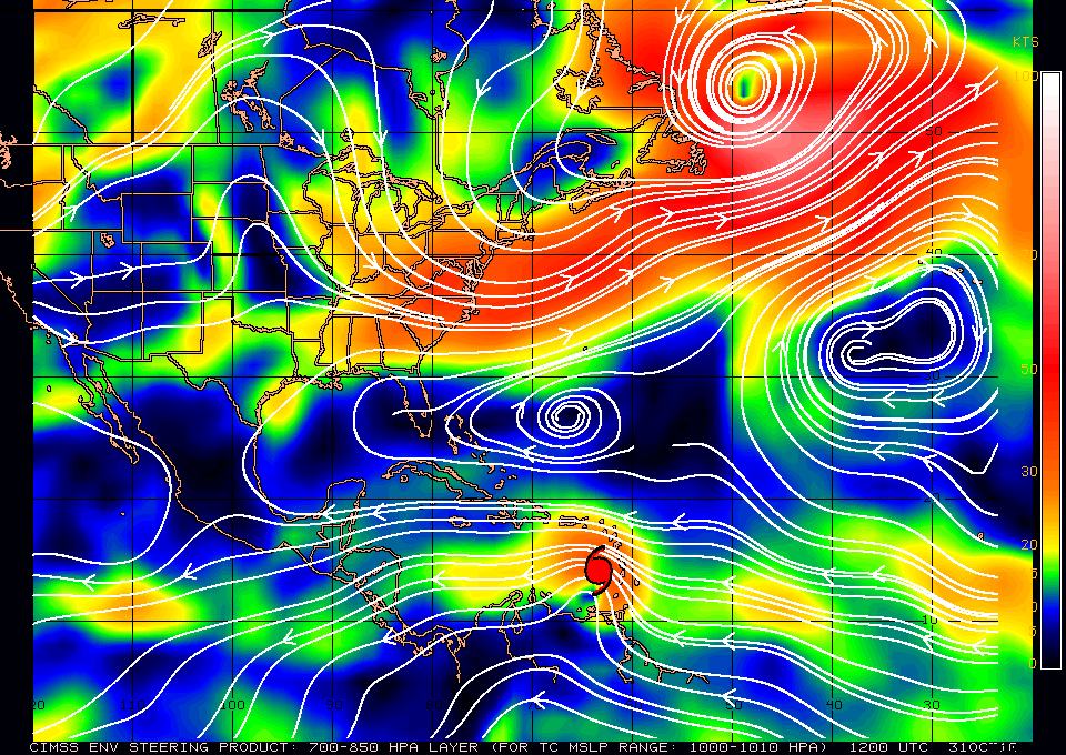
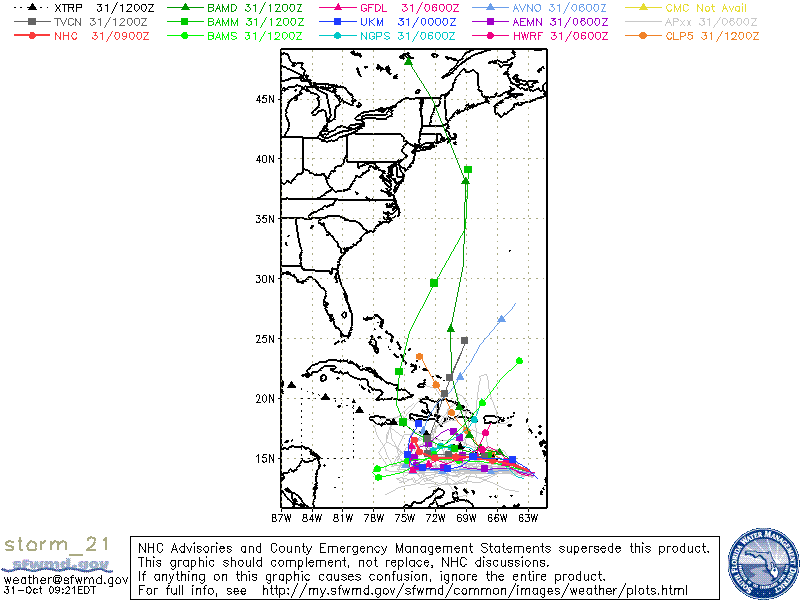
Hurricane Tomas is currently located south of a mid-level trough that is over the southwestern Atlantic. As this trough continues to move eastward a mid level ridge will build just north of Tomas and this will turn Tomas on a westward track for the next 2 or 3 days. Later in the forecast period, that ridge breaks down as a very large deep layer trough moves into the eastern U.S. and also digs southward. This will slow the forward speed of Tomas and also allow Tomas to gain latitude. Model guidance at days 4 and 5 is poor as far as the timing and the the sharpness of the turn to the north but there is a consensus that there will be the northern turn as Tomas will be forced north by the trough.

Visible Satellite image of Hurricane Tomas
AVN Satellite image of Hurricane Tomas
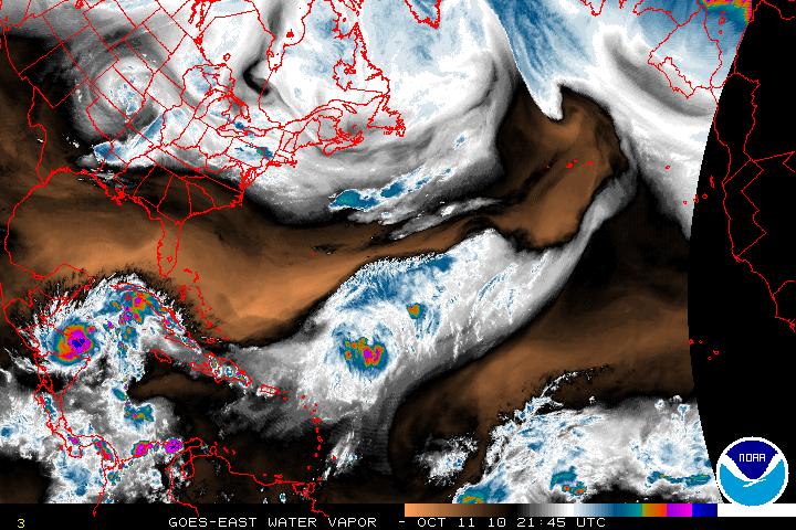
Water Vapor Satellite image of US and Western Atlantic/Tomas
Steering Layer
Models for Hurricane Tomas
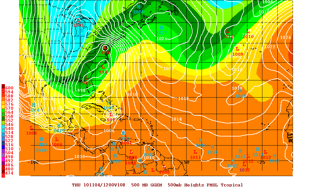
Canadian Model at 108 hours
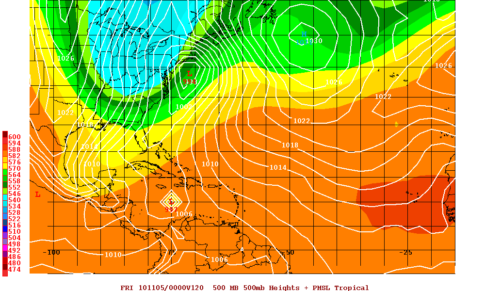
UKMET Model at 120 hours
Categories
Tropical Weather

Tropical Storm Paula

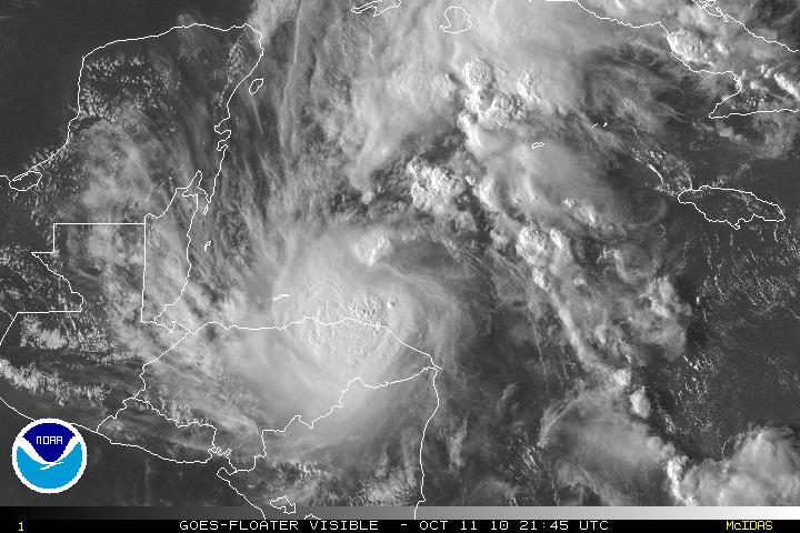
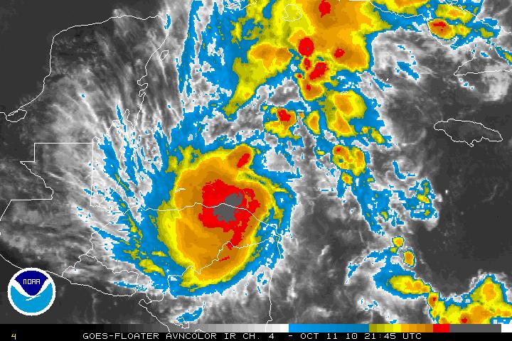
Invest 98L has been upgraded to Tropical Storm Paula as of the 5PM advisory from the NHC. Recon earlier today found winds of 60 MPH, but that might be a little conservative. The forecast is for Tropical Storm Paula for additional strengthening and Paula is forecast to possibly become a hurricane within 24 hours according to the models SHIPS, and LGEM. Strengthening will only be possible for a few days, then slow weakening on days 4 or 5. For the next few days the track for Paula will be NW then N. The western edge of a ridge that extends across northern Caribbean is expected to weaken because of a deep-layered trough that will be moving eastward across the Southeastern US. After that forecast period most of the guidance is suggesting that the trough will move east and then leave Paula in an area of weak steering currents and Paula is expected to drift eastward for for a day or two then possibly drift southward. Model guidance after day 3 or 4 and confidence is quite low. Whether Paula will stay in the Western Caribbean and impact Nicaragua or head north and northeast unfortunately it is too difficult to forecast.

Visible Satellite image of Tropical Storm Paula
AVN Satellite image of Tropical Storm Paula
Water Vapor Satellite image of Western Atlantic/Tropical Storm Paula
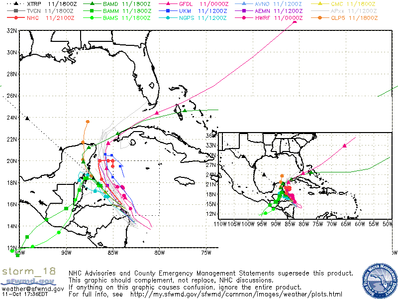
Models for Tropical Storm Paula