Categories
Science Tropical Weather

Invest 93L / Pouch P09L

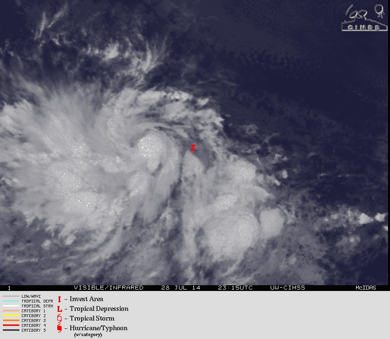
A tropical wave that came off the coast of Africa a few days near the Cape Verde Islands was designated as 93L by the [tooltip title=”NHC” content=”National Hurricane Center” type=”info” ]NHC[/tooltip] yesterday afternoon. With the exception of Hurricane Arthur, this is the first significant wave with a “possibility” of development. Previous waves were pretty much not given a chance to develop due to [tooltip title=”SAL” content=”Saharan Air Layer” type=”info” ]SAL[/tooltip] and upper level winds.

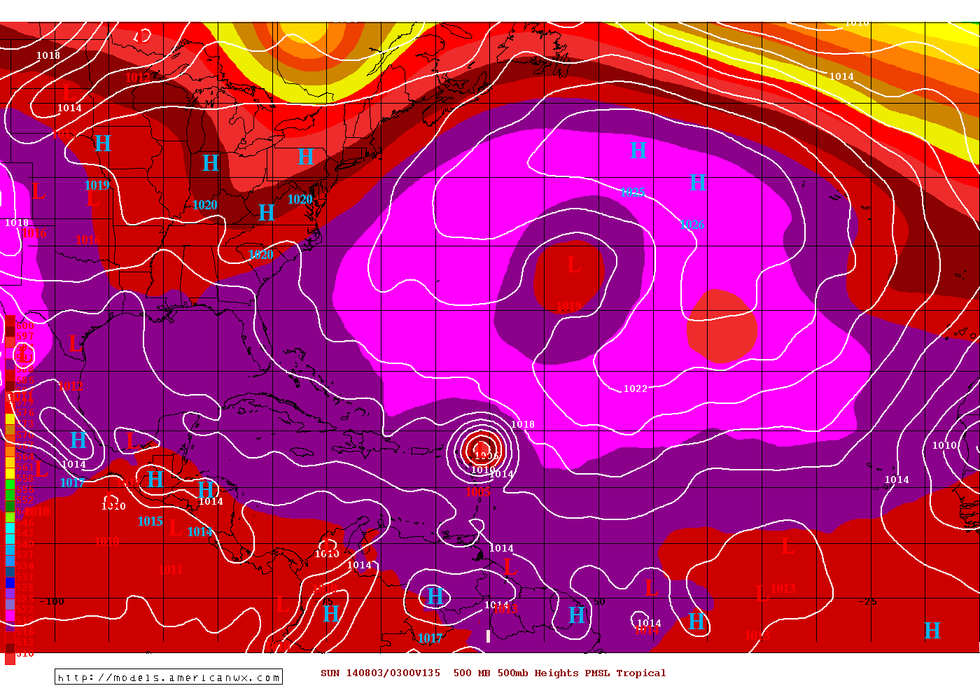
During the early morning hours, 93L is somewhat disorganized but has been a slowly progressing in getting some deep convection which is extremely vital for tropical cyclone development. If fact during the day today, 93L has much better organized since earlier this morning. 93L is far enough south of the SAL and at least for the time being, is not a factor although 93L is still attached to the [tooltip title=”ITCZ” content=”Intertropical Convergence Zone – Area encircling the earth near the equator where the northeast and southeast trade winds come together.” type=”info” ]ITCZ[/tooltip]. Both the two major models, the GFS and the ECMWF model camps are forecasting to build an anti-cyclone over over 93L as it tracks westward toward the Lesser Antilles. This should allow relaxation of the upper level winds and possibly let further consolidation of the entire system.
93L
Satellite photo of Invest 93L

Credit: American Weather Model Center
GFS Model
GFS Model 1800z at 135 hours

Credit: American Weather Model Center
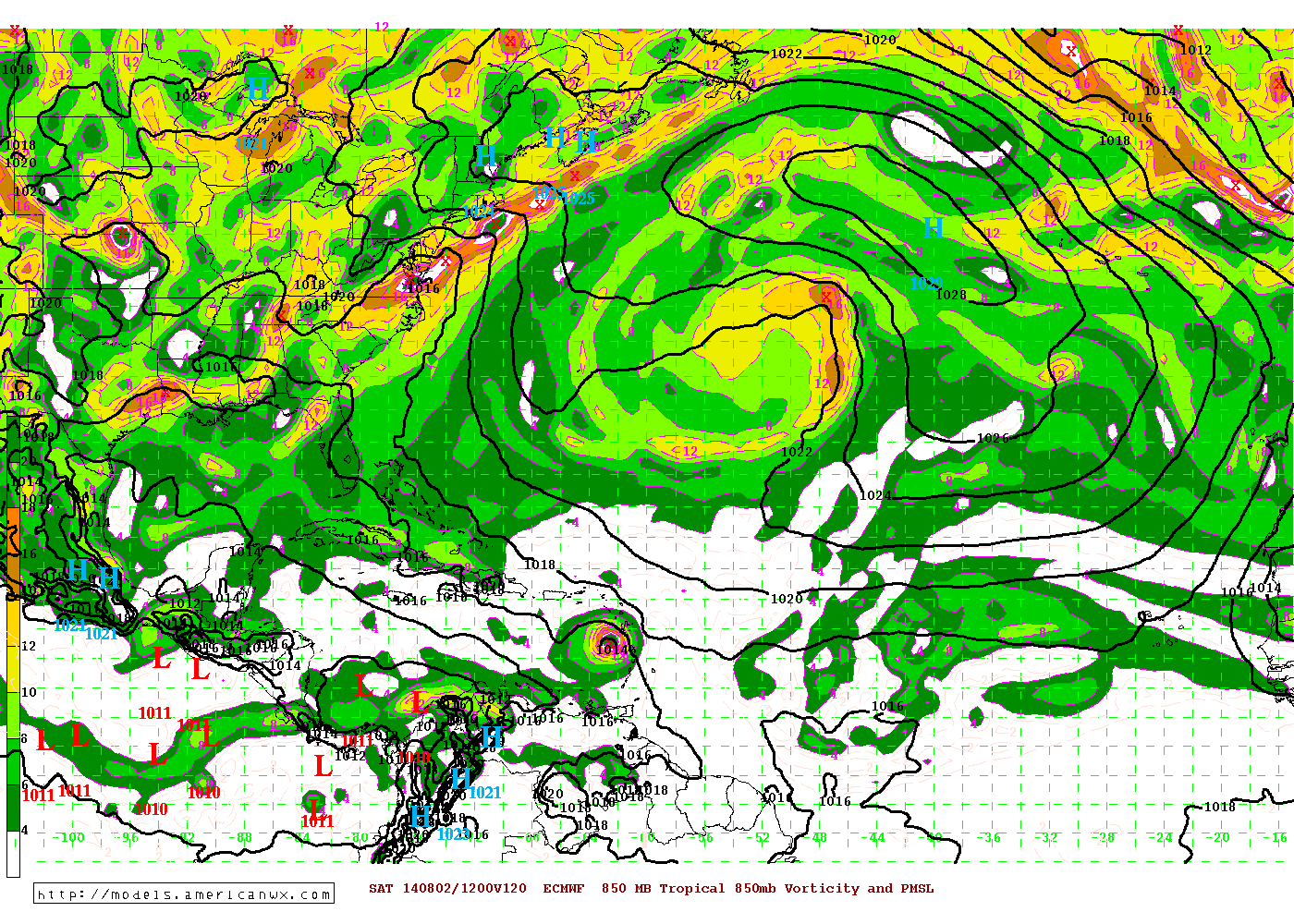
ECMWF Model
ECMWF Model 1800z at 120 hours

Credit: American Weather Model Center

The GFS and the ECMWF seem to want to 93L to develop into at least a tropical depression some time later in the week, the ECMWF is a bit faster than the GFS and even the UKMET. Currently, 93L is tracking westward (with a slight north of west) and this movement should continue for the next 3-4 days. Although the global models may feel there is weakness in the ridge along with a trof over the east coast of the US, this should enough to allow 93L to turn WNW then NW before entering the area just east of the Northern Leeward Islands. The ECMWF though is faster and goes through the islands before turning NW. Guidance at this point in time would be sheer speculation. If factors such as shear, SAL, etc. occur, then those factors could alter the steering currents. Although this seems unlikely, anything is possible in the tropics.

All those in the Great Antilles to the Leeward Islands need to monitor 93L closely for any significant changes in both the track and the possibility of early development of a tropical cyclone.

Remember, always stick with official information such as your local WFO and the NHC.
Categories
Tropical Weather

Hurricane season ending?

At the moment there is nothing tropical and things seem to getting where conditions for tropical development will be difficult to do. Hopefully the hurricane season will be ending early.

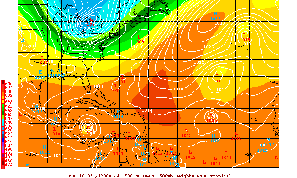
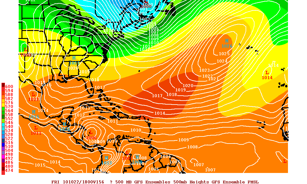
There are some disorganized showers and thunderstorms within the southwestern Caribbean Sea. The GFS and the Canadian models are the only models that support any development. Even if that area does develop into something tropical, the synoptics are for whatever is there – will eventually head west and landfall near Nicaragua.

GFS Model at 156 hours
Canadian Model at 144 hours
Categories
Tropical Weather

Tropical Storm Lisa & Invest 95L

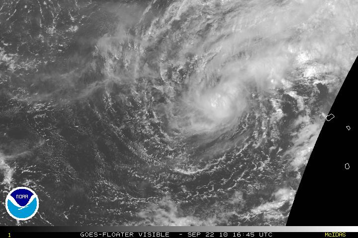
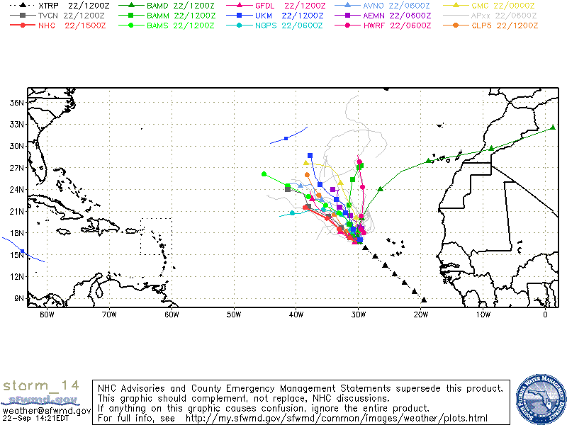
Tropical Storm Lisa way out in the Eastern Atlantic has been somewhat stationary or has drifted southeastward and the low-level center has been exposed. Tropical Storm Lisa is in an area of weak steering currents and is forecast to be drifting for the next 24-48 hours. Lisa is located within a COL which is an area between two high- and two low-pressure centers. After 48 hours a trough is expected to lift up northeastward and another ridge will build westward. This will allow Lisa to slowly move westward. At the moment shear over Lisa is light, but here is a lot of dry air around Lisa which is inhibiting or slowing further intensification. Since the shear is still low, there is the slight possibility of some intensification during the next 48 hours, but any intensification will be slow, if any. After the 48 hours, increasing shear is forecast. The forecast is for Lisa to weaken and there is the possibility it will just become an open wave.

Visible Satellite image of TS Lisa
Models for TS Lisa

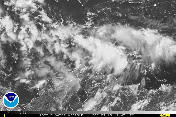
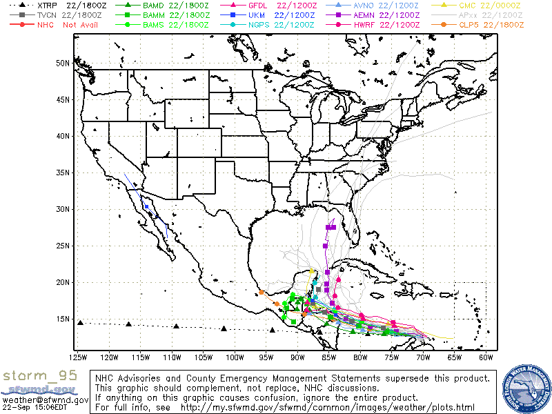
Invest 95L is very disorganized and this will probably be this way until the system heads westward and gets to longitude 75W where there will be less interaction with South American coast. Shear will be light at that time and further development is forecast. There are two camps divided on where the system may head. A few models believe the Invest 95L will head due west and landfall will be near Nicaragua and possibly Honduras and dissipate. The other models like the Euro and the GFS believe 95L will slowdown and head WNW to NW and landfall will be around the Yucatan. With a strong trough coming down from the US this may pick this system up and the implications with that is this may be a strong tropical system that may head anywhere from Texas to the west coast of Florida. This is a system that needs to be watched carefully for the next 7 – 10 days. By then a much better forecast can be made.

Visible Satellite of Invest 95L
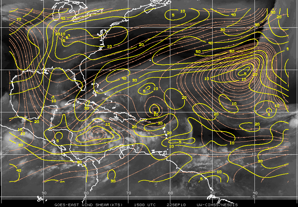
Wind Shear Map
Models for Invest 95L
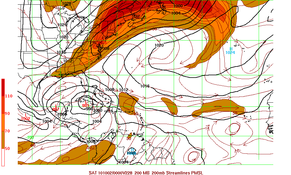
GFS Model 228 hour forecast
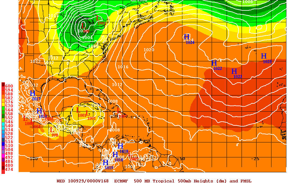
EURO Model 168 hour forecast
Categories
Tropical Weather

Hurricane Earl & Tropical Storm Diona

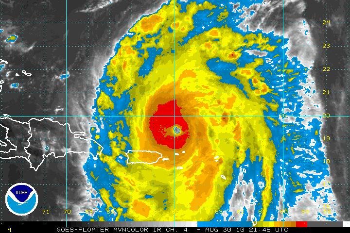
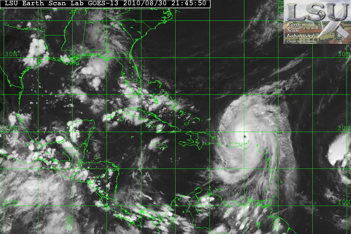
Hurricane Earl has been in an environment for continuing intensification and has blown up today and is now a Category 4 storm. There will probably be times where there will be an ERC (Eyewall Replacement Cycle) which is normal with a storm this strong. The intensification will be short term, probably 36-48 hours.

AVN Satellite image
IR Satellite image

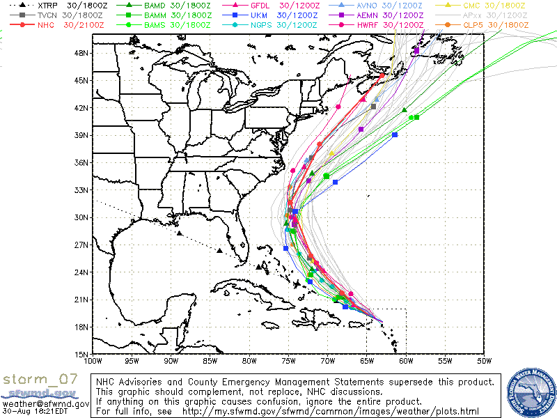
What was Invest 97L has been upgraded to Tropical Storm Fiona. Diona lack organization and the wind field is very large. The overall structure of Fiona is very poor and intensification will be slow. Most models are forecasting that Fiona may be a hurricane in 36-48 hours although the GFS model wants to dissipate Fiona is 2 or 3 days. The Models are still forecasting that Fiona will turn NW then N but there is a chance that the subtropical ridge will build back in and that will keep Diona from recurving. This is something forecasters will have to keep an eye on.

AVN Satellite image of Fiona
IR Satellite image of Fiona
Models for TS Fiona
Categories
Tropical Weather

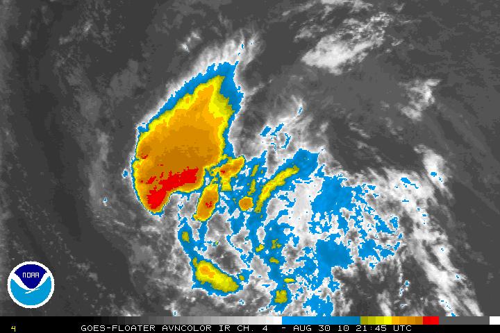
Invest 93L

Starting yesterday, a system was beginning to catch the eyes of those who are interested in the tropical weather. A modest to strong region of very intense thunderstorms that are in the Caribbean are beginning to look like that we may soon have the first tropical depression (at least in the Atlantic basin). Wind shear in the area is very low, the SST’s are very warm – 29 to 30 degrees Celsius. The MJO (Madden-Julian Oscillation) also does seem to favor tropical development. It is now in the wet-phase over that region. One negative side is there has not been a lot of spin according to the University of Wisconsin 850 mb relative vorticity analysis. 93L will probably begin to get an increased inflow from low level air and help the development of the spin soon.

At this time the NHC is calling for a 40% chance of developing of into a tropical depression. I wouldn’t see that until at least Wednesday maybe even Thursday. The GFS, NOGAPS, and UKMET models have been very reluctant to develop 93L for the time being. The GFDL model is expecting 93L to be a weak tropical storm in the next 5 days. At this time – the GFDL has been flip-flopping so lets just see what happens.

One worry is the possible flooding in Haiti. Any mudslides then there will be some unfortunate deaths. Lets just pray this will not be the case. Haiti has had enough over the past couple years.

As always – please use the NHC or your local weather for official information.