Categories
Tropical Weather

Tropical Storm Lisa & Invest 95L

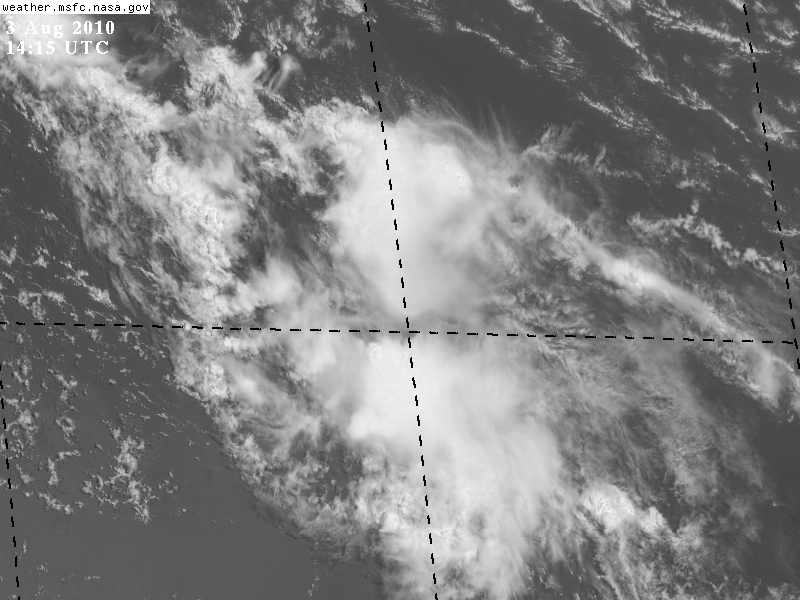
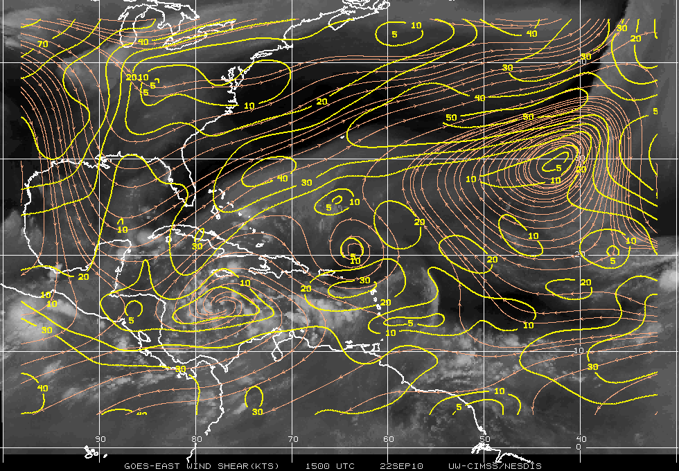
Tropical Storm Lisa way out in the Eastern Atlantic has been somewhat stationary or has drifted southeastward and the low-level center has been exposed. Tropical Storm Lisa is in an area of weak steering currents and is forecast to be drifting for the next 24-48 hours. Lisa is located within a COL which is an area between two high- and two low-pressure centers. After 48 hours a trough is expected to lift up northeastward and another ridge will build westward. This will allow Lisa to slowly move westward. At the moment shear over Lisa is light, but here is a lot of dry air around Lisa which is inhibiting or slowing further intensification. Since the shear is still low, there is the slight possibility of some intensification during the next 48 hours, but any intensification will be slow, if any. After the 48 hours, increasing shear is forecast. The forecast is for Lisa to weaken and there is the possibility it will just become an open wave.
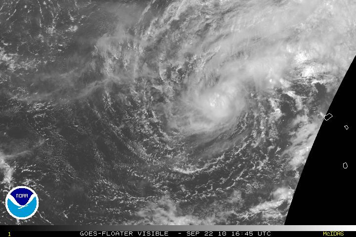
Visible Satellite image of TS Lisa
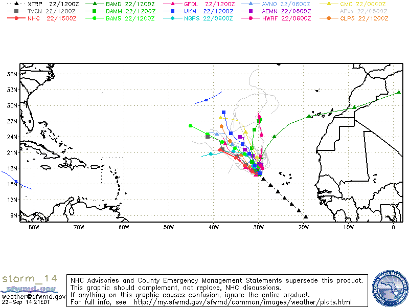
Models for TS Lisa

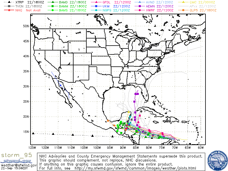
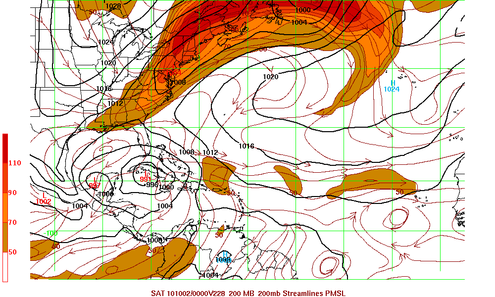
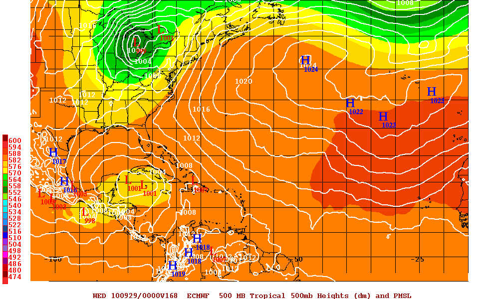
Invest 95L is very disorganized and this will probably be this way until the system heads westward and gets to longitude 75W where there will be less interaction with South American coast. Shear will be light at that time and further development is forecast. There are two camps divided on where the system may head. A few models believe the Invest 95L will head due west and landfall will be near Nicaragua and possibly Honduras and dissipate. The other models like the Euro and the GFS believe 95L will slowdown and head WNW to NW and landfall will be around the Yucatan. With a strong trough coming down from the US this may pick this system up and the implications with that is this may be a strong tropical system that may head anywhere from Texas to the west coast of Florida. This is a system that needs to be watched carefully for the next 7 – 10 days. By then a much better forecast can be made.
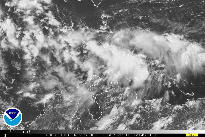
Visible Satellite of Invest 95L
Wind Shear Map
Models for Invest 95L
GFS Model 228 hour forecast
EURO Model 168 hour forecast
Categories
Tropical Weather

Tropical Storm Colin

Invest 91L was reclassified as Tropical Depression Four yesterday morning and at 5:00 am today it became the third tropical storm of the season – Colin.

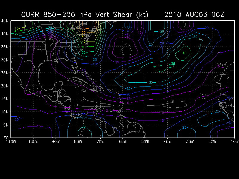
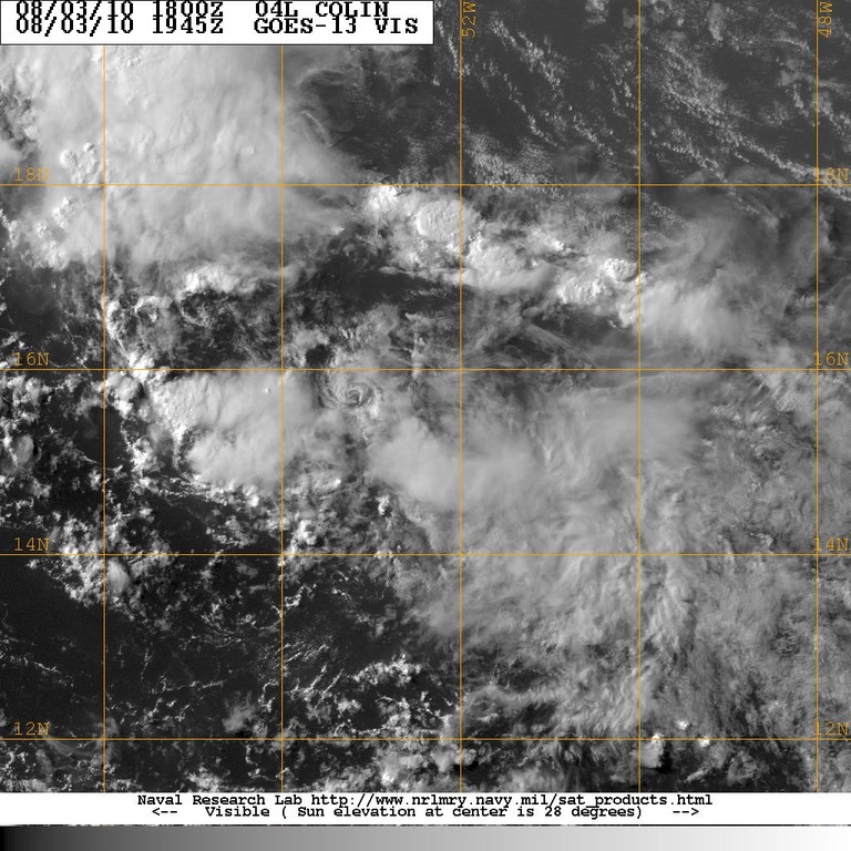
Although it is a tropical storm, it is very small in size. It is also very ragged in appearance. The SST’s in the area of TS Colin are in the 28° – 29° (C) range which is plenty enough for continued development but Colin’s biggest negative is the storm’s size. It makes Colin vulnerable to any mid to upper increases in either dry air entrainment or wind shear. There is some SAL but it is to the northwest of TS Colin and it is not affecting the storm right now.

Satellite image - Tropical Storm Colin

Currently, TS Colin looks very sickly due to some westerly vertical shear along with the rapid forward motion (24 MPH). There is also a question whether Colin has a closed circulation or not. It is a must for a tropical cyclone to have a closed center of circulation other wise it will be downgraded to an open wave.

Vertical Shear Map

The forecast (short term) is fairly simple. If Colin survives the day and/or can find a way to he must do it quickly. The next 24 – 36 hours are crucial for any further development. Beyond that time frame, Colin will start to encounter an increase in the upper level winds caused by a western Atlantic trough. Any further strengthening is not indicated at this time.

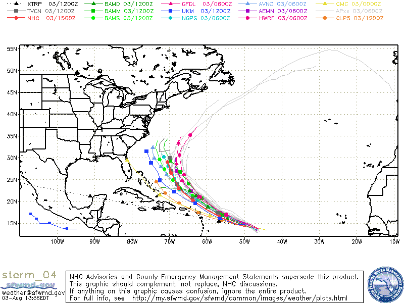
Long term forecast is very difficult. Colin is on the southern side of the low/mid Bermuda high. In 48-72 hours a weakness in that ridge due to mid/upper level near the southeastern coast of the US. This should cause Colin to steer on a WNW pattern and then turn to the the NW as it slows down. At that point, the forecast is very unclear. There is no model consensus at this time. The HWRF and the GFDL models are on the right side of the guidance envelope whereas the Canadian(CMC) and GFDN models are on the left. For this forecast period, the NHC has shifted the track southwest and to the left of the previous model track.

Latest Model Tracks

ADDENDUM:
As expected, Colin did not last long. As of 5:00pm the NHC dropped Colin from as TS to a remnant low and no longer putting out any advisories unless regeneration occurs. There is still a lot of vorticity so regeneration may happen in a 2-3 days.

Colin - now a remnant low