Categories
Tropical Weather

Impressive wave

A new very impressive wave is just coming off western Africa coast and another is following it. Will it have a chance to develop it to something tropical?
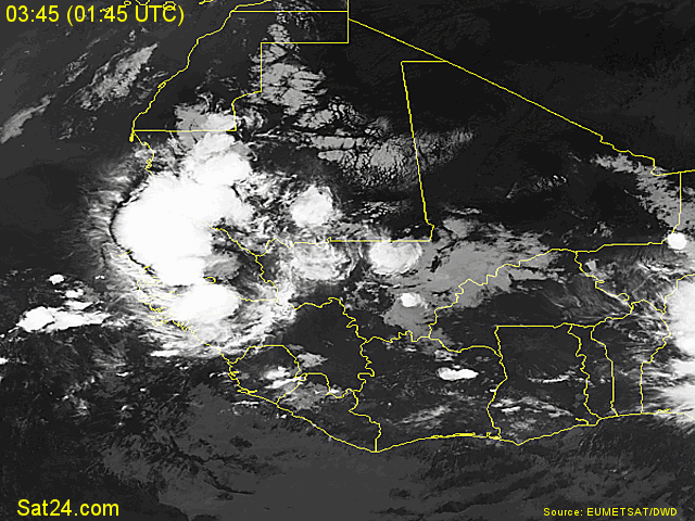
Wave off Africa

At the moment I do not see the MJO (Madden Julian Oscillation) as a factor. During the summer the MJO has a modulating effect on hurricane activity in the Indian Ocean, the western and eastern Pacific and Atlantic basin.
The MJO is characterized by an eastward progression of large regions of both enhanced and suppressed tropical rainfall.

The SAL (Saharan Air Layer) maybe a factor. The SAL at times can be a very intense, dry and dusty layer of the atmosphere. This can suppress any tropical cyclone development. The image from CIMSS shows a major layer of dust in the Eastern Atlantic.
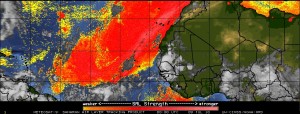
SAL

Vertical Shear is in the 15-20 knot range but is is decreasing as the wave moves westward.
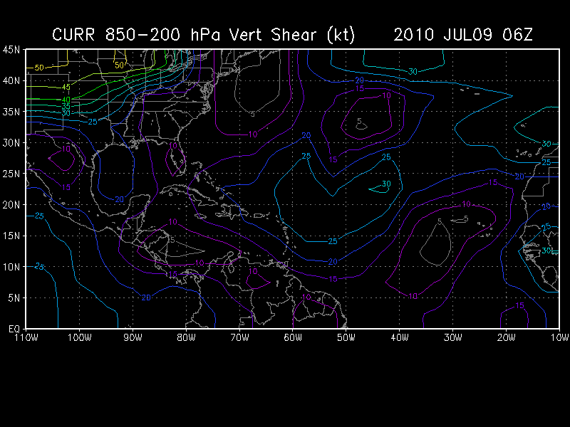
Vertical Shear

The SST’s (Sea Surface Temperature) in the area are above average (anomaly) and are 28°-29° Celsius or (82° – 84° Fahrenheit). Tropical Cyclones tend to need a minimum of 26° Celsius and above for anything to develop.

It is still to early to what will transpire with this wave but this is the time of year when storms will soon be developing in the Eastern Atlantic rather than the Caribbean or Gulf of Mexico. My own feeling is that won’t develop and can be counted out for at least the next couple days or will dissipate entirely.

Categories
Tropical Weather

Invest 93L

Starting yesterday, a system was beginning to catch the eyes of those who are interested in the tropical weather. A modest to strong region of very intense thunderstorms that are in the Caribbean are beginning to look like that we may soon have the first tropical depression (at least in the Atlantic basin). Wind shear in the area is very low, the SST’s are very warm – 29 to 30 degrees Celsius. The MJO (Madden-Julian Oscillation) also does seem to favor tropical development. It is now in the wet-phase over that region. One negative side is there has not been a lot of spin according to the University of Wisconsin 850 mb relative vorticity analysis. 93L will probably begin to get an increased inflow from low level air and help the development of the spin soon.

At this time the NHC is calling for a 40% chance of developing of into a tropical depression. I wouldn’t see that until at least Wednesday maybe even Thursday. The GFS, NOGAPS, and UKMET models have been very reluctant to develop 93L for the time being. The GFDL model is expecting 93L to be a weak tropical storm in the next 5 days. At this time – the GFDL has been flip-flopping so lets just see what happens.

One worry is the possible flooding in Haiti. Any mudslides then there will be some unfortunate deaths. Lets just pray this will not be the case. Haiti has had enough over the past couple years.

As always – please use the NHC or your local weather for official information.