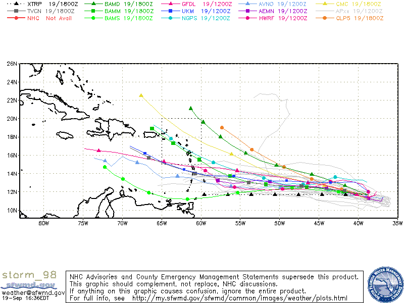
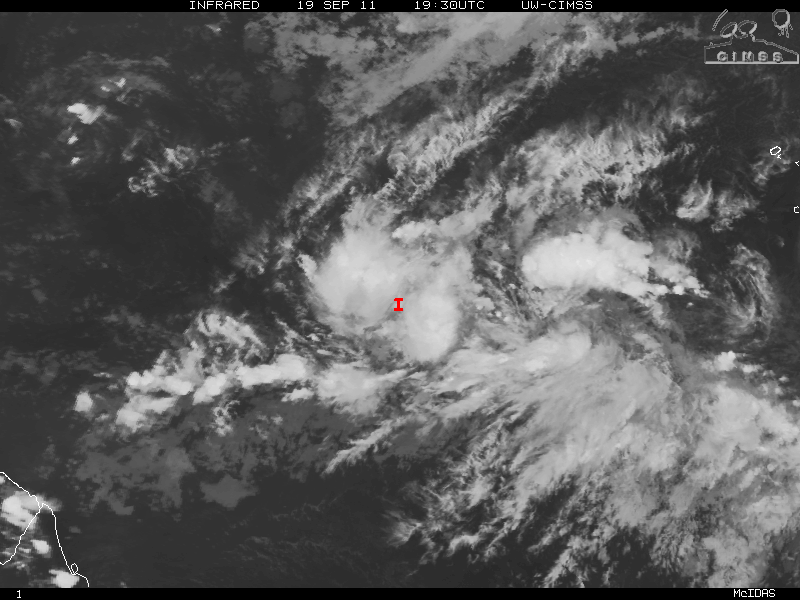
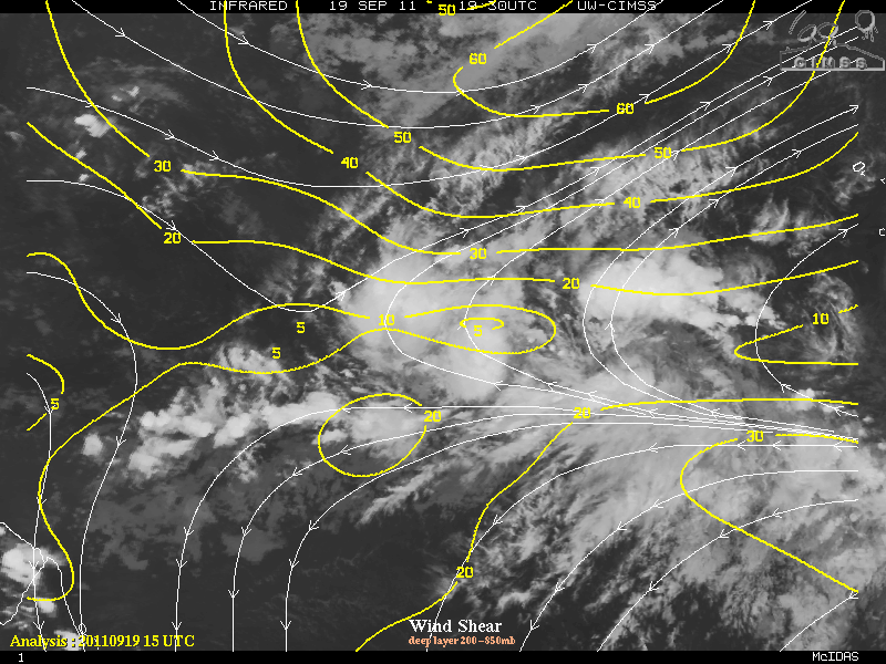
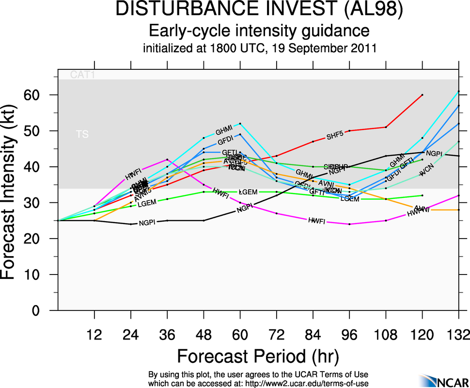
The tropical wave tagged as Invest 98L about 1400 miles east of the Windward Islands has continued to develop and is much better organized than yesterday. Conditions are now much more favorable for the few days 98L may develop into a tropical depression possibly as soon as tomorrow. Most of the major players in the global models guidance are in agreement for Invest 98L to develop as a tropical storm as it continues to head westward and eventually into the eastern Caribbean. That said, both the European and the GFS models do want to weaken 98L possibly to just a tropical depression, mostly due to a ridge of high pressure that is forecast to strengthen along with increasing shear. This should cause 98L to accelerate it’s forward motion leaving the convection behind and eventually decoupling whatever is left of 98L back to just a tropical wave.
Dependent on what is left of 98L and also what the track guidance will be, regeneration may or may not occur. If 98L continues it’s westward track and can pass through the “graveyard” (an area near Hispaniola hostile for storms) somewhat intact, as it gets to 75°W longitude there is the slight chance, of regeneration, albeit very slim. More likely than not, 98L will not track westward but a more west-northwest and affecting the Leeward Islands and possibly Puerto Rico, although it would be more of a rain event than a wind event due to the shear.


