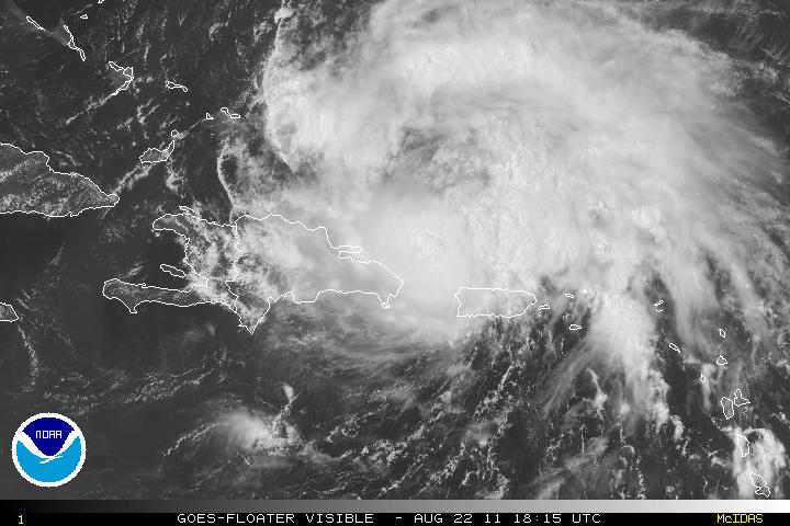
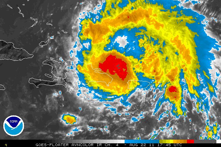
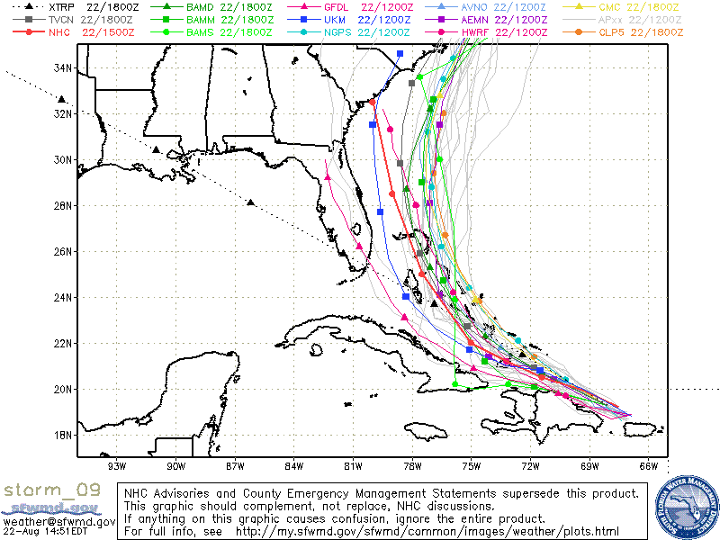
Hurricane Irene, the first of the 2011 Atlantic basin. Hurricane Irene is a very large and possibly a very dangerous storm and is forecast to skirt the coastline of the Dominican Republic as a hurricane, then move out into the warmer waters of the Atlantic. The forecasted track is a very complicated one, but there is some consensus within some of the models with most models having it heading toward southern Florida, possibly skirting the coastline of Florida then a trough will begin to help pull it upward and head north. There is the distinct possibility that it may have landfall as far north as North Carolina. As Irene heads further north, the environment will be very favorable for further development and intensification.
The possibility of Irene going into the GOM has pretty much been eliminated now. The Texas ridge has not retrograded and is actually staying firm. Between that ridge will be the trough digging downward the eastern seaboard of the US. Usually, the troughs will have a tendency to hang around, but this season has been different. The troughs have been digging down almost as fast as they leave. This is also the case with Irene. When the trough leaves, it will leave a more zonal flow (which is more west to east, versus a meridional flow which is more like a roller coaster and is more north to south). The Atlantic (sometimes called the Bermuda) high pressure ridge will be to the right of the trough. Once the trough leaves, there is a weakness and the Atlantic ridge will start to fill in that weakness with high pressure.
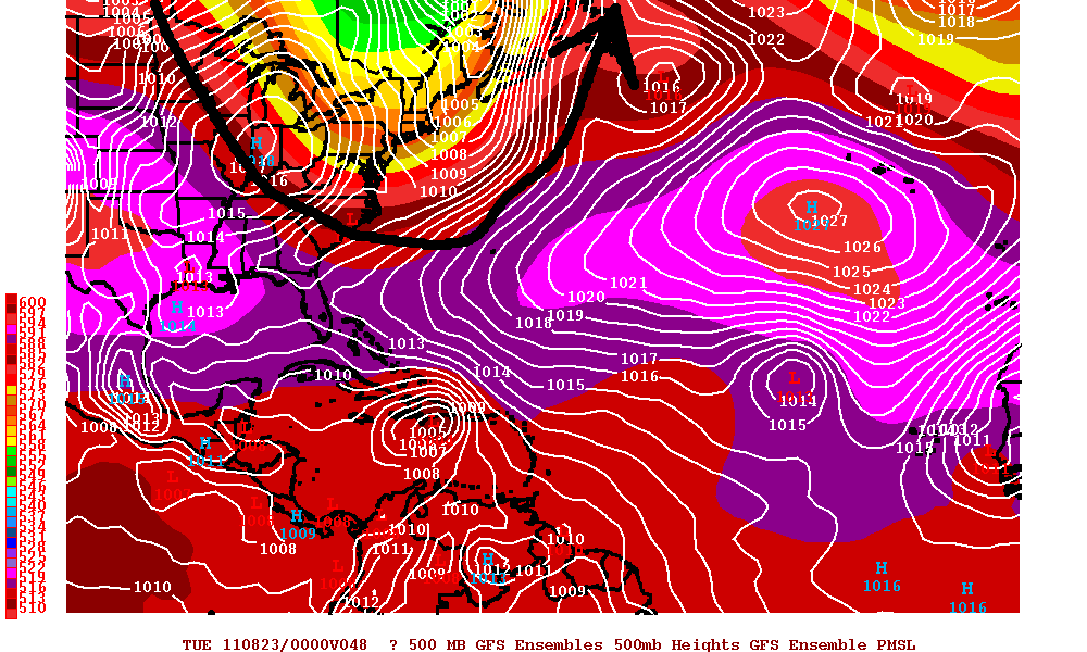
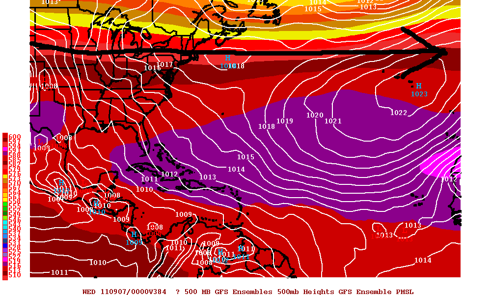
Irene is now heading WNW toward the Dominican Republic and if the trend continues, Irene will be skirting the northern coastline of the Dominican Republic. Irene is forecast to stay on the WNW track for the next 36-48 hours. Irene may lose some strength even though the center will be over water but because of the flow from the south with the high mountains it may temporarily disrupt it enough to lose some of it’s strength. Once Irene is further away from the coastline, Irene is forecast to strengthen rapidly.
The trough will eventually dig down and it will want to pull Irene upward. Irene will then be forced to head NNW and possibly north and will be headed into the southern Bahamas and later on toward the coast of Florida. Timing will be critical as if the turn to the north is much later than the forecast, Southern Florida, including Miami and Fort Lauderdale may be severely impacted. If the turn is to the north happens as forecasted, Irene may just skirt the coastline of Southern Florida with either category one force winds or possibly even just tropical force winds. If Irene just skirts the coast, there will be plenty enough oceanic heat to draw upon and Irene may become a very dangerous storm as it heads north. If the model forecast pans out and misses Florida, Georgia, and the Carolina’s, with little shear, and very warm waters, the environment will be conducive for a very large and strong hurricane with the possibility of winds in the category three or more along the US coastline.
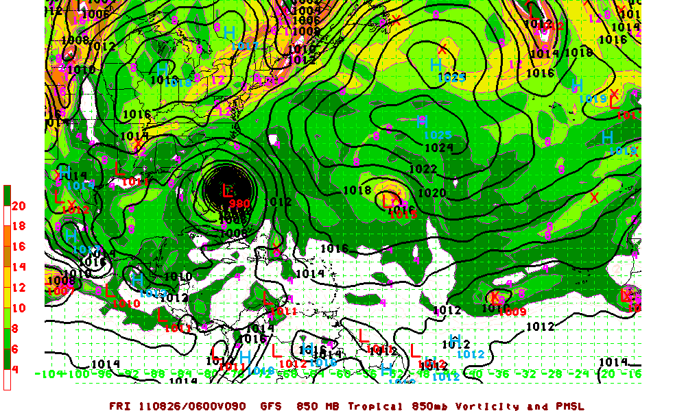
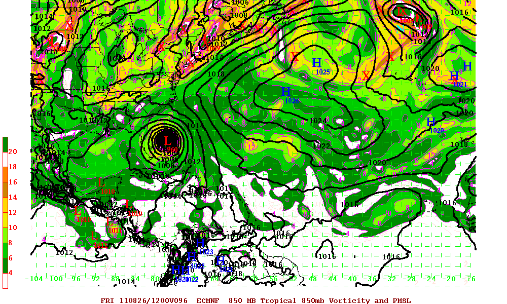
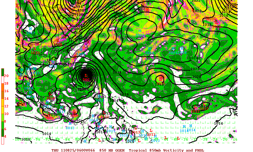
ALL interests from the Dominican Republic, Bahamas, and the US eastern coastline need to watch this storm CAREFULLY. Any slight deviation of the forecast track toward the west can have major implications down the line. And of course, always check for all the latest from the National Hurricane Center site for all official information.
