Categories
Tropical Weather

Sub Tropical Storm Otto

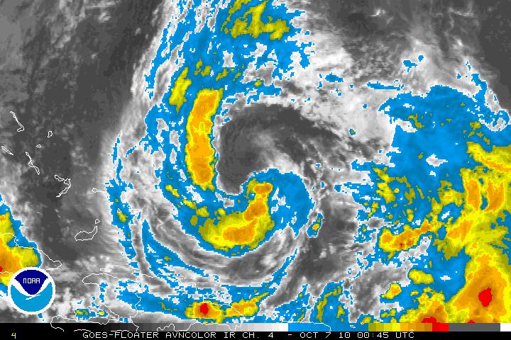
Sub Tropical Depression Seventeen has been upgraded to Sub Tropical Storm Otto as of the 5PM advisory from the NHC. Otto is heading northward between a weakness in a ridge in the Mid-Altlantic. A very strong mid-tropospheric trough that is located in the Eastern U.S. will be heading east and eventually turn Otto on Northeast track for 24- 36 hours. After that forecast period, Otto will accelerate very rapidly and will then be tracking ENE. Otto will be going through the transition period from Sub Tropical to Tropical within 12-18 hours or sooner due to warm SST’s and the dissipation of a upper-level low just SE of Otto. Otto is forecast to possibly reach hurricane status within 36 hours. Otto will then start to weaken due to upper level winds from the aforementioned trough. In 96 hours or so, Otto will go through transition from a tropical cyclone to a extra-tropical low.
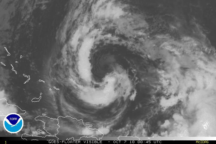
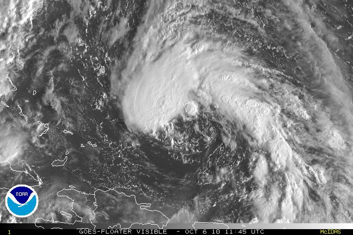
Visible Satellite image of Sub Tropical Storm Otto
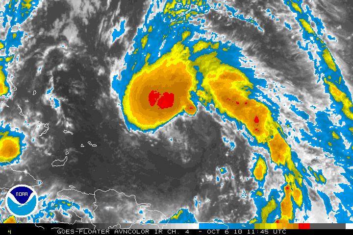
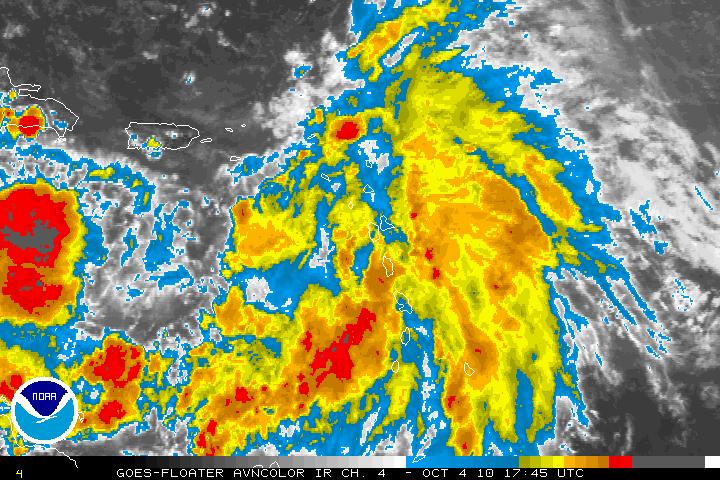
AVN Satellite image of Sub Tropical Storm Otto
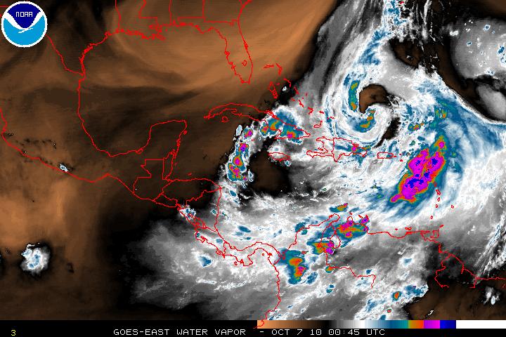
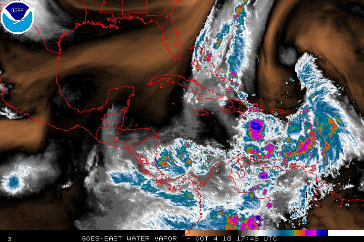
Water Vapor Satellite image of Western Atlantic/Sub Tropical Storm Otto
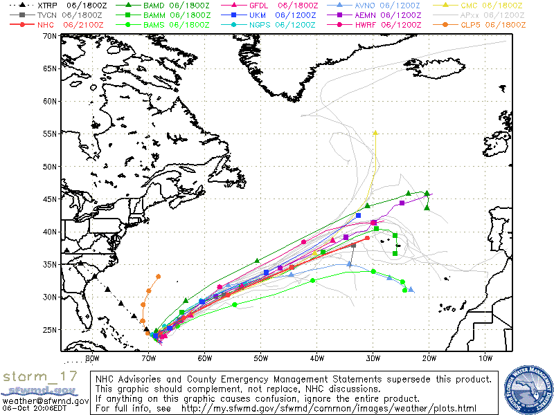
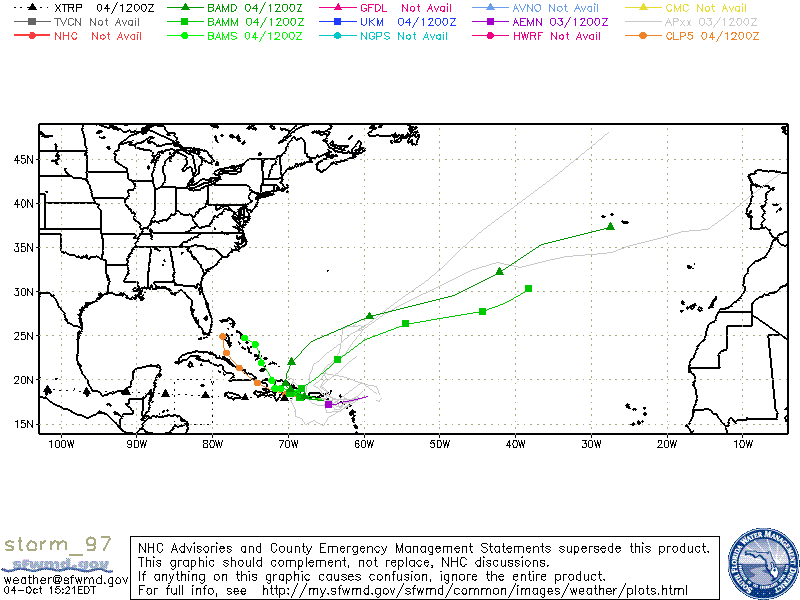
Models for Sub Tropical Storm Otto
Categories
Tropical Weather

Sub Tropical Depression Seventeen

Invest 97L has now been upgraded to Sub Tropical Depression Seventeen as of the 5am advisory from the NHC. Although Sub Tropical Depression Seventeen is still classified as sub tropical, it is very close to becoming a tropical system. Again, the difference between a sub tropical versus a tropical system is that in a sub tropical system, the center if the system is cold core and the strongest winds are away from the center. In a tropical system, the center of the is warm core and the strongest winds are in the center. A warm core allow the venting of the storm to be pushed out at the top of the system.

There is an upper level low is within the area of where Sub TD Seventeen is but this is headed southeast and is forecast to weaken. This will allow Sub TD Seventeen to be in a more favorable area for strengthening. Along with warm waters and light shear, slow intensification is forecast and the transition from sub tropical to tropical is also forecast. Vertical shear is forecast in a few days so any strengthening will be halted at that time. The depression at the moment it headed NW and is being steered by the upper level low and a very large ridge in the Central Atlantic. The ridge is forecast to erode in a few days and a series of mid-latitude troughs that are near the SE US coast will force the depression on a NE track and away from any land masses.

Visible Satellite image of Sub TD Seventeen
AVN Satellite image of Sub TD Seventeen
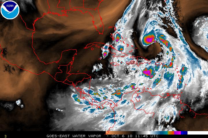
Water Vapor Satellite image of Western Atlantic/Sub TD Seventeen
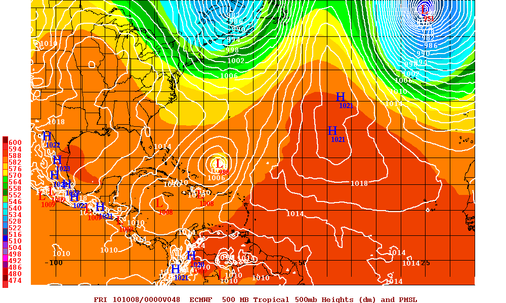
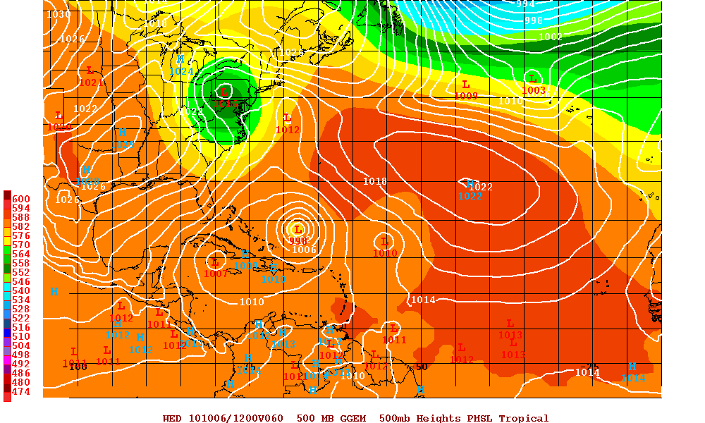
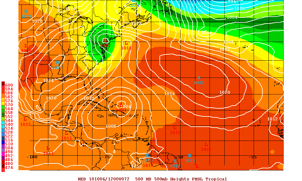
Euro Model at 48 hours
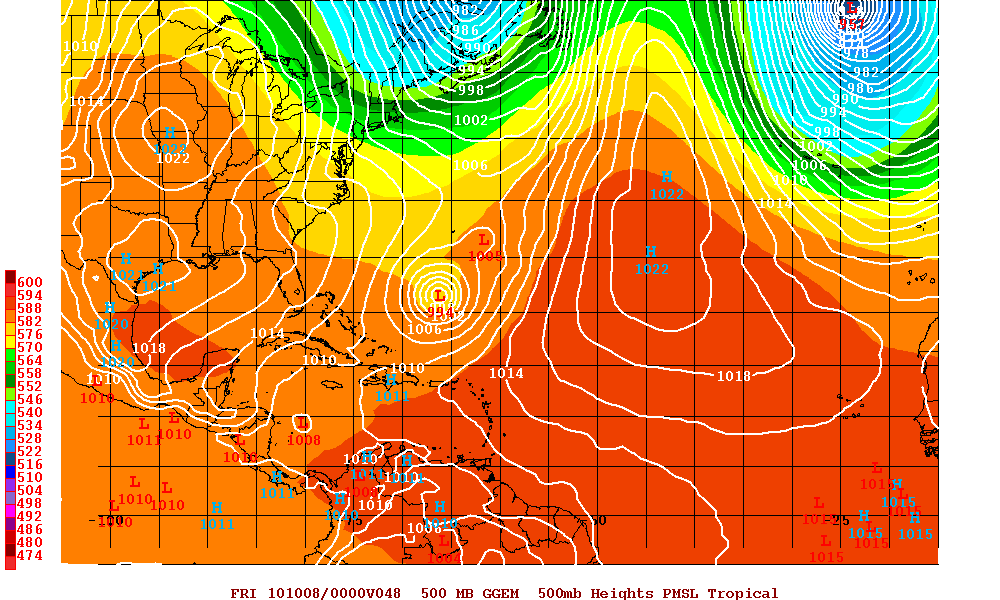
Canadian Model at 48 hours

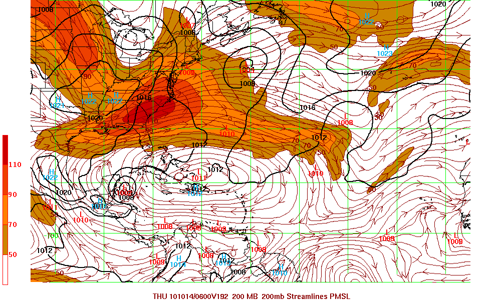
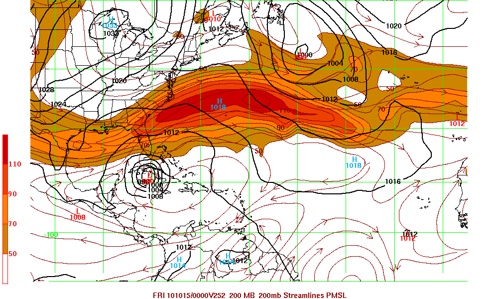
The GFS model along with Euro model are now forecasting a developing system in the western Caribbean. Whether the other models begin see this system or not, and even if the GFS and Euro models are correct, that system will be picked up and head over Eastern Cuba and then out to sea.

GFS Model at 192 hours
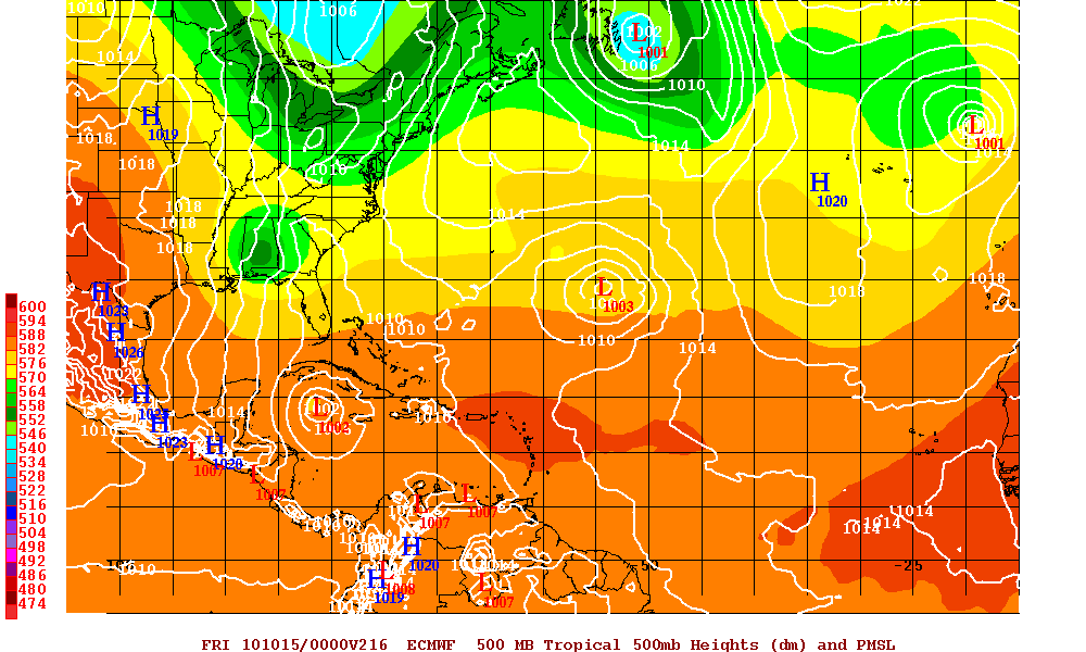
Euro Model at 216 hours
Categories
Tropical Weather

Invest 97L – A disorganized system

Invest 97L which is now near the Leeward Islands is still a very disorganized system and has still been a elongated east -west low pressure system but it has maintained it’s identity. Upper level winds will be decreasing and there is a possibility that 97L might become a depression in 48 hours or so. A few models are forecasting that 97L will become at least a depression and at least one model has it as at least a tropical storm. Due to a vigorous trough off the US East coast, 97L is forecast to back a sharp turn NE and away from the US coast. Regardless of any development, Puerto Rico and Hispaniola will be having heavy rains.

Visible Satellite image of Invest 97L
AVN Satellite image of Invest 97L
Water Vapor Satellite image of Western Atlantic
Models for Invest 97L
Canadian Model at 60 hours
UKMET Model at 72 hours

The GFS Model is forecasting that a new system will be developing in the Western Caribbean. We will have to see in a few days if the other models start see this system.

GFS Model at 252 hours