Categories
Science Tropical Weather

Tropical Storm Emily – A Florida Threat??

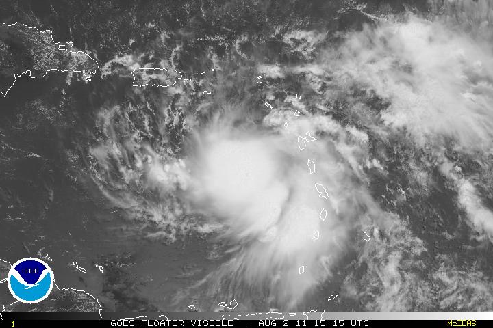
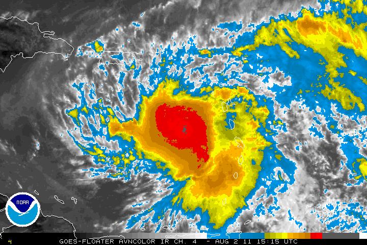
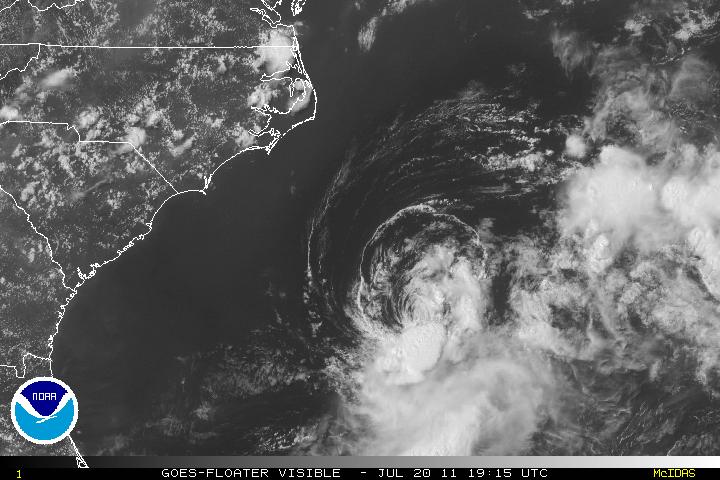
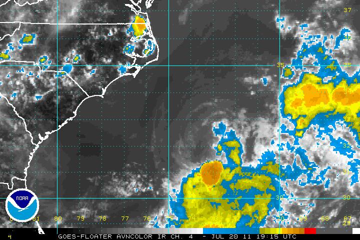
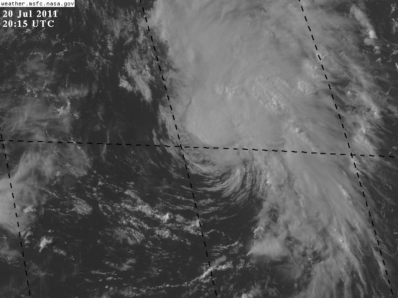
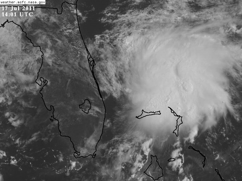
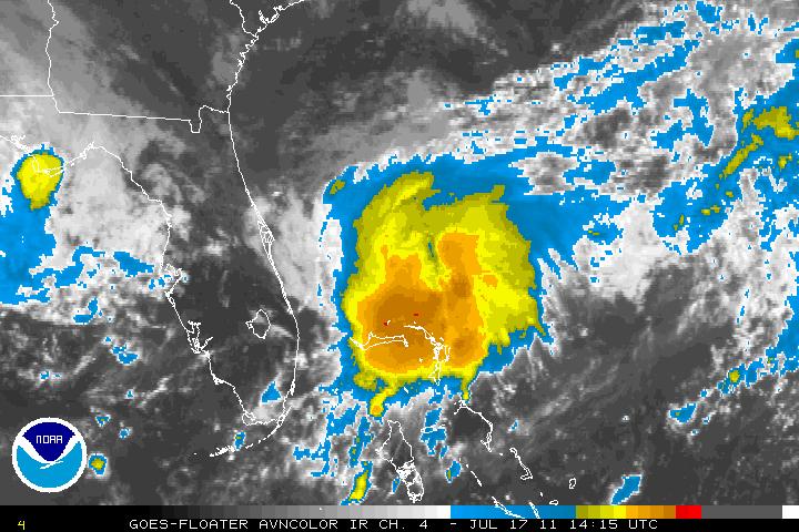
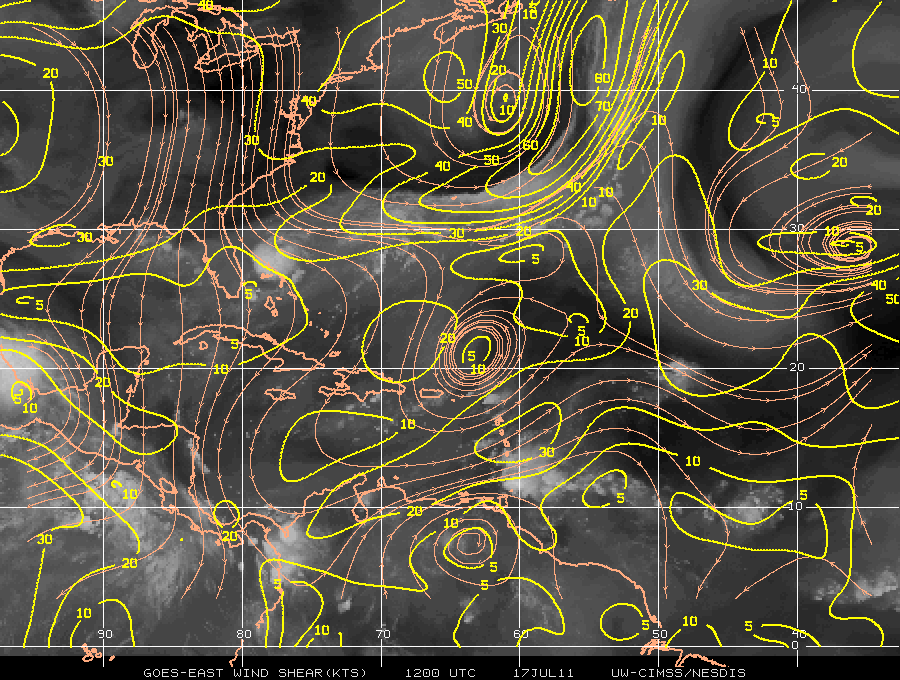
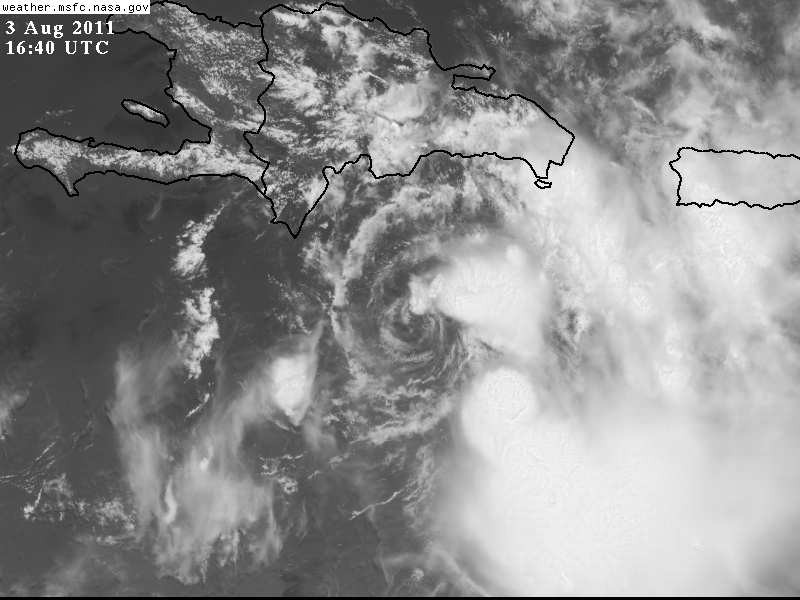
Tropical Storm Emily has continued to trek more toward the west than west-northwest and is still a minimal tropical storm. Recon is investigating Emily as we speak and will give a better estimate of the intensity at that time. Although the center seems to be well defined, the center has decoupled from the mid-levels with all the convection well far from the center of circulation. The dry air to the NW of Emily along with some shear from the westerly wind shear has the culprit for Emily. There is also a high south of Emily and the flow from that is also helping to remove some of the convection from the center of Emily. Some convection may try to wrap around the center again, whether or not it can sustain it is difficult to say. EDIT The convection has started to wrap around the center of Emily and the “naked swirl” is no longer shown in the latest images.

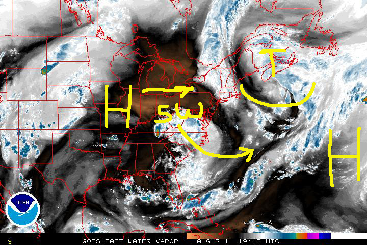
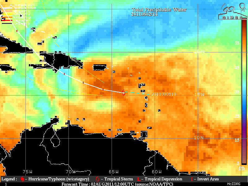
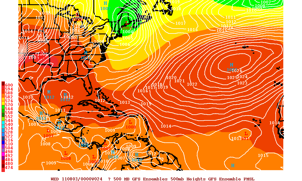
As I alluded to in my previous post, Emily is expected to make a turn to the northwest as it approaches either the western end of the Dominican Republic or Haiti. One of the problems right now is that the trough that was to pick up Emily is beginning to lift out and Emily has still been on that westward track. The forecast was for Emily to picked up by that trough. There is the possibility that since the trough is lifting out and Emily is a weak storm, Emily may not be picked up by that trough. Why Emily has not turned northwest as of yet is because there is a high pressure ridge in the Atlantic and another high pressure ridge in the midwest heading east. Emily being too far south and also being a weak storm, the two different ridges may have somewhat shielded the trough from picking Emily up. A shortwave trough in the southeast US is forecast to head southeast and this is expected to then pick up Emily and this will make a sharp turn taking Emily to the northeast. The problem is if Emily misses the first trough then Florida may be in Emily’s sight.

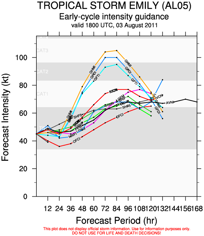
Now assuming that survives the trip over Hispaniola, Emily should regenerate and slowly strengthen. The high pressure ridge from the midwest will bring both subsidence and dry air off the coastline of the Southeast. This will make the strengthening gradual. Although there is no real consensus within the intensity models, some have Emily near a high category two where as others have it below hurricane strength. The intensity models that have it over hurricane strength I think have to be discounted unless Emily survives the crossing over Hispaniola in somewhat intact.
Categories
Science Tropical Weather

Tropical Storm Emily

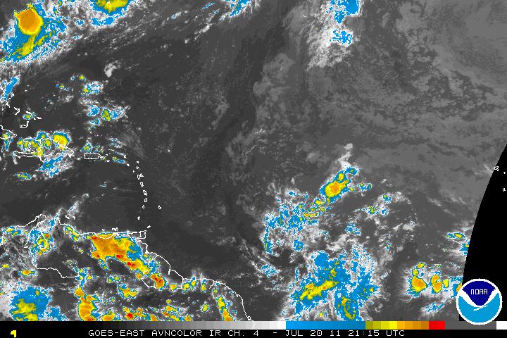
The large tropical wave that was near the Antilles Islands has been upgraded to Tropical Storm Emily as of 7:30 PM last night by the NHC. Emily at this time is a storm with 40 MPH but should slightly increase for the next 24-48 hours. One of the reasons Emily is struggling somewhat is because there is a lot of dry air to the north of Emily and the flow from that dry air is wrapping around the storm thus making difficult for intensification. There is also a upper trough that is to the NE of Emily and that outflow is shearing the north side of the storm and again limiting the amount of intensification. This upper trough will be leaving within the next day or so and this may allow some further intensification, but this will be gradual.

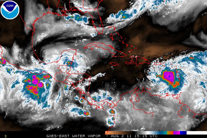
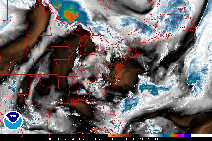
A very strong trough will be diving south in the western Atlantic and soon should allow Emily to take a northwestern turn and then a turn to the north. The forecast is for Emily to possibly be a moderate strength storm with possible wind speeds of 50 – 60 MPH while heading northwest and having landfall somewhere in Hispaniola. (The trough depicted in the image below is the green to yellow to light orange pattern.)

If Emily makes landfall in the western edge of Hispaniola, Emily may or may not survive the crossing to the Atlantic due to some mountains as high as 10,000 feet. Assuming Tropical Storm Emily does cross to the Atlantic, weakened but still tropical in nature, Emily may regenerate and some strengthening may be foreseeable.

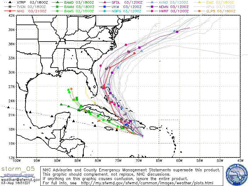
The track for Emily is very uncertain and Florida/Bahamas may be the next target. The trough will be lifting out, roughly during hours 72-96 and Emily may head a little more west-northwest heading somewhere in the vicinity of Florida or the Bahamas. Eventually a shortwave will cause a sharp turn northeastward and take Emily out to sea. If Emily stalls for a long period of time, then the track for Emily will be changed and Florida may have to deal with her. Everyone in the possible affected areas should keep an eye on this storm.

Categories
Science Tropical Weather

Tropical Storm Bret, Tropical Storm Cindy

Tropical Storm Bret which at one time was close to attaining hurricane status but due to dry air entrainment along with vertical shear from the north of Bret, the storm has struggled to keep it’s identity. The southwesterly flow of a tropical ridge is expected to make Bret on a northeasterly track.

Furthermore, there is a large area of dry air along with subsidence in the middle Atlantic states. This mixture should introduce dissipation of Bret within two or three days, if not sooner, as that dry air heads southeastward toward Bret.


Invest 99L is a low pressure system about 565 miles ENE of Bermuda and has been getting better defined during the day and was updated as Tropical Storm Cindy as of 5PM Advisory from the NHC. Tropical Storm Cindy is in some warm SST’s and may continue to strengthen for a day or so. After that it will be cooler waters which will allow Cindy’s transition to an extratropical storm.


A large tropical wave east of the Windward Islands may be our next Invest in the next couple days. This wave does have some cyclonic turning but at the moment, convection is limited. Only the Euro (ECMWF) model is seeming to pick this system up. Whether or not any other models jump on board or if this tropical wave will develop, remains to be seen.

Categories
Science Tropical Weather

Invest 98L

A couple days ago a few models were hinting that a weak surface trough may detach itself from the frontal boundary. Yesterday afternoon, Invest 98L was initiated as thunderstorm activity had become better organized. Upper level winds are are slowly diminishing and this may allow for a more conducive environment for possible better organization of this system. The synoptic pattern should keep it drifting slowly southward for the next 48 hours or so.

Some cyclonic turning is presented by satellite. At the moment the surface pressures are still too a bit to high. Mid-level shear from the NW is also hindering any development but this will be relaxing. Model guidance, at least for right now is not showing cyclonic development, but this is due to the resolution for these models. Recon will be flying into this system later today and when we get a fix from recon and models will be initialized for the 00z (zulu time) run which might clear up the uncertainty.

If the convection can tuck under the LLC (Low Level Circulation) along with Invest 98L heading southward a possible tropical depression may develop within the next couple days or even hours. The track for this system is a bit difficult as it doesn’t have a LLC yet. Being that the system is close to the coast of Florida, all interest should keep tabs on this system.

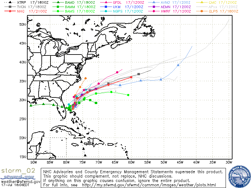
UPDATE: As of the 5PM advisory, Invest 98L has now been upgraded to Tropical Depression Two. The system was found to have a LLC but a lot of the convection has diminished. Dry air to the north of the system should keep the system from developing into a hurricane. Most of the models guidance in now in agreement that TD Two will continue to drift southward in the short term but a weakness in the sub-tropical ridge will allow a northern turn and eventually a northeasterly track. The LGEM model (intensity) suggests that TD Two will develop further into a Tropical Storm but holds limits it to just a Tropical Storm but not a hurricane.

UPDATE: As of the 8PM advisory, TD Two has been upgraded to Tropical Storm Bret and the satellite images have been updated to reflect the change. Convection has been consolidated near the LLC. Maximum winds have increased to 40 MPH and strengthening is forecast.

Categories
Science Tropical Weather

Tropical Storm Arlene

Invest 95L which was just an open wave has been upgrade to Tropical Storm Arlene as of the 8 PM advisory from the NHC Tuesday evening. Today, recon has gone in and found that while Arlene is getting better organized, a well-defined inner core is still lacking. Upper-level winds are slowly decreasing and the environment will be conducive for further development. There is a good chance that Tropical Storm Arlene might become a hurricane just before landfall. The SHIPS (model) for Rapid Intensification Index is high and 20 to 30 knots within the next 24 hours is not unreasonable.

A deep-layer ridge to the north of Arlene will induce a westerly track and some model guidance are indicating a possible shift to the left of the westerly track for a WSW track. No matter the track, this will be more of a rainfall event and the biggest concern is possible flash-floods or mudslides in Mexico.

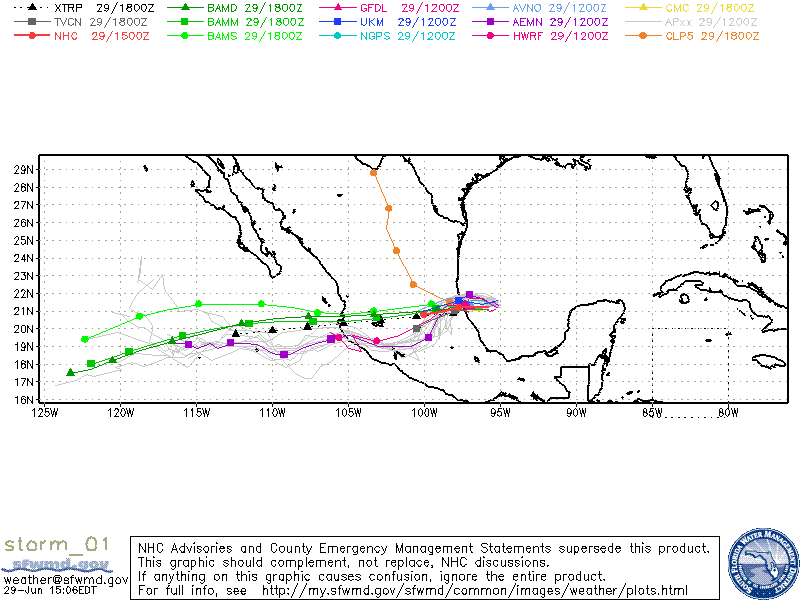
Model for TS Arlene
Categories
Science Tropical Weather

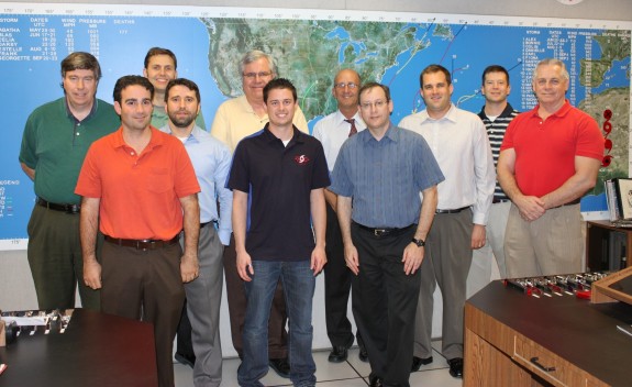
Hurricane Specialists

Have you ever wondered who the hurricane specialists (forecasters) are at the National Hurricane Center (NHC) other than just their names you might see on the reports they produce during the hurricane season?

These people are the very best in their field. Not anyone can work as a specialist at the NHC. Only the best of the best were chosen. Although there will be those people who criticize every aspect of what the NHC does, thankfully those people are in the minority. These specialists do more than just view different satellite views and use some of the fantastic software they have (NAWIPS, ATCF, etc.) before they they write up the advisories, forecasts, warnings and other public products – there is a lot more behind the scenes. One thing the general public may not understand is that the specialist when writing up any of these advisory products, there are specific guidelines in how the report is written although there a few qualifiers that do allow some “freehand text” in a few of the reports. The forecaster will check on the latest model runs as this allows the specialist to help forecast where the storm might be heading. The data from the recon aircraft comes from the folks in the CARCAH (Chief Aerial Reconnaissance Coordination, All Hurricanes) office. The forecaster will have many conversations with whoever is staffing that office during the course of a recon mission – as that person is their link to the aircraft crew. The forecaster will also be checking with the TAFB (Tropical Analysis and Forecast Branch) as they provide a storm intensity estimate. The Hurricane Specialist uses the TAFB estimate as guidance but the Specialist will consider all available data in determining the intensity for the advisories.

A normal 6 hour forecast cycle;
The cycle begins, and 45 minutes later there is the reception of the fix data although that is the deadline time. The vast majority are in specialists hands 15 to 30 minutes after synoptic time. Aircraft fixes usually come right at synoptic time or even a bit earlier. An hour after the cycle started – the models are initialized. Again, that is the deadline time, usually the initialization of the models start a bit earlier. A few minutes later, the forecaster receives model guidance and starts the preparation for writing up the forecast. The primary text products in the forecast are the tropical advisory, forecast/advisory, and discussion. The second hour after the cycle started, the hotline call to both the (NWS) National Weather Service and the (DOD) Department of Defense is made. On the third hour, the forecaster has a deadline to release the tropical advisory products. Hours four and five are for possible media interviews. On hour six, the next cycle begins.

When storm watches or warnings are activated or during a landfall event the media is in the NHC building, but usually it’s the Director (Bill Read), Deputy Director (Ed Rappaport, PhD), or the Branch Chief (James Franklin) doing those interviews, not the Specialist on duty. There are a few times after the the advisory has been posted someone from the media may call and the forecaster on duty may answer any questions they may might have. When landfall is imminent within a stretch of shoreline, Federal and state level Emergency Managers, the NHC has someone who acts as a liaison between the EM’s and the NHC. Local EM’s are supposed to be in touch with their local WFO (Weather Forecast Office), who in turn relay their concerns to the NHC.

When hurricane season ends (officially) November 30th, the hurricane specialists remain busy outside the hurricane season. Occasionally, storms form before the official beginning of the hurricane season and also after the official end of the season, so specialists still have the responsibility with that storm too. They also have to attend some national and international hurricane conferences. The specialists do help the CPC (Climate Prediction Center), basically to prepare for the annual seasonal hurricane forecast. The specialists must also write seasonal summary articles and also participate in some applied research projects.

So each hurricane season these specialists (and who get little recognition) are the ones that have to deal with criticism when their forecast might be off, but more times they are very close in their forecast. Maybe it’s time for people to really thank the specialists for all the hard work they do.

Photo credit – Dennis Feltgen

Categories
Science Tropical Weather

ENSO – La Niña Advisory

El Niño/Southern Oscillation (ENSO) Diagnostic Discussion

During the latter part of 2010 and the very early months of 2011 the La Niña has been strong to moderate but most of ENSO models are forecasting a weakening of the La Niña within the next few months.

La Niña comes from changes in both the ocean and the atmosphere. High pressure usually dominates the atmosphere over the eastern Pacific, while low pressure tends to reign in the west. The pressure difference creates the trade winds, which blow surface water across the equatorial Pacific to a pool of warm water in the west. Cooler deep water wells up to replace the surface water. During La Niña events, the pressure difference and the resulting trade winds are stronger. The more intense winds push more water west, where it builds up north of Australia. Meanwhile, more cold water wells up in the central and eastern Pacific. La Niña occurs only when both the ocean and the atmosphere change together. The unusual ocean temperatures and imbalance in air pressures alter weather patterns across the world.

Although most models are forecasting the weakening of the La Niña, there are a few that are forecasting a lessening in the the La Niña until the mid-summer months. Whether or not the hurricane season will be a neutral one or an active season is still a little early to forecast.

Synopsis: ENSO-Neutral or La Niña conditions are equally likely during May-June 2011

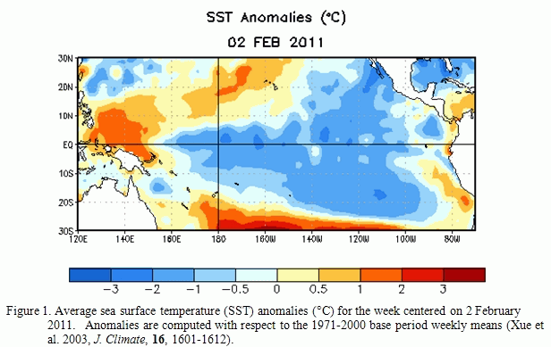
“La Niña persisted during January 2011 as reflected by well below-average sea surface temperatures (SSTs) across much of the equatorial Pacific Ocean (Fig. 1).


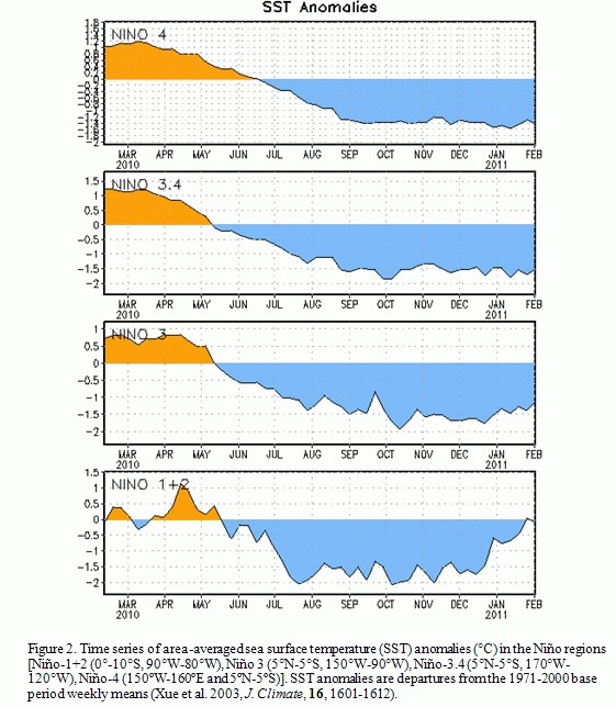
However, some weakening was evident in certain atmospheric and oceanic anomalies, in part due to Madden-Julian Oscillation activity. Most Niño indices were between –1oC and –1.5oC at the end of January, with the easternmost Niño-1+2 region returning to near-average (Fig. 2).


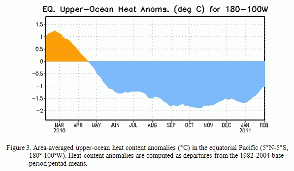
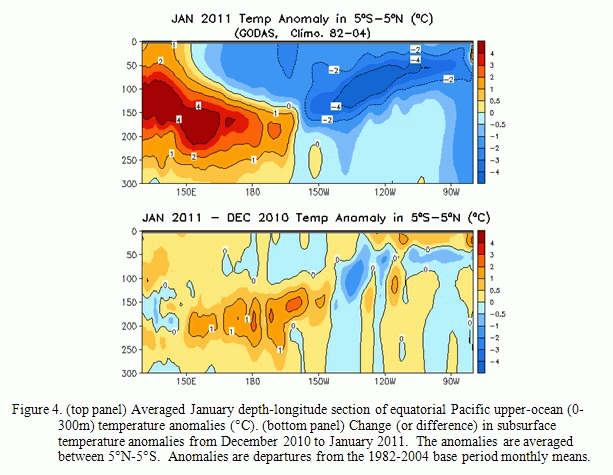
A lessening of the negative subsurface oceanic heat content anomalies (average temperatures in the upper 300m of the ocean, Fig. 3) was observed mostly in association with an eastward shift in the above-average temperatures at depth in the central equatorial Pacific (Fig. 4).

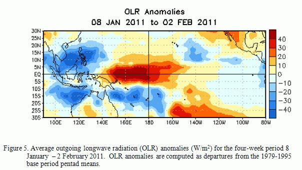
Convection remained enhanced over Indonesia and suppressed over the western and central equatorial Pacific (Fig. 5).

Also over the western and central equatorial Pacific, the anomalous low-level easterly and upper-level westerly winds decreased in magnitude. Collectively, these oceanic and atmospheric anomalies reflect an ongoing, mature La Niña that has begun to weaken.

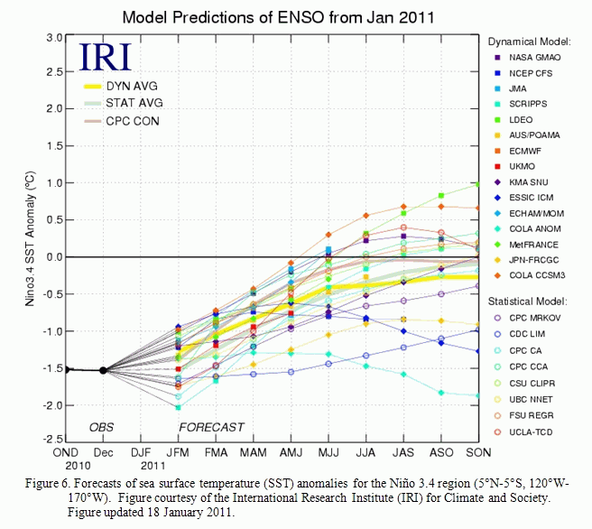
Nearly all of the ENSO model forecasts weaken La Niña in the coming months (Fig. 6).

A majority of the models predict a return to ENSO-neutral conditions by May-June-July 2011, although some models persist a weaker La Niña into the Northern Hemisphere summer 2011. Recent trends in the observations and models do not offer many hints on which outcome is more likely. Also, model skill is historically at a minimum during the Northern Hemisphere spring (the “spring barrier”). Therefore La Niña is expected to weaken during the next several months, with ENSO-neutral or La Niña conditions equally likely during May-June 2011.

Expected La Niña impacts during February-April 2011 include suppressed convection over the west-central tropical Pacific Ocean, and enhanced convection over Indonesia. Potential impacts in the United States include an enhanced chance of above-average precipitation in the Northern Rockies and western regions of the Northern Plains (along with a concomitant increase in snowfall), Great Lakes, and Ohio Valley. Below-average precipitation is favored across much of the southern states. An increased chance of below-average temperatures is predicted for much of the West Coast and northern tier of states (excluding New England), and a higher possibility of above-average temperatures is forecast for much of the southern and central U.S.” (see 3-month seasonal outlook released on January 20th, 2011).

Click here if you would prefer to see the entire report.

Categories
Music Science

Monthly Full Moon Names

Did you know that the moon has more than one name each month. Of course all of this was from the ancient past.
Native Americans in the eastern and northern US were the ones that started the naming of the full moon each month. Although there were some variations of the monthly names, generally the names were the same.

Here are the names for each month:

Full Wolf Moon
With the freezing zero cold along with extreme snows of midwinter – the packs of wolves were hungry and just outside the Indian Villages. The Full Wolf Moon is also known as the Old Moon or the Moon After Yule. In some tribes though, this is also known as the Full Snow Moon and would apply it to the name to the next moon.

Full Snow Moon
Usually the heaviest snows fall in this month. Hunting becomes extremely  difficult, so some tribes will call this the Full Hunger Moon.

Full Worm Moon
During March, the ground starts to soften and this allows the earthworms to appear, inviting the return of the robins. The Northern tribes also thought of this a the Full Crow Moon due to the cawing of the crows and hoping this will be the signal of the ending of winter. Or sometimes some tribes would call it the Full Crust Moon due to the snow cover becoming crusted from the thawing during the day and freezing during the night.

Full Pink Moon
The grass pink or wild ground phlox is one of the earliest widespread flowers of the spring. Other names were the Full Sprouting Grass Moon, the Egg Moon and – among coastal tribes – the Full Fish Moon, when the shad come upstream to spawn.

Full Flower Moon
Flowers are now sprouting everywhere. This moon was also known as the Full Corn Planting Moon or the Milk Moon.

Full Strawberry Moon
In the north, strawberry (yummy) picking season peaks during this month.

Full Buck Moon
This is the month when the antlers of new bucks appear from their foreheads and their fur. It was also often called the Full Thunder Moon, thunderstorms being now most frequent. Sometimes it’s also called the Full Hay Moon.

Full Sturgeon Moon
This month the large fish of the Great Lakes and from other major bodies of water is most readily caught.
A few tribes named it as the Full Red Moon because when the moon rises it looks reddish when the moon appears thru the haze. Also called the Green Corn Moon or Grain Moon.

Full Harvest Moon
The Harvest Moon usually comes in September in the Northern Hemisphere, but (on average) once or twice a decade it will fall in early October. At the peak of the harvest, farmers can work into the night by the light of this moon.
Usually the moon rises an average of 50 minutes later each night, but for the few nights around the Harvest Moon, the moon seems to rise at nearly the same time each night – just 25 to 30 minutes later across the U.S., and only 10 to 20 minutes later for much of Canada.

Full Hunters’ Moon
It’s hunting time. Since the fields have been reaped, hunters can ride, and can more easily see the animals, which can be caught for a Thanksgiving banquet after the harvest.

Full Beaver Moon
At this point of the year, it’s time to set beaver traps before the swamps freeze to ensure a supply of warm winter furs.   Some tribes call this month the Frosty Moon.

Full Cold Moon
December is also the month the winter cold fastens its grip. Sometimes this moon is referred to as the Full Long Nights Moon or the Moon Before Yule.


Categories
Science Tropical Weather

Invests 97L & 98L

The tropics are now heating up and becoming active.

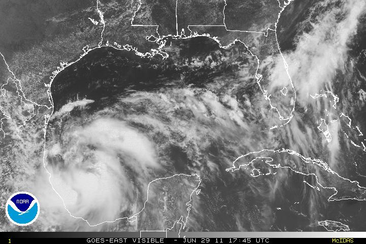
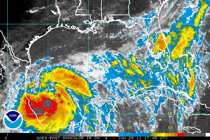
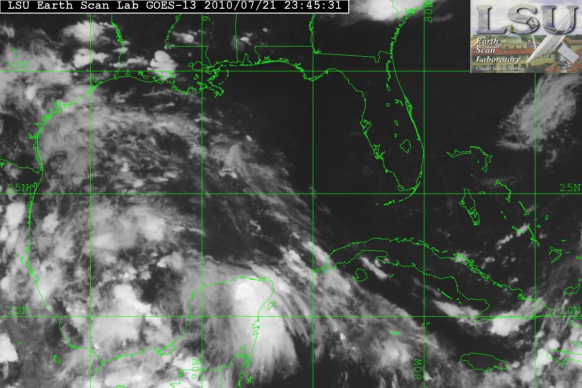
An area in the BOC(Bay of Campeche) has become designated as Invest 98L. The satellite image does show an organizing system with very large amounts of convection along with an anticyclone over it. This also has SST’s of 28° Celcius and the anticyclone it is providing a very good outflow. 98L may have the potential to become Tropical Storm Bonnie. Invest 97L is not as organized as 98L due to moderate amounts of shear and dry air. 98L is currently heading NW-WNW and possibly inland within 72 hours.

Invest 98L
Shear


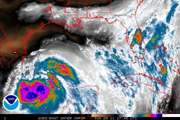
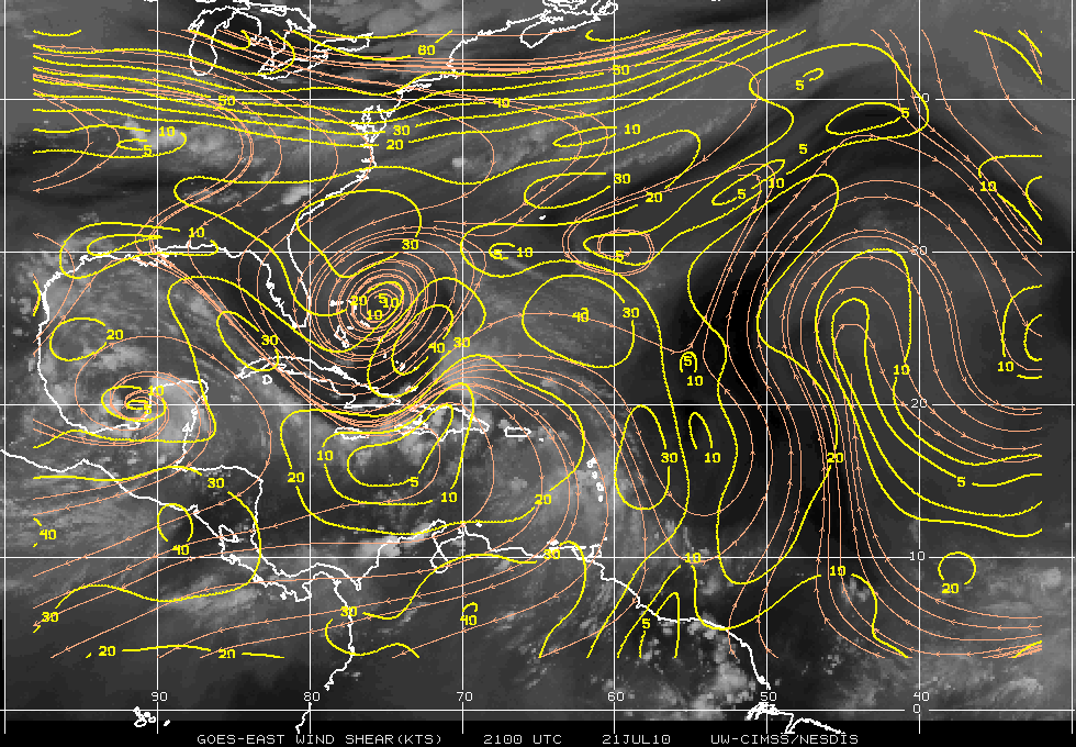
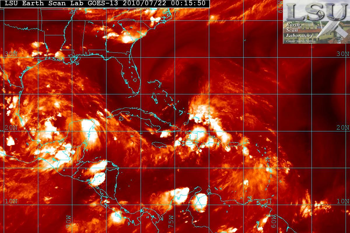
As mentioned – 97L is having problems trying to organize. The data from the NOAA Gulfstream IV jet took samples of the enviroment around 97L and it indicated that the upper-level winds were not conducive for development at least for the moment. The enviroment will probably be changing and within 24-36 hours shear may relax as the upper level low to the north west will be retrograding to the west allowing for a better chance for 97L to develop. In fact, during the day today 97L looked like it was trying to develop a LLC(Low Level Circulation) but all the convection to the right side of the “LLC” was being sheared. The quadrants to the the south and west had no convection due to the dry air and shear. Dry air in the image below is the darker area.

Water Vapor & Dry Air Image

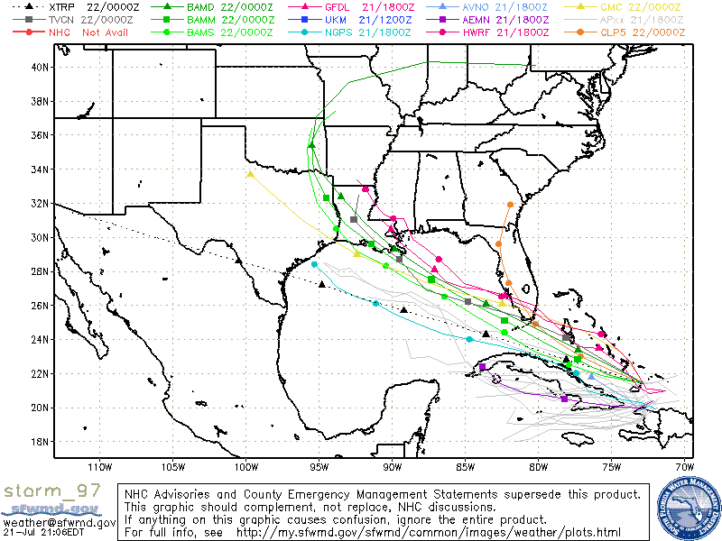
Models seem to indicate that 97L will probably in the South Florida area, at least as Tropical Depression or posssibly as a Tropical Storm. Hurricane development is not indicated at this time.