Categories
Miscellaneous/General Science Tropical Weather

Hurricane Katia & Invest 95L (Pouch P24L)

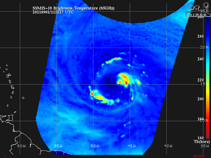
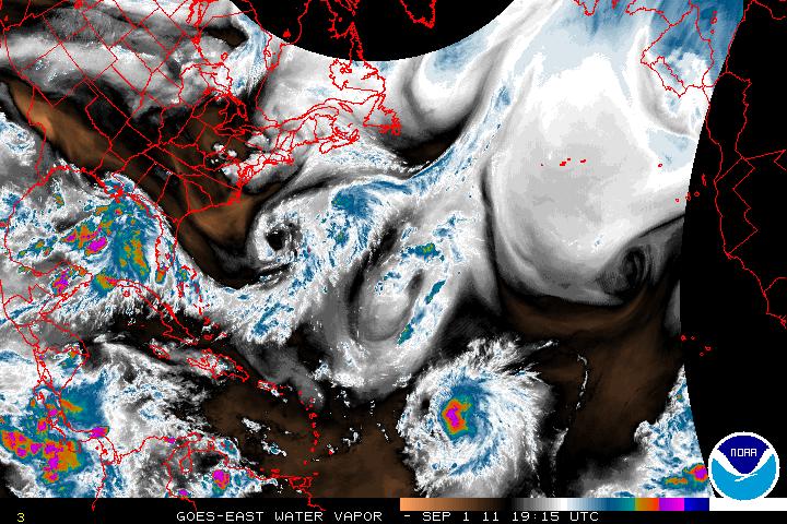
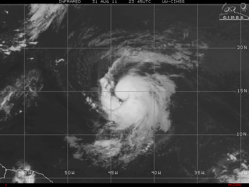
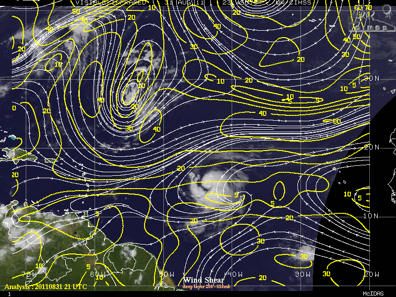
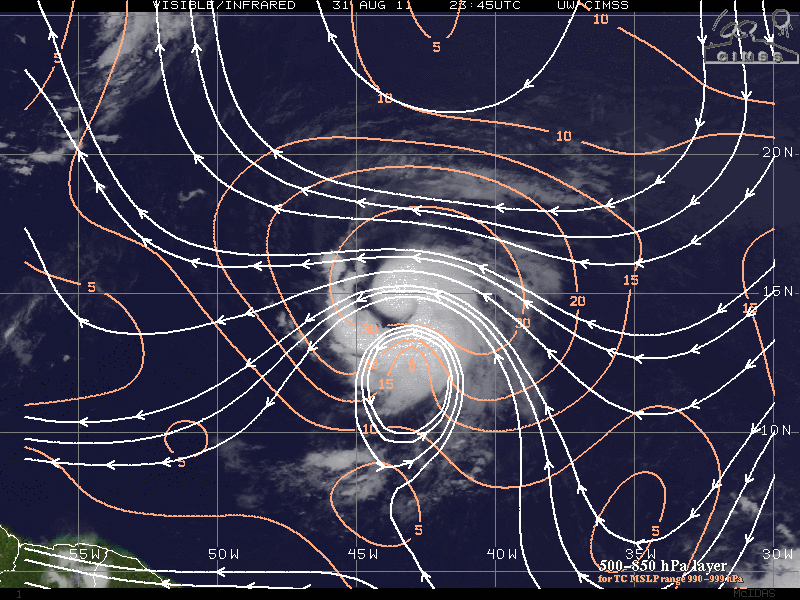
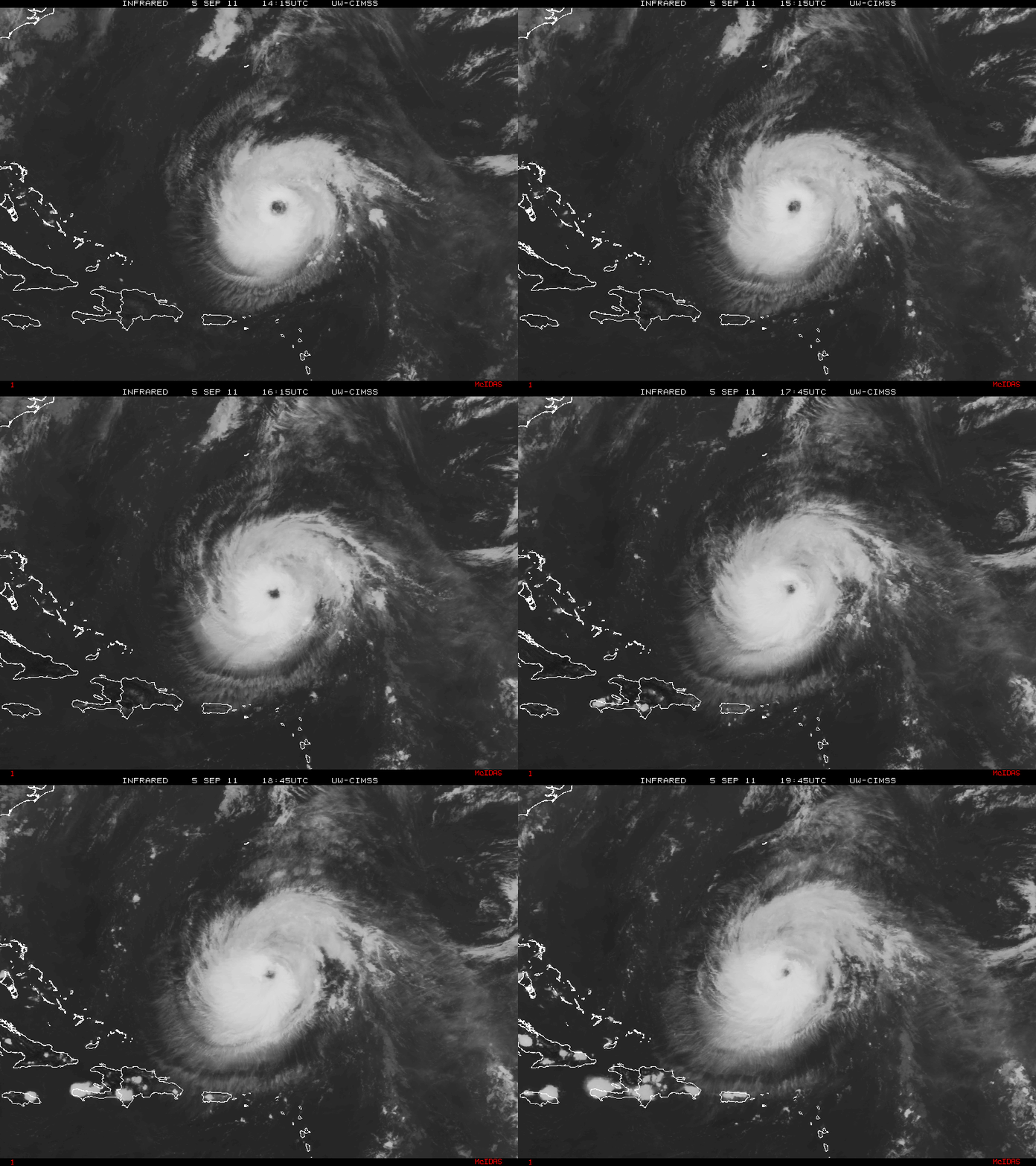
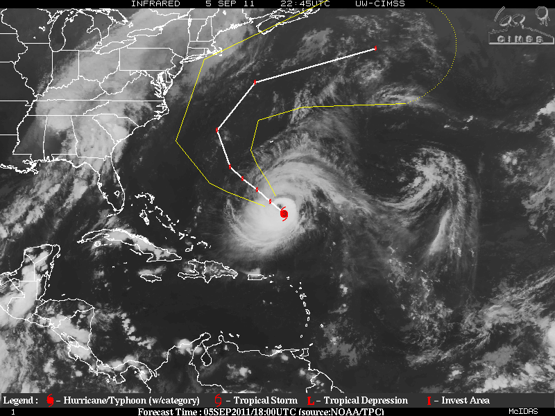
Hurricane Katia regained hurricane status again yesterday then the Rapid Intensification leveled off. Katia is a category two hurricane but the environment will be in place for Katia to intensify again to a category three storm. During the early morning hours, Katia was struggling for a short period of time as an Eyewall Replacement Cycle (ERC) was allowing some dry air to enter the inner core of the storm. This has finished and Katia started to have a very large eye but is now contracting, and the upper levels of the environment became conducive for further intensification within the next 6-12 hours and as of the 5PM advisory today, Katia became a category three hurricane. Oceanic heat will not be a factor this time so intensification will be limited for 48-72 hours or so. After that forecast period, vertical shear will be on the increase along with cooler waters. No matter where the storm goes, there will be very dangerous swells and rip tides, along the US east coast and Bermuda, please be careful!!!
EDIT: Extremely Powerful Hurricane Katia has been upgraded to category Four storm, as of the 11PM advisory for the NHC.

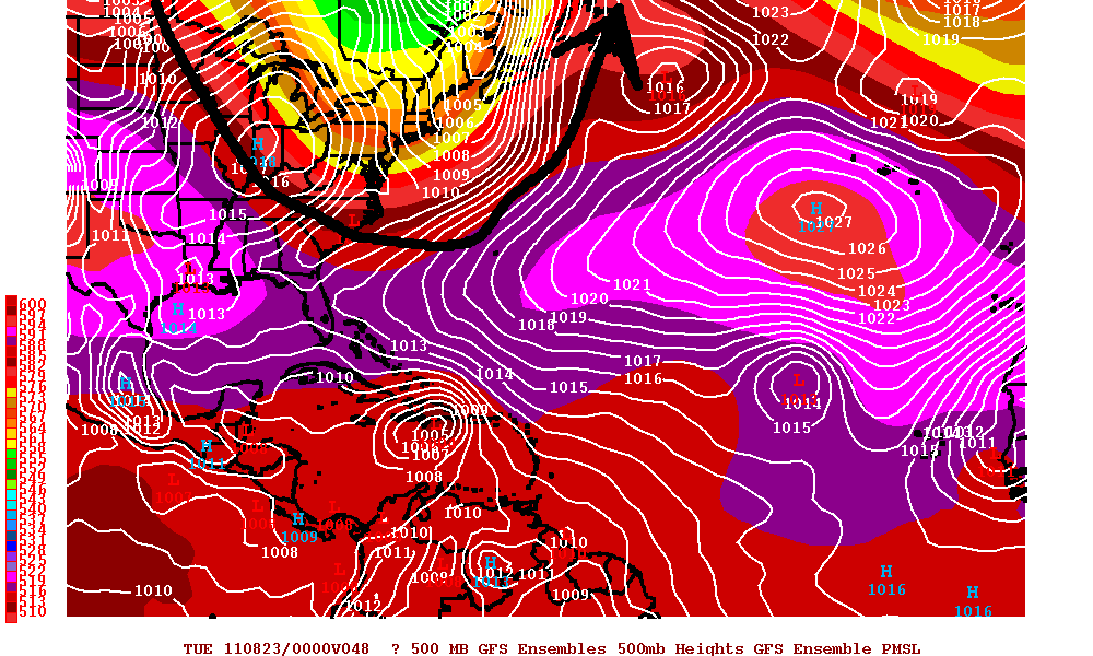
Katia is moving NW around the southwestern periphery of a central Atlantic high pressure system(subtropical ridge) and also a very deep trough that is in the eastern US and the western Atlantic ocean. Although there are some differences in the models, there should be a decrease is the forward speed within the next 36-48 hours. The track guidance within most of the models is very good and a very sharp recurve is forecast that hopefully will take the center of Katia between Bermuda and the the US east coast.


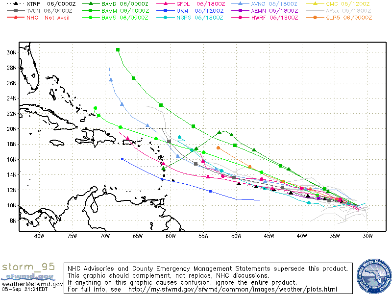
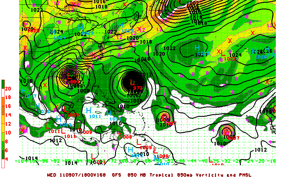
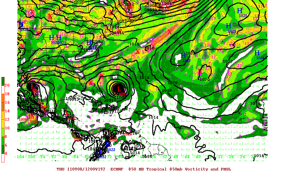
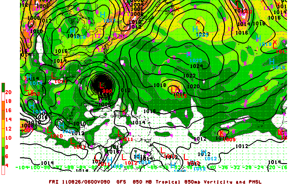
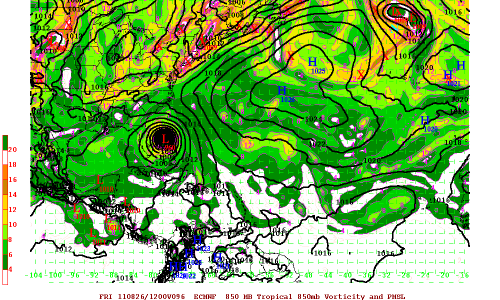
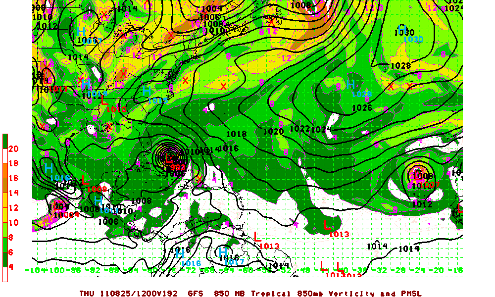
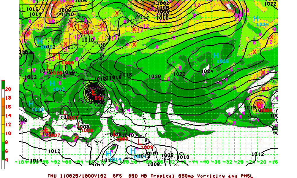
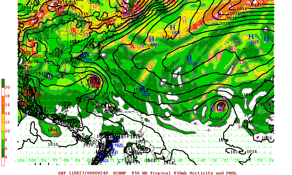
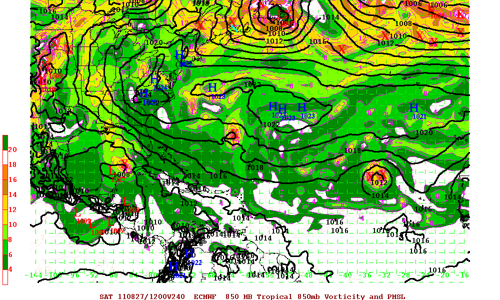
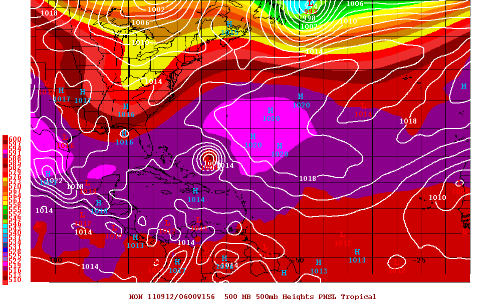
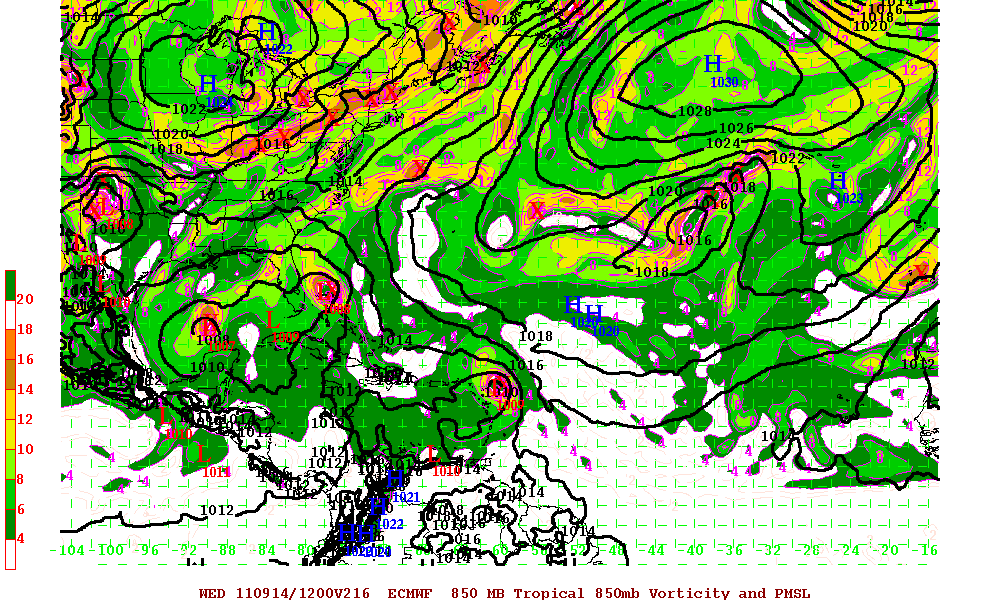
Invest 95L is a strong and very well established tropical wave with excellent cyclonic turning. The environment for Invest 95L will be conducive for further development and a tropical depression may form within the next 24-48 hours, if not sooner. Since this system has really just got started and the time the models were initiated, track guidance will not be the best in the beginning runs. Furthermore, there is no LLC as of yet and it seems at least this year, many models have had a bias too much to the north. The GFS 18z run has 95L well east of Florida at 156 hours where as the Euro (ECMWF) has it just off the coast of Florida at 216 hours. Whether or not 95L develops and if so, will it be a low rider (heads due west into the western Caribbean) or is a storm that may affect the Windward/Leeward Islands, Bahamas, Florida – is just to early to forecast at this point.
GFS Model at 156 hours

ECMWF Model at 216 hours


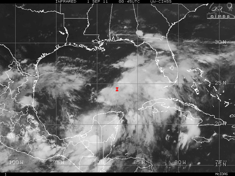
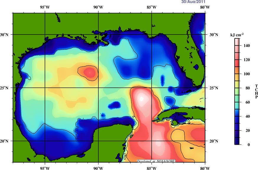
Elsewhere in the tropics, Some models are hinting that there might be some development of a system in the Bay of Campeche in the Gulf of Mexico. The GFS run has backed out for now but the ECMWF is still hinting something will form. With the Monsoonal trough near the East Pacific and especially the MJO in a upward motion in that area in 8-10 days from now, development is not far fetched.
Categories
Miscellaneous/General Science Tropical Weather

Katia, A Temporary Downgrade to Tropical Storm

Hurricane Katia has been downgraded be to Tropical Storm status as Katia’s low level core is at least 3/4th exposed. Several factors have created this possible downgrade, but the major problem Katia is having southwesterly shear. This shear is mostly being caused by an upper level low to the northwest of Katia. This upper level low is forecast to eventually lift out which should allow a much better environment of upper level winds aloft. Katia is also having problems with dry air intrusion which is disrupting the circulation of the storm. This seems to have been the problem for a majority of the storms this year.
Although Katia has been downgraded, all indictions are that this is just temporary and Katia will regain hurricane status, possibly in 24-48 hours and should still be a major hurricane in a few days.

Categories
Miscellaneous/General Science Tropical Weather

Hurricane Katia

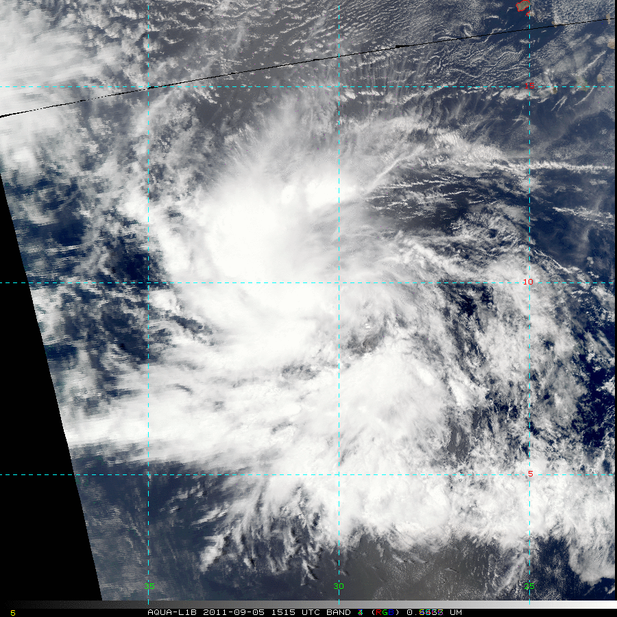
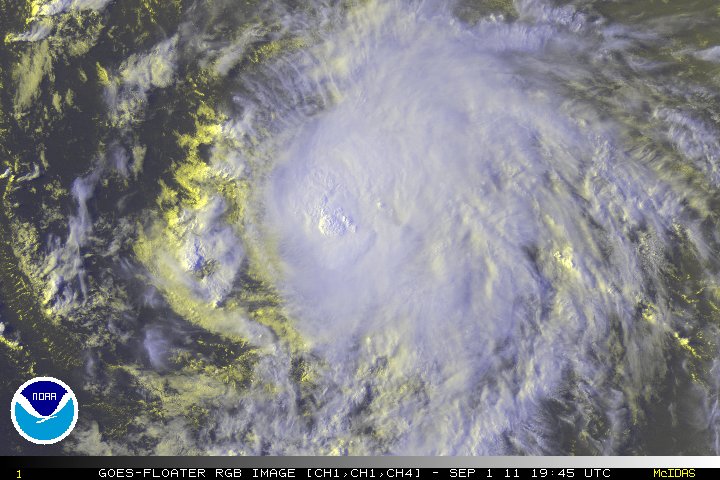
A large tropical wave near the Cape Verde Islands had been tagged as Invest 92L and upgraded to Tropical Depression Twelve and later was upgraded to Tropical Storm Katia by the NHC. Tropical Storm Katia as had excellent cyclonic turning before it even exited the coast of Africa. Katie is a well organized system, and is well is the process of developing an excellent Central Dense Overcast (CDO) and in fact is becoming more symmetrical via satellite presentation. Katia is moving at a fast clip of 20 MPH and has pretty much stayed on the 285 degree (WNW) track with a few wobbles now and then. An upper level low to the NW of Katia may, in time, become a role in the intensity of Katia, but should be a hurricane within the next 12-24 hours. The same upper level low may also induce some southwesterly shear, possibly within 96- 129 hours. At the same though, weak vertical shear and warm SST’s may be able to overcome the shear and allow further strengthening.
EDIT: As of the 11pm advisory tropical storm Katia has been upgraded to Hurricane Katia

Although it is way to early as to where Katia will be heading in the long term forecast, here are 3 trains of thought.

  1.  Katia stays west and heads into the Caribbean and is a threat to the western Caribbean and possibly later into the GOM.
  2.  Katia continues its WNW and either is a threat to the Lesser Antilles or is north of the Antilles and later turns NW toward the US coastline.
  3. Katia continues its WNW track, then NW, and eventually heads north possibly threatening Bermuda and even possibly heading into the Canadian maritimes or even recurves out to sea threatening no one.

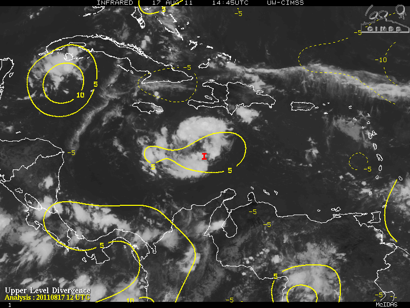
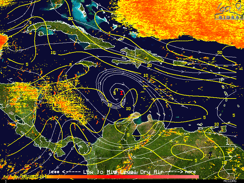
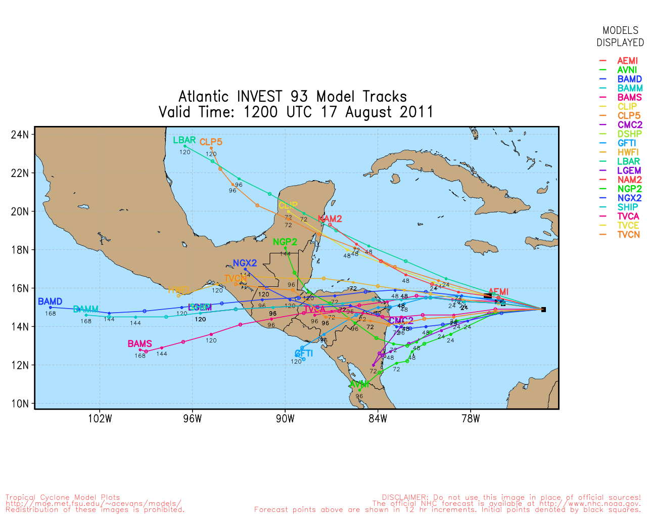
Another fly in the ointment is an area of low pressure near western Cuba (now tagged as Invest 93L). That area possibly may develop into a tropical cyclone. This may have implications as to where Katia may head later in the forecast period.
Scenario 1 where Katia stays in the Caribbean, has a very low chance, maybe 10% and thats being generous. Katie is already at 14.4 °N latitude and slowly gaining. Unless something drastic happens, I just can’t see that scenario 1 will ever play out, but I don’t want to rule it out.
Scenario 2 where Katia possibly threatens the Lesser Antilles or is 100 miles north of the islands, this has maximum of a 30% chance. If Katie has not made the turn from WNW to NW then this scenario might happen. The trough that is forecast is either to weak or pulls out early, this may allow Katia to head a little further west than forecast. It also is dependent on that area of low pressure in the southern GOM has developed into a tropical cyclone or not (I will allude to that later).

Scenario 3 – recurving and not hitting the eastern coast of the US but possible impacting Bermuda. This scenario has the highest chance – 60% chance. At this moment, most of the models are very much in agreement. Katia should begin to turn to the northwest and eventually turn north because of the trough that will situated over the eastern US by Monday of next week.

Assuming that scenario 1 is out of the picture , lets visit the area of low pressure in the southern Gulf (93L).

In the Eastern Pacific, the western Caribbean and into the southern GOM, along with an old frontal boundary that runs along Florida to the western GOM, a surface low may be trying to form possibly to the north of the Yucatan. Some models are supporting this and this may head NW toward the Texas area. The oceanic heat is very warm in this area (in some areas, 30°-31° Celsius) and a depression or tropical storm (Lee) most likely will develop. The ridge over Texas is still strong but a shortwave trough might have enough punch to create a weakness in that ridge in a few days. As the trough gets closer to Texas, this may cause the 93L to stall or drift for a few days. Even if this system does not have “landfall” in Texas, this may create enough rainfall to help the relief in that area.

Back to Katia, and scenarios 2 and 3. If 93L develops to become a named storm “Lee”, then a ridge would be in place in the west central Caribbean. With 93L in the Gulf, Katia in the Atlantic and the ridge between the two, this would be enough to force Katia northwest and should keep Katia from the eastern coast of the US or at least the southeast coast.

GFS Model at 168 hours

ECMWF Model at 192 hours

Again, this is just a long term forecast – which ever scenario plays out – all of them will have changes in them. As always, remember to always use the official information from your local NWS and the NHC.

Categories
Miscellaneous/General Science Tropical Weather

Powerful and Dangerous Hurricane Irene

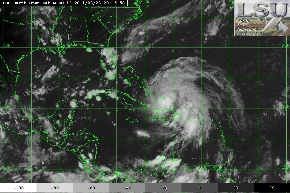
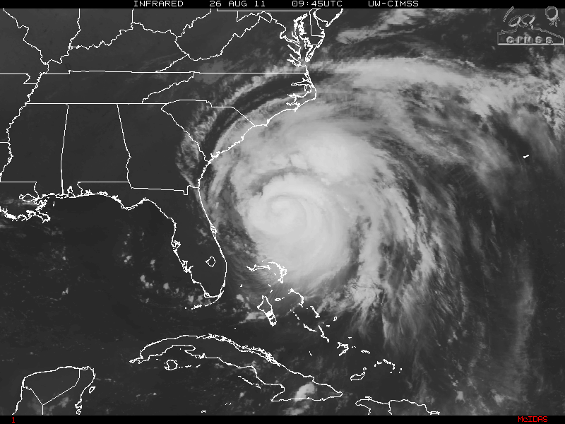
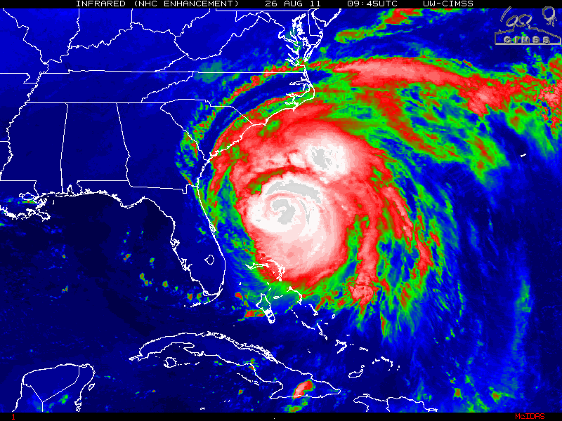
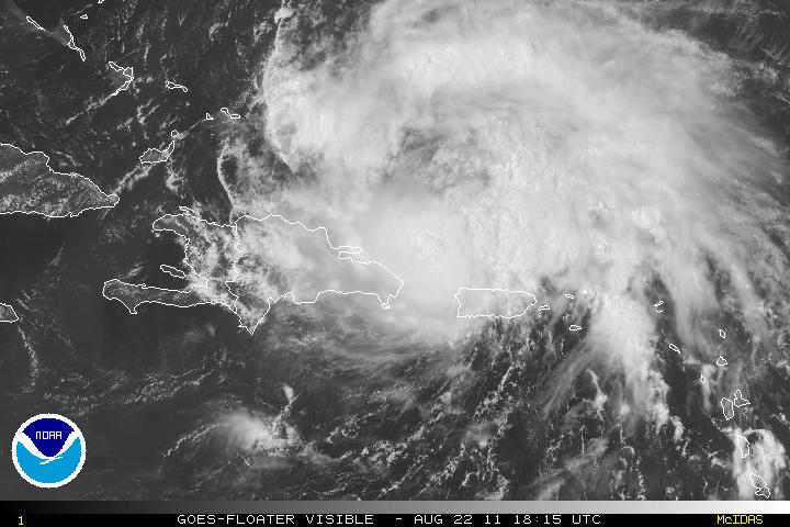
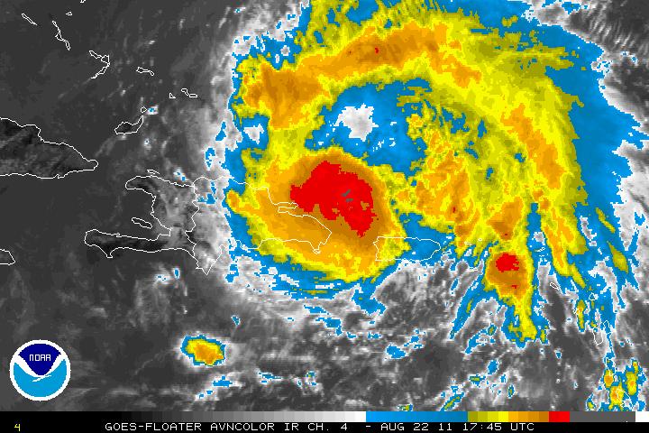
As the Bahamas got pummeled by Hurricane Irene with some Category two and Category three winds with hopes that damages would be minimal and no one has lost their life, all eyes are looking at Hurricane Irene’s next target, North Carolina and all points north. From the time Irene began it’s turn from the coast of the Dominican Republic, into the southern Bahamas and the eye wobbling (Trochoidal Oscillation) towards the Bahamas different islands, it was apparent that this was going to be one of the most dangerous hurricanes in a long time.

Irene near Dominican Republic/Haiti & Southern Bahamas – 08/23/11

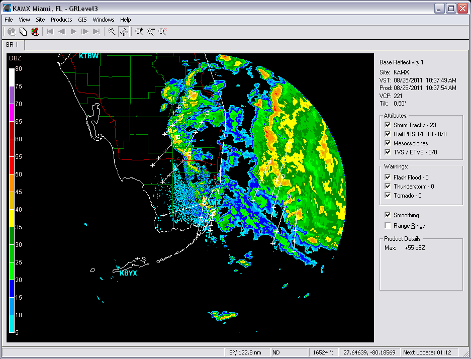
Thankfully, those who live in Florida were being spared as Irene was just offshore a hundred miles or so. Florida had been and continued to have just some breezy winds and a few outer rain bands as Irene continued it’s trek northwestward. Although it took a while to do so, Irene began it turn to the north-northwest.

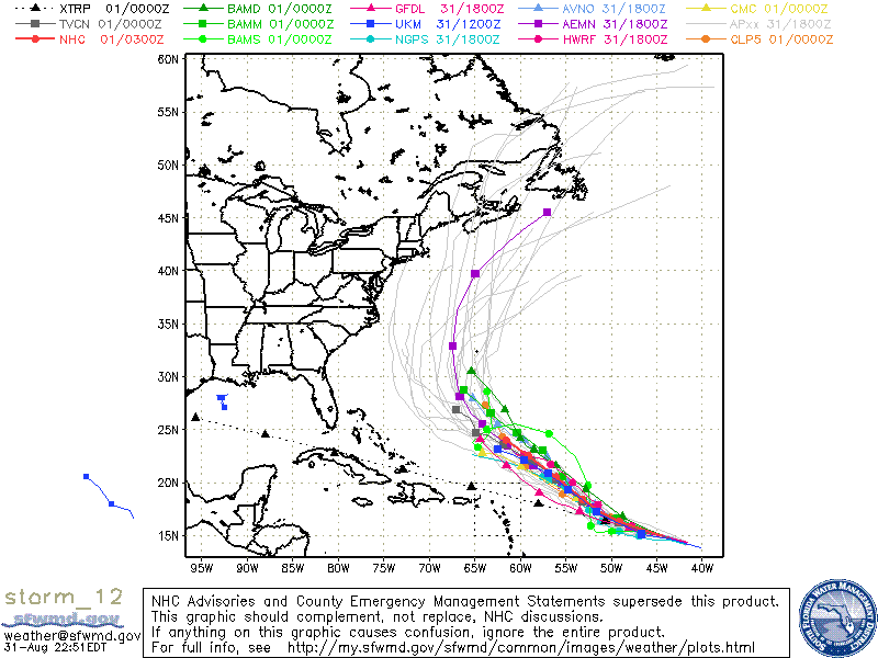
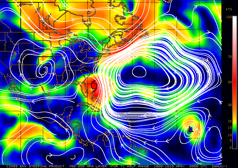
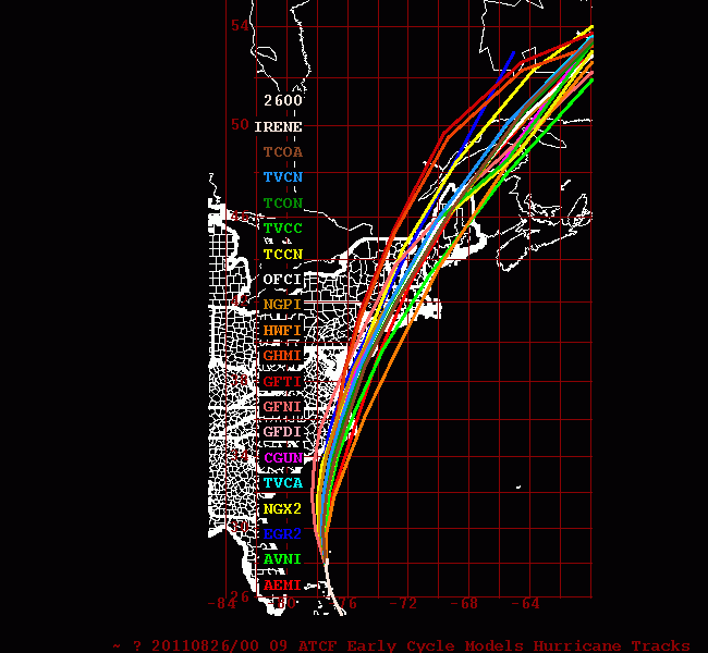
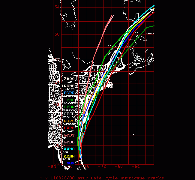
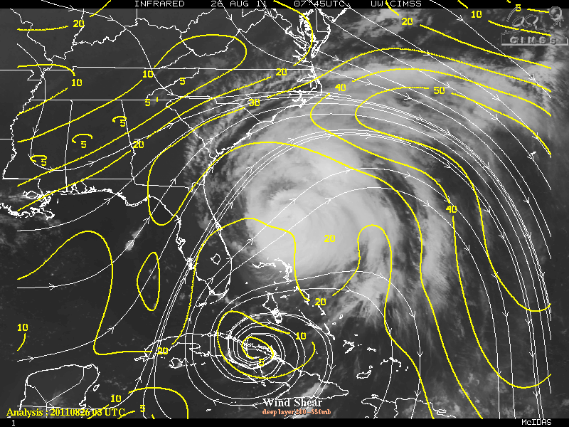
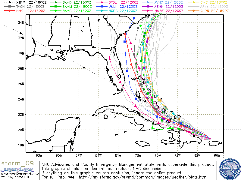
The latest steering current layer for Irene is now showing that the subtropical ridge has strengthened a little thus it has moved slightly allowing the weakness in the ridge to also move a little to the west. The trough had kept Irene on a north or north-northeast track. Currently, Irene is on a north-northeastward track which keep Irene heading toward North Carolina and the Outer Banks. Unfortunately, the ridge will continue to be there as as Irene heads toward Delaware, Long Island, and upward and this will keep Irene on a north-northeastward track. The most models are very much in a consensus and are very tightly clustered and a curvature out to sea is not indicated.

Steering Current

00z Dynamic(Early) Models

00z Dynamic(Late) Models

Currently, light to moderate southwesterly vertical wind shear along with some dry air has made it slightly difficult for Irene to strengthen but at the same time Irene will be in 28°-29°C SST’s so some possible strengthening may occur.

As Irene approaches the Outer Banks of North Carolina, some slight weakening may occur so Irene will either be a Category 3 or Category 2 Storm. Irene should begin a weakening phase after leaving North Carolina as it heads towards the Long Island area. By the time Irene moves into New England, Irene will weaken very quickly and under goes the extra-tropical transition phase.

By now all those who will be affected, especially those on the Outer Banks and North Carolina have evacuated their homes and into safe shelters.

Categories
Miscellaneous/General Science Tropical Weather

Tropical Depression Ten

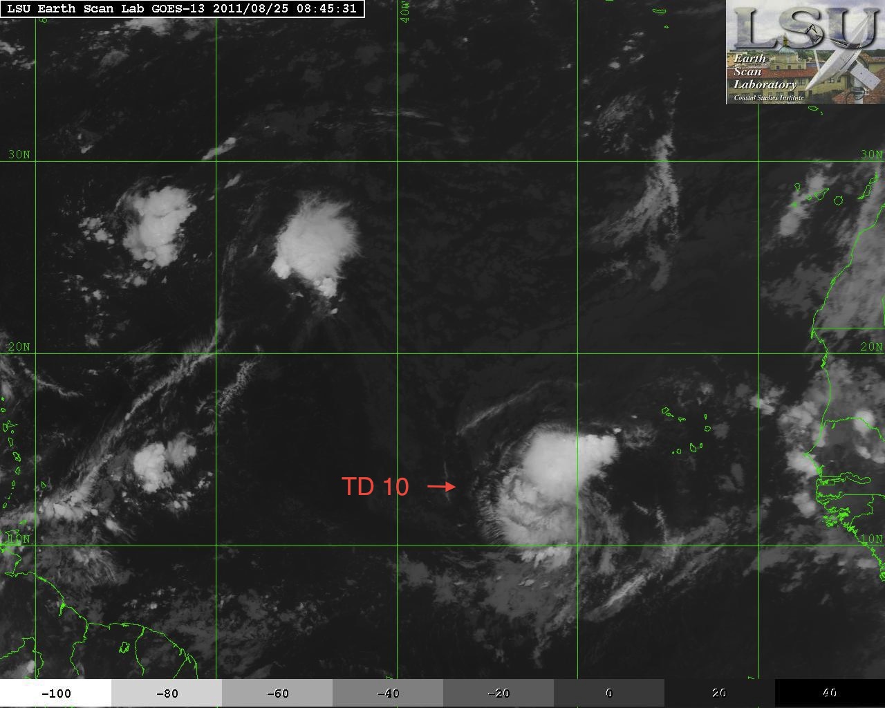
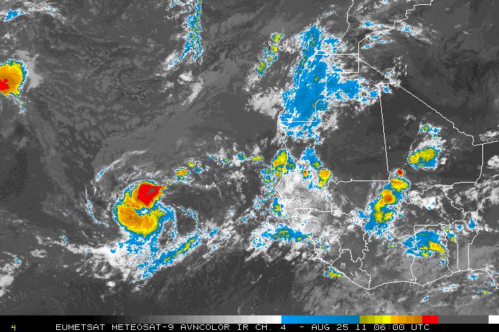
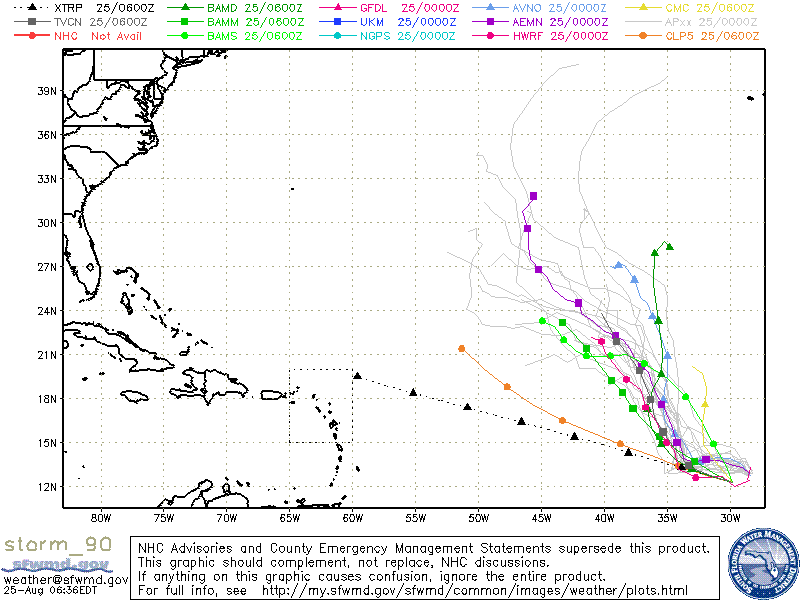
The tropical wave south west of the Cape Verde Islands had been tagged as Invest 90L but has been upgraded to Tropical Depression Ten as of the 5:00AM advisory from the NHC. The environment for Tropical Depression Ten is somewhat favourable for continuing development and a tropical storm may form within the next day or two. A few of the models show a possible tropical storm may develop. Most of the models also are supporting a track toward the northwest but by day 3 or 4, Tropical Depression Ten should encounter southwesterly shear along with a turn toward the north. Tropical Depression Ten will also begin to weaken as it encounters cooler SST’s of 25°-26°.

Categories
Miscellaneous/General Science Tropical Weather

Dangerous Hurricane Irene

Hurricane Irene, the first of the 2011 Atlantic basin. Hurricane Irene is a very large and possibly a very dangerous storm and is forecast to skirt the coastline of the Dominican Republic as a hurricane, then move out into the warmer waters of the Atlantic. The forecasted track is a very complicated one, but there is some consensus within some of the models with most models having it heading toward southern Florida, possibly skirting the coastline of Florida then a trough will begin to help pull it upward and head north. There is the distinct possibility that it may have landfall as far north as North Carolina. As Irene heads further north, the environment will be very favorable for further development and intensification.

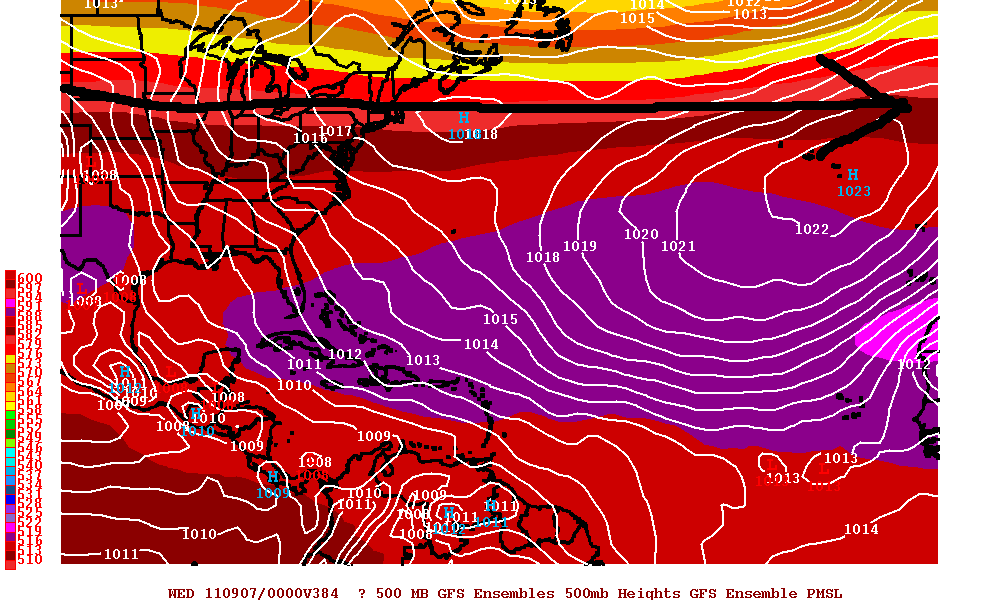
The possibility of Irene going into the GOM has pretty much been eliminated now. The Texas ridge has not retrograded and is actually staying firm. Between that ridge will be the trough digging downward the eastern seaboard of the US. Usually, the troughs will have a tendency to hang around, but this season has been different. The troughs have been digging down almost as fast as they leave. This is also the case with Irene. When the trough leaves, it will leave a more zonal flow (which is more west to east, versus a meridional flow which is more like a roller coaster and is more north to south). The Atlantic (sometimes called the Bermuda) high pressure ridge will be to the right of the trough. Once the trough leaves, there is a weakness and the Atlantic ridge will start to fill in that weakness with high pressure.

Meridional Flow


Zonal Flow

Irene is now heading WNW toward the Dominican Republic and if the trend continues, Irene will be skirting the northern coastline of the Dominican Republic. Irene is forecast to stay on the WNW track for the next 36-48 hours. Irene may lose some strength even though the center will be over water but because of the flow from the south with the high mountains it may temporarily disrupt it enough to lose some of it’s strength. Once Irene is further away from the coastline, Irene is forecast to strengthen rapidly.
The trough will eventually dig down and it will want to pull Irene upward. Irene will then be forced to head NNW and possibly north and will be headed into the southern Bahamas and later on toward the coast of Florida. Timing will be critical as if the turn to the north is much later than the forecast, Southern Florida, including Miami and Fort Lauderdale may be severely impacted. If the turn is to the north happens as forecasted, Irene may just skirt the coastline of Southern Florida with either category one force winds or possibly even just tropical force winds. If Irene just skirts the coast, there will be plenty enough oceanic heat to draw upon and Irene may become a very dangerous storm as it heads north. If the model forecast pans out and misses Florida, Georgia, and the Carolina’s, with little shear, and very warm waters, the environment will be conducive for a very large and strong hurricane with the possibility of winds in the category three or more along the US coastline.

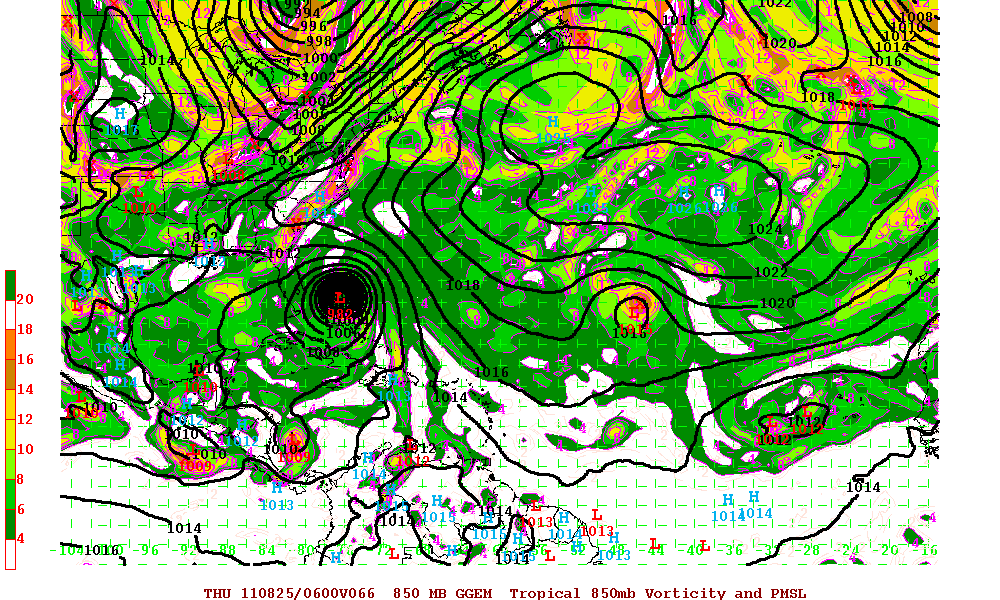
12z GFS Model

12z ECMWF Model

12z Canadian Model

ALL interests from the Dominican Republic, Bahamas, and the US eastern coastline need to watch this storm CAREFULLY. Any slight deviation of the forecast track toward the west can have major implications down the line. And of course, always check for all the latest from the National Hurricane Center site for all official information.

Categories
Miscellaneous/General Science Tropical Weather

Invest 93L & Large Tropical Wave

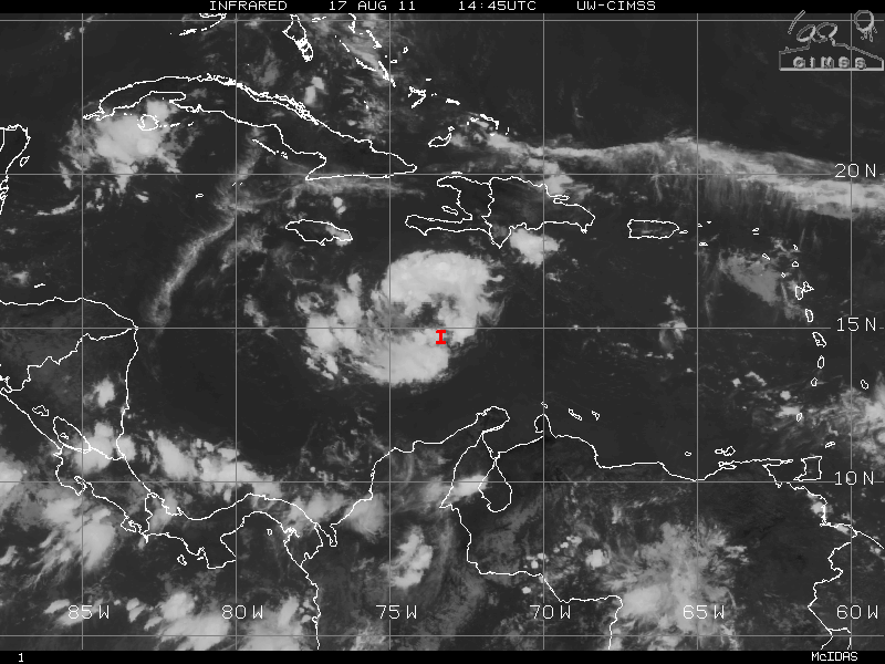
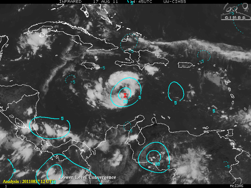
Invest 93L, the resilient tropical wave in the Caribbean, continue its westward motion it’s journey though the “Graveyard” where many storms either weaken or die. The trade winds in that area usually are much faster and especially weak storms are not able to develop roughly between 65°W to 75°W. Once again during the day today, 93L seemed to be developing somewhat albeit very slowly. From the CIMSS maps, there is an increase in the low level convergence (is where the flow over some area is moving inward toward that area) and there is also a marked increase of divergence (where the air at some particular level in the atmosphere over some area is moving outward or away from the area, on average). 93L also has a classic upper level anticyclonic high over it. During the latter portion of the day, 93L began to exhibit signs of cyclonic turning although very, very slowly – mostly in the mid to upper levels but there is no indication of low-level circulation.

Looking ahead, 93L will be dealing with dry air from the west. This will keep any development to a minimum for the next 24-36 hours or so. Shear in minimal so if 93L could get just get a low level circulation, conditions will be conducive for gradual development.

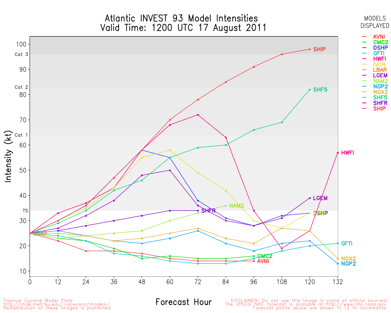
Tracking for 93L is pretty straight forward. Most models forecast that 93L will continue the westward motion toward Nicaragua/Honduras. If 93L were to develop into a very strong hurricane (which is not indicated), then a more poleward shift would result with a turn toward Belize. At this moment, model intensity keeps 93L below hurricane status or just minimal category one.


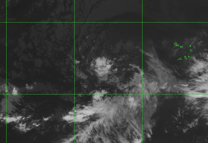
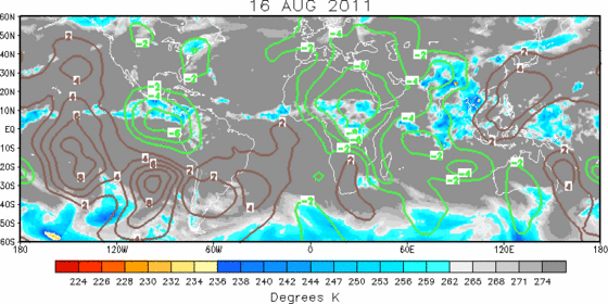
A large tropical wave southwest of the Cape Verde Islands is the next possible concern. Although it is surrounded by massive amounts of dust (SAL), as it gets closer to 55°W, two of the major models (GFS and ECMWF respectively) have it as a possible major hurricane north of the Leeward Islands with a very possible threat to Florida and also the Eastern seaboard. The ECMWF has been flipping during a few runs so we will have to see how things pan out in a few days. Just remember, these are LONG term models. It’s still way too early to panic but all those in affected areas should keep an eye on this system as it heads westward. If you have not begun to stock up of your hurricane supplies, now would be a great time to do so. The MJO for the next three weeks or so will be in a upward motion for the entire Atlantic basin. Upward motion has a tendency to allow for thunderstorm development. This is the time of year where development ramps up and the Atlantic basin is more active with tropical cyclones.

GFS RUNS

ECMWF RUNS

Categories
Miscellaneous/General

IPv4 IANA Free Pool Depletion

As of February 3, 2011, the Internet Assigned Numbers Authority (IANA) allocated the remaining of the last five /8 of the IPv4 address space to the Regional Internet Registries. With that – the free pool of IPv4 addresses that are available is now fully depleted.

The IPv4 addresses look like:

195.0.6.244

where as the new IPv6 addresses look like:

2001:2dc4:44d2:0000:0000:6b3d:0565:2236.

ARIN still has a pool of IPv4 address space and they will continue to do so in accordance to the policy in the Number Resource Policy Manual. The depletion of the IANA IPv4 pool will have a direct impact on a number of policies. For information see: https://www.arin.net/resources/request/ipv4_depletion.html

Categories
Miscellaneous/General

Verizon iPhone Announcement – Big Deal or Not?

So, today was the day the Verizon iPhone was to be announced. After seeing the releases, not a big deal yet a lot of people are going to switch to Verizon. The first editions of the Verizon iPhone will not be 4G. No voice and data at the same time. The new iPhone will be available next month, prices  32mb $199 – 64mb $299.

The big announcement of course was played out at 11am on 1/11/11. From what I got – many people were very disappointed. So now those who go out and buy the 3G version of the Verizon iPhone will have to wait at least a year before the 4G iPhone will be available. The new iPhone will use the CDMA technology and not the LTE. It will have a 5 megapixel camera, HD video, and the custom A4 chip.

So when the second generation of the Verizon iPhone rolls out, lets hope it will have the LTE (or better), and if a lot of people do switch from ATT to Verizon, will they be able to handle the influx and not have the same problems ATT is having. What will the pricing be for the second generation?

My own opinion is this was one big disappointment and I think a lot more people thought Verizon was going to shock them with something fantastic.

photo from http://www.engadget.com/
Categories
Miscellaneous/General

Post-a-day?

Its been 6 days now and I wanted to post once a day as WP Daily Post suggested. At this rate, my grade would be a D- and that is not even adding my content rating. All this week, my thoughts have been clouded and I just can’t seem to get back on track. I have heard the suggestions that writing once a day, unless you are a professional writer, you might be sacrificing quantity versus quality. That argument is very true as you cannot become a better writer without a lot of experimenting, thus making your posts stand out against the others. On the other side of the coin though if you just write something that has no quality or merit, should you be punished for the lack of quality. At least you posted something even though it might not be your best writing. Will just writing anything help your writing skills. I don’t think anyone could truly answer that question.

So now I am wondering is there another way to help polish my post. Should I add music or a photo that reflects what the post is all about? Does adding the music or photo diminish the quality of the post. Surely just adding the music/photo does not help my writing skills. So here I am banging my head on the wall and pondering with all these thoughts. Oh well, maybe next week my head will be out of the clouds.