Categories
Music Science

Monthly Full Moon Names

Did you know that the moon has more than one name each month. Of course all of this was from the ancient past.
Native Americans in the eastern and northern US were the ones that started the naming of the full moon each month. Although there were some variations of the monthly names, generally the names were the same.

Here are the names for each month:

Full Wolf Moon
With the freezing zero cold along with extreme snows of midwinter – the packs of wolves were hungry and just outside the Indian Villages. The Full Wolf Moon is also known as the Old Moon or the Moon After Yule. In some tribes though, this is also known as the Full Snow Moon and would apply it to the name to the next moon.

Full Snow Moon
Usually the heaviest snows fall in this month. Hunting becomes extremely  difficult, so some tribes will call this the Full Hunger Moon.

Full Worm Moon
During March, the ground starts to soften and this allows the earthworms to appear, inviting the return of the robins. The Northern tribes also thought of this a the Full Crow Moon due to the cawing of the crows and hoping this will be the signal of the ending of winter. Or sometimes some tribes would call it the Full Crust Moon due to the snow cover becoming crusted from the thawing during the day and freezing during the night.

Full Pink Moon
The grass pink or wild ground phlox is one of the earliest widespread flowers of the spring. Other names were the Full Sprouting Grass Moon, the Egg Moon and – among coastal tribes – the Full Fish Moon, when the shad come upstream to spawn.

Full Flower Moon
Flowers are now sprouting everywhere. This moon was also known as the Full Corn Planting Moon or the Milk Moon.

Full Strawberry Moon
In the north, strawberry (yummy) picking season peaks during this month.

Full Buck Moon
This is the month when the antlers of new bucks appear from their foreheads and their fur. It was also often called the Full Thunder Moon, thunderstorms being now most frequent. Sometimes it’s also called the Full Hay Moon.

Full Sturgeon Moon
This month the large fish of the Great Lakes and from other major bodies of water is most readily caught.
A few tribes named it as the Full Red Moon because when the moon rises it looks reddish when the moon appears thru the haze. Also called the Green Corn Moon or Grain Moon.

Full Harvest Moon
The Harvest Moon usually comes in September in the Northern Hemisphere, but (on average) once or twice a decade it will fall in early October. At the peak of the harvest, farmers can work into the night by the light of this moon.
Usually the moon rises an average of 50 minutes later each night, but for the few nights around the Harvest Moon, the moon seems to rise at nearly the same time each night – just 25 to 30 minutes later across the U.S., and only 10 to 20 minutes later for much of Canada.

Full Hunters’ Moon
It’s hunting time. Since the fields have been reaped, hunters can ride, and can more easily see the animals, which can be caught for a Thanksgiving banquet after the harvest.

Full Beaver Moon
At this point of the year, it’s time to set beaver traps before the swamps freeze to ensure a supply of warm winter furs.   Some tribes call this month the Frosty Moon.

Full Cold Moon
December is also the month the winter cold fastens its grip. Sometimes this moon is referred to as the Full Long Nights Moon or the Moon Before Yule.


Categories
Miscellaneous/General

Verizon iPhone Announcement – Big Deal or Not?

So, today was the day the Verizon iPhone was to be announced. After seeing the releases, not a big deal yet a lot of people are going to switch to Verizon. The first editions of the Verizon iPhone will not be 4G. No voice and data at the same time. The new iPhone will be available next month, prices  32mb $199 – 64mb $299.

The big announcement of course was played out at 11am on 1/11/11. From what I got – many people were very disappointed. So now those who go out and buy the 3G version of the Verizon iPhone will have to wait at least a year before the 4G iPhone will be available. The new iPhone will use the CDMA technology and not the LTE. It will have a 5 megapixel camera, HD video, and the custom A4 chip.

So when the second generation of the Verizon iPhone rolls out, lets hope it will have the LTE (or better), and if a lot of people do switch from ATT to Verizon, will they be able to handle the influx and not have the same problems ATT is having. What will the pricing be for the second generation?

My own opinion is this was one big disappointment and I think a lot more people thought Verizon was going to shock them with something fantastic.

photo from http://www.engadget.com/
Categories
Miscellaneous/General

Post-a-day?

Its been 6 days now and I wanted to post once a day as WP Daily Post suggested. At this rate, my grade would be a D- and that is not even adding my content rating. All this week, my thoughts have been clouded and I just can’t seem to get back on track. I have heard the suggestions that writing once a day, unless you are a professional writer, you might be sacrificing quantity versus quality. That argument is very true as you cannot become a better writer without a lot of experimenting, thus making your posts stand out against the others. On the other side of the coin though if you just write something that has no quality or merit, should you be punished for the lack of quality. At least you posted something even though it might not be your best writing. Will just writing anything help your writing skills. I don’t think anyone could truly answer that question.

So now I am wondering is there another way to help polish my post. Should I add music or a photo that reflects what the post is all about? Does adding the music or photo diminish the quality of the post. Surely just adding the music/photo does not help my writing skills. So here I am banging my head on the wall and pondering with all these thoughts. Oh well, maybe next week my head will be out of the clouds.

Categories
Non-Tropical Weather

Dry Season for Florida

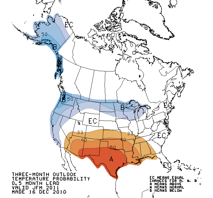
This has been one of those years where the weather for south Florida has been a little unusual. Although the abnormally strong La Nina was anticipated, a couple of fronts plowed through Miami and leaving some areas of below freezing temperatures was abnormal to say the least. The abnormally cold temperatures took their toll on the agricultural areas with farmers up all night spraying water on the plants and just praying the cold did not damage the entire harvest. I myself love to pick the strawberries right after we have a a cold front with temperatures in the upper 30’s- low 40’s. This tends to sweeten the strawberries.

90 day Temperature Probability Outlook

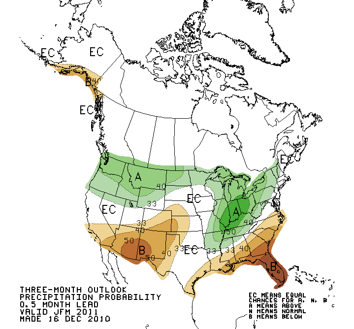
So now we are now in a dry spell. Not good for Florida. What is most damaging is that this dry spell actually began during the hurricane season. Florida, even though we don’t like those tropical systems, they bring rain in south Florida usually during the late summer and early fall. Since this did not happen this year, we are now into that rain starved dry season.

There is possible chance that the forecast for March is indicating for some rainfall. After that, there is a very good chance of below normal rainfall for all of Florida and unfortunately this will set the stage for a bad fire season which peaks March-May.

90 day Precipitation Probability Outlook
Categories
Non-Tropical Weather

Rainstorms in the Desert?

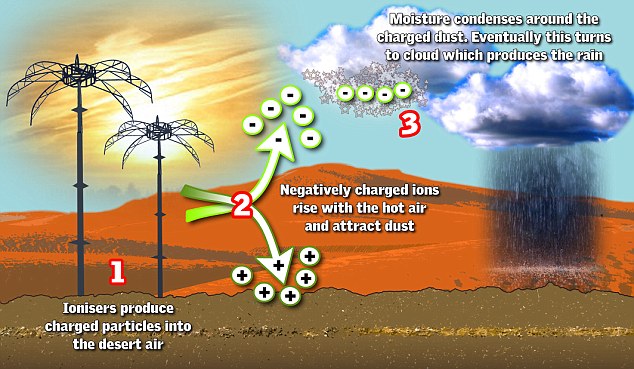
Have scientists been able to use technology to create rainstorms in the desert? There are claims that scientists that are employed by the ruler of Abu Dhabi have actually done so. Fifty rainstorms were created last year in the Al Ain region during the summer in July and August. At that time of year there is normally no rain at all. Some people living in Abu Dhabi were puzzled when they saw lightning and even some hail during the rainstorms when there should not be any at this time of year.

Scientists from Metro System used ionizers to produce negatively charged particles (electrons). The negative charged ions will rise due to the hot air and during this process it will also attract dust. Eventually the dust particles will reach the right height to form cloud formation. The charges will soon attract water molecules that are are floating in the air and those molecules will condense around them.
If there is sufficient moisture in the air, it will induce billions of droplets to form thus these will become clouds and the whole theory is that this will create rain.

Image from http://www.dailymail.co.uk
Categories
Non-Tropical Weather

Tornado vs Train

Although this is an older video it is still something to watch

Categories
Tropical Weather

An Early End of Hurricane Season in Atlantic Basin?

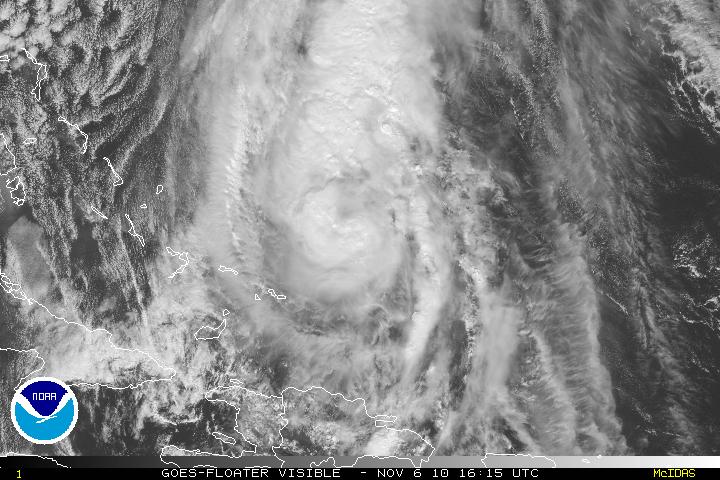
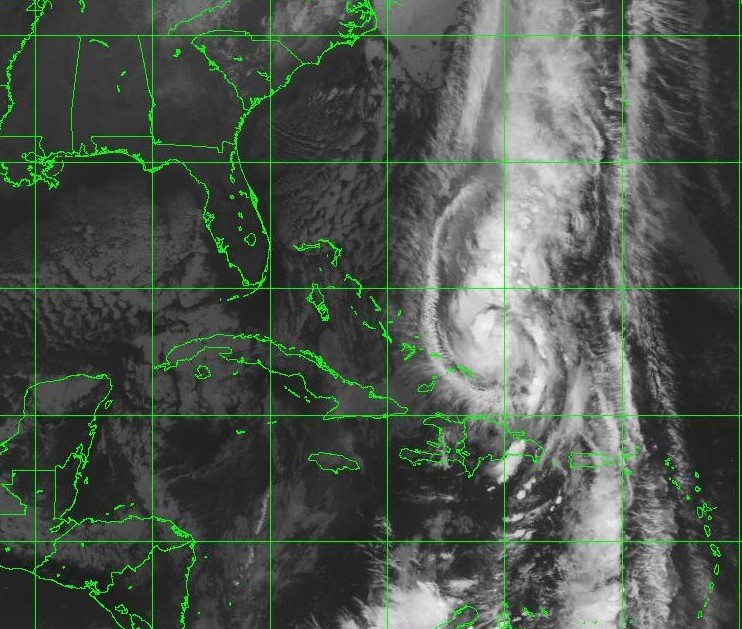
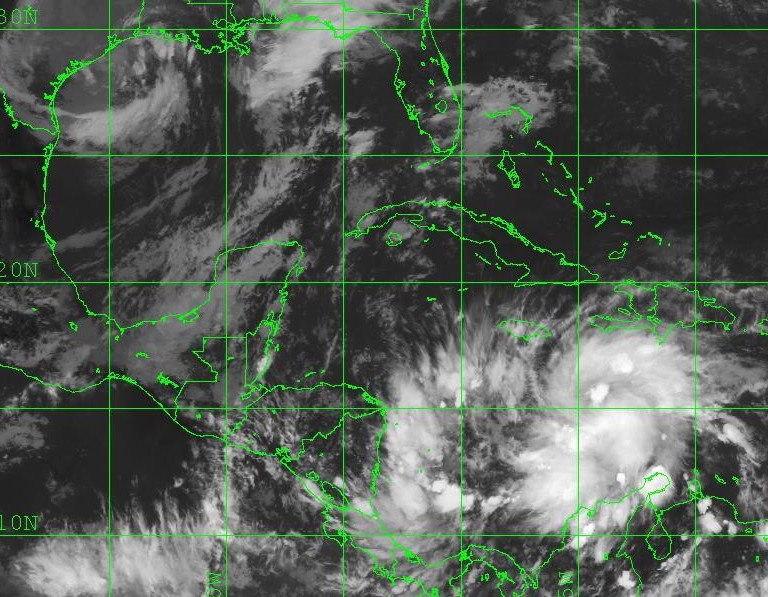
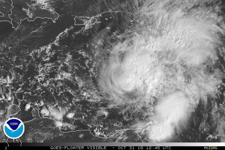
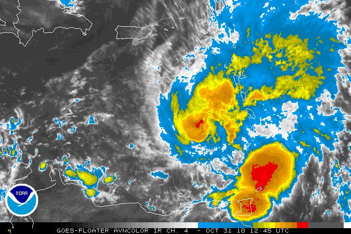
Although Tropical Storm Tomas is still around after hitting Eastern Cuba, Haiti, and the Turks and Caicos Islands in the southern Bahamas – it is moving away and that should be the end of the hurricane season. Officially the season does not end till November 30th. Hopefully, Tomas will be very last of any tropical cyclones. At the moment, I see no models forecasting tropical development. It is way to early to even project or forecast what the season will be like next year. Will we have a very strong La Niña and how will the SOI (Southern Oscillation Index) fall into play?

IF this the last blog for the hurricane season, please be sure to continue to use the weather site The Coriolis Effect for both the winter and summer (Tropical) updates. For next hurricane season I hope to implement a daily tropical weather update screencast, a forum and anything I can come up with (or something users ask me to add if at all possible). This blog will continue, just with other categories.

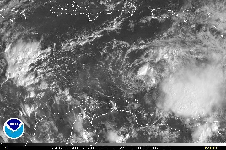
Visible Satellite image of Tropical Storm Tomas
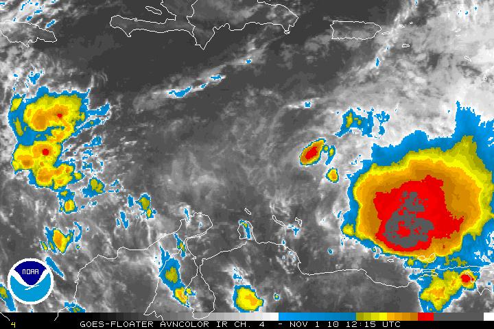
IR Satellite image of TS Tomas and the Western Atlantic
Categories
Tropical Weather

Tropical Storm Tomas Reborn

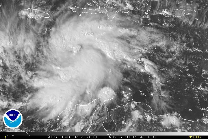
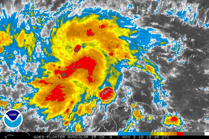
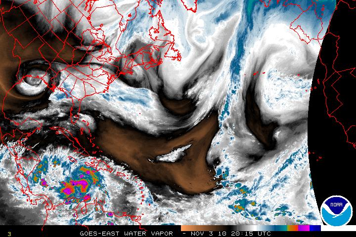
After losing tropical storm status early in the morning, Tomas has been able to regain it’s structure and reorganized during the day and as of the 5PM advisory from the NHS, Tomas has been upgraded to Tropical Storm status. Now with Tomas reorganizing and with light vertical shear and warm SST’s, intensification is forecast. SHIPS rapid intensification index is showing a 50% chance of 30 knot strengthening within the next 24 hours. An argument can be made that with the current organization of Thomas, that is a little too much. The new intensity forecast is a compromise between SHIPS and the LGEM model forecast. Although it is not out of the question but here is the possibility that Tomas may become a hurricane before land interaction stops any further intensification. After passing Hispaniola, southwesterly wind shear will cause Tomas to weaken.

IR Satellite image of Tropical Storm Tomas
Visible Satellite image of TS Tomas
AVN Satellite image of TS Tomas
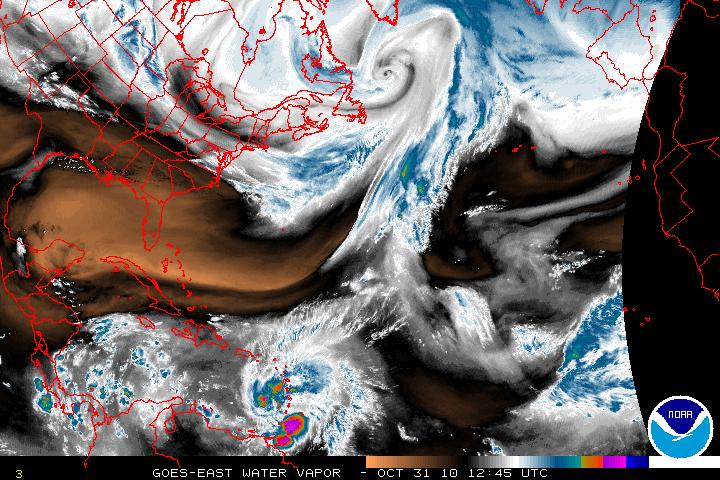
Vapor Satellite image of US and TS Tomas
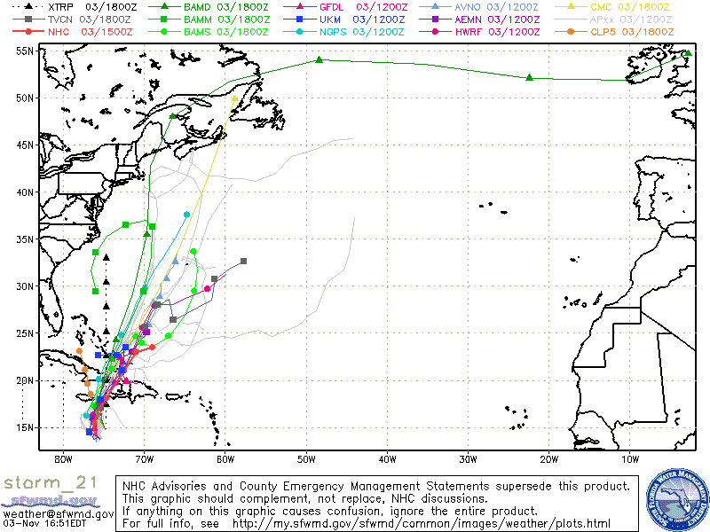
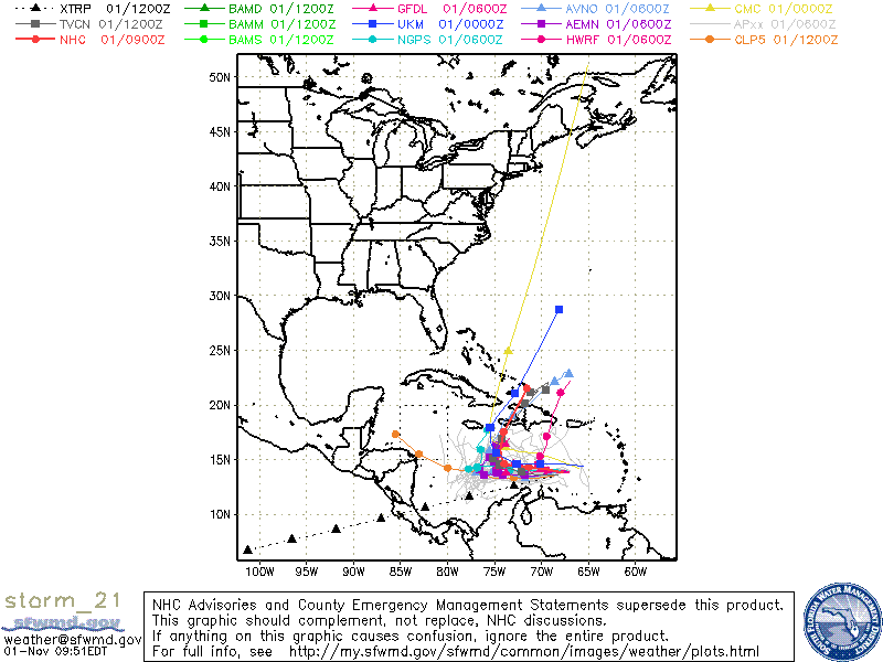
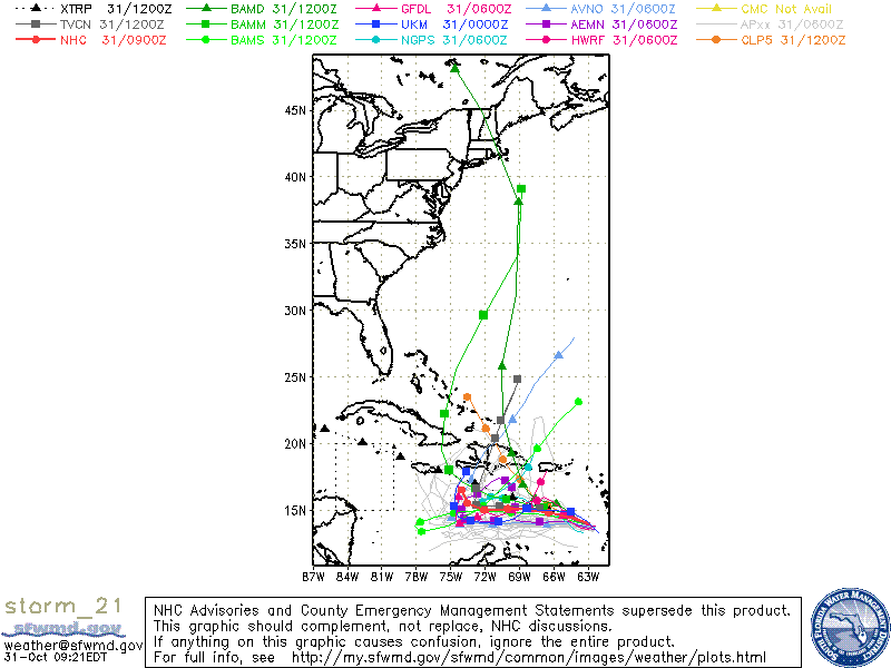
Models for TS Tomas
Categories
Tropical Weather

Weakening Tropical Storm Tomas

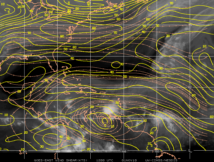
Tropical Storm Tomas, once a category 2 storm, has been downgraded to a weak Tropical Storm and there is about another 24 hours before Tomas has any chance to restrengthen again. Tomas has been decoupled as the convection is about 100 miles to the east of the center. Westerly vertical shear is the main factor that is impacting Tomas. There is also a little dry air, but it is not as much as a factor. Both the Ships and LGEM model are forecasting that Tomas will strengthen again to a hurricane. A weakening low-mid level ridge to the north of Tomas will keep the storm on westward motion. In about 72-96 hours a large mid-tropospheric trough will be heading eastward into the Gulf of Mexico. The flow from the trough will turn Tomas north and northeast with an increase in forward speed.

Visible Satellite image of Tropical Storm Tomas
AVN Satellite image of Tropical Storm Tomas
Shear Map
Models for Tropical Storm Tomas
Categories
Tropical Weather

Dangerous Hurricane Tomas

Hurricane Tomas in the early morning hours was found to have winds of 100MPH and Tomas is now a category 2 hurricane. With data from the reconnaissance plane and satellite imagery, Tomas is better organized but it was noted that the vertical stack of the storm is tilted northeastward with height. The tilting is probably due to the Southwesterly shear that is beginning to impact Hurricane Tomas. The shear has been forecast and further intensification will stop for about 48- 72 hours. There is the possibility Tomas may lose some strength during that forecast period. After that period, the shear will relax and further strengthening is forecast. Intensity guidance in at least the LGEM model does have Tomas strengthening and possibly be a major hurricane of at least a category 3 storm.

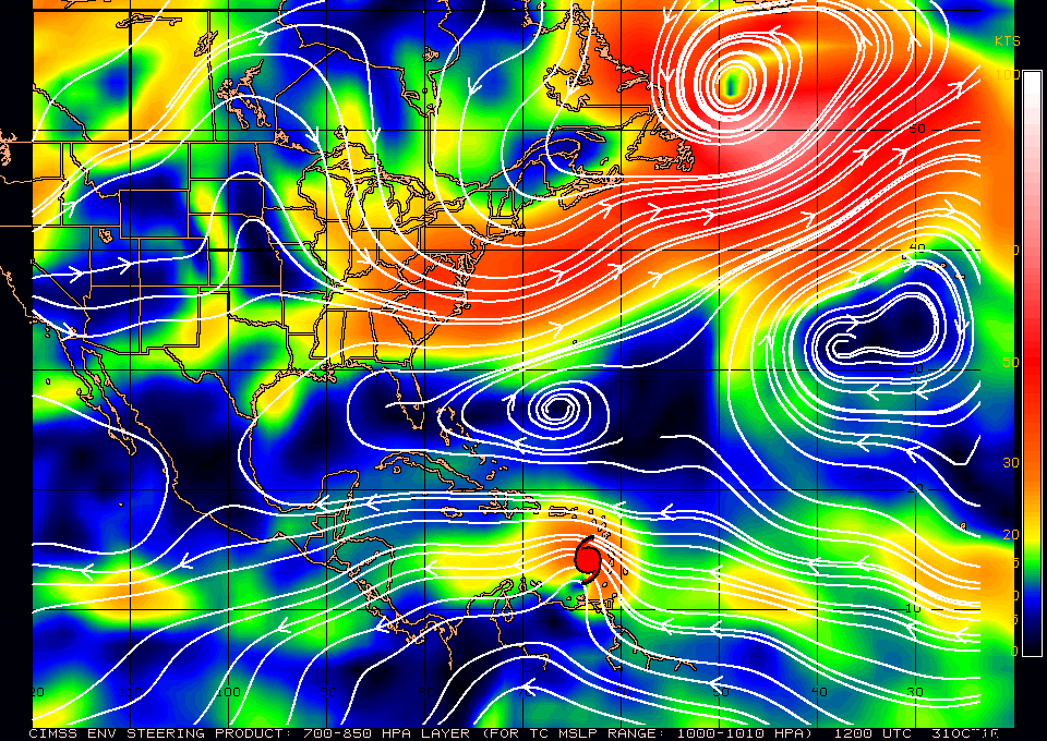
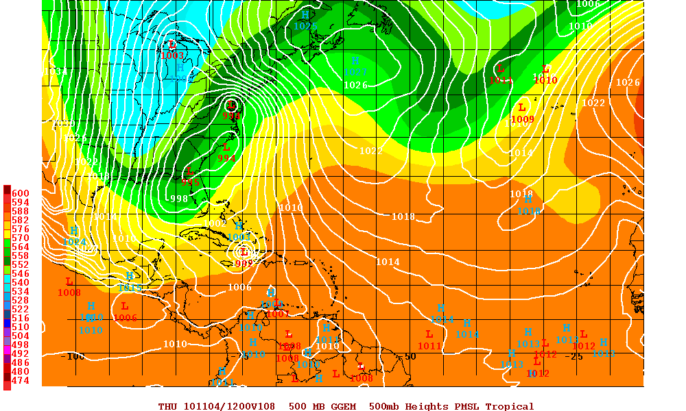
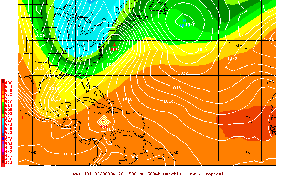
Hurricane Tomas is currently located south of a mid-level trough that is over the southwestern Atlantic. As this trough continues to move eastward a mid level ridge will build just north of Tomas and this will turn Tomas on a westward track for the next 2 or 3 days. Later in the forecast period, that ridge breaks down as a very large deep layer trough moves into the eastern U.S. and also digs southward. This will slow the forward speed of Tomas and also allow Tomas to gain latitude. Model guidance at days 4 and 5 is poor as far as the timing and the the sharpness of the turn to the north but there is a consensus that there will be the northern turn as Tomas will be forced north by the trough.

Visible Satellite image of Hurricane Tomas
AVN Satellite image of Hurricane Tomas
Water Vapor Satellite image of US and Western Atlantic/Tomas
Steering Layer
Models for Hurricane Tomas
Canadian Model at 108 hours
UKMET Model at 120 hours