Categories
Tropical Weather

Tropical Weather Trains

The tropics are now in full throttle and as of today we have Hurricane Danielle, Tropic Storm Earl, and a new wave coming off the coast of Africa. Those three systems are all from Africa and are what is called Cape Verde type systems. There is also a low pressure system in the Gulf of Mexico but nothing tropical at this time.
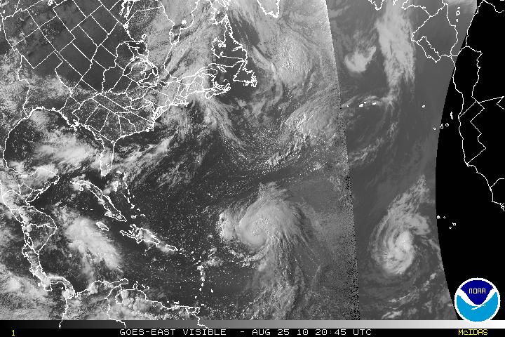
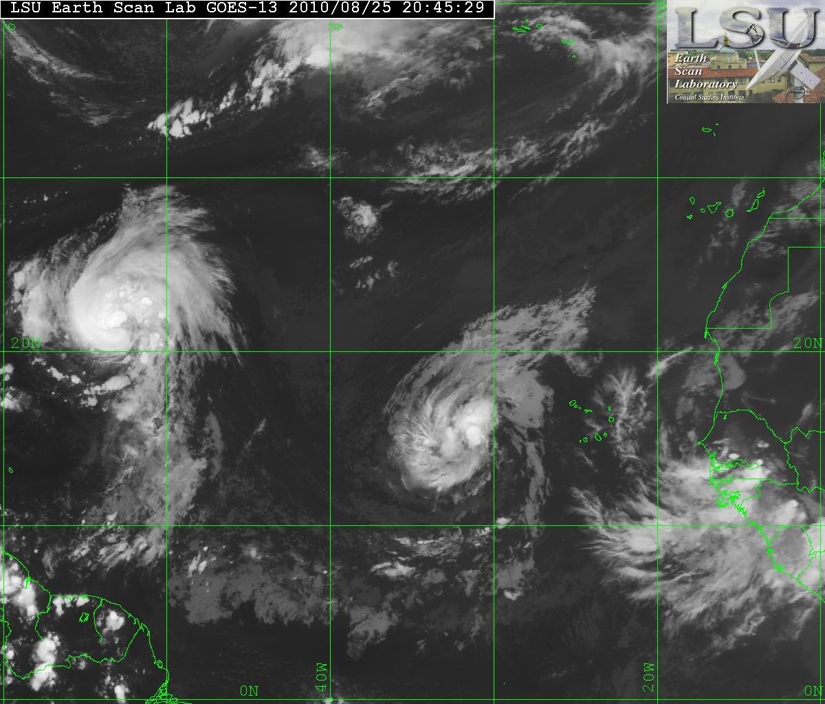
Visible Satellite of Danielle & Earl
Satellite Image of Danielle & Earl
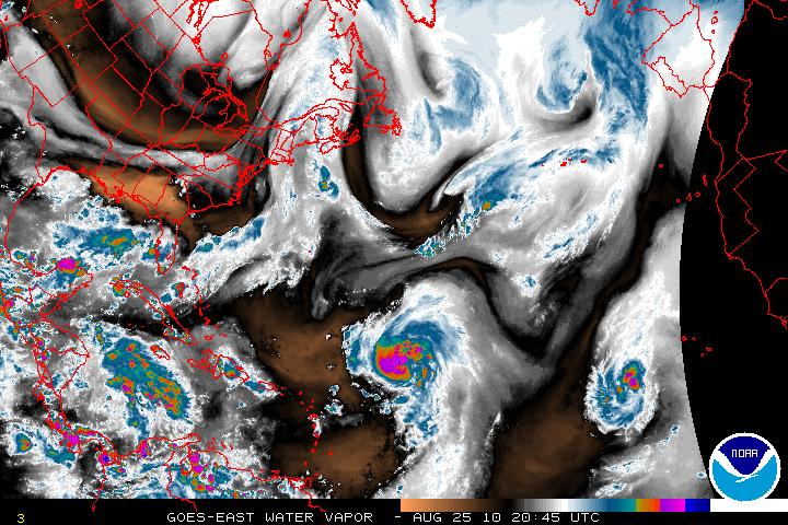
Water Vapor Satellite image

Hurricane Danielle
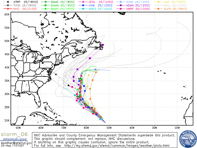
During the night, Danielle had lost some of its strength and was downgraded to a Tropical Storm but it has gradually gotten better and is now back to Hurricane status. Danielle is headed NW and soon will slow down it forward speed. Danielle is expected to make a northward turn within 48-72 hours. Danielle has a very good CDO, but there is a little southwestward upper level winds entering the core of the system but will be relaxing very soon.
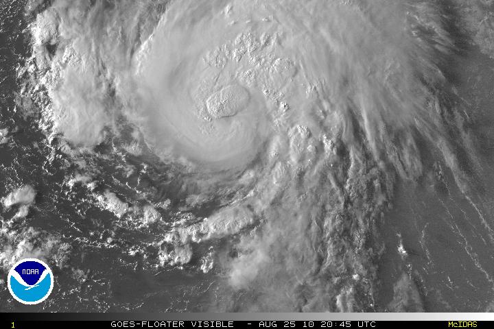
Visible Satellite image of Danielle
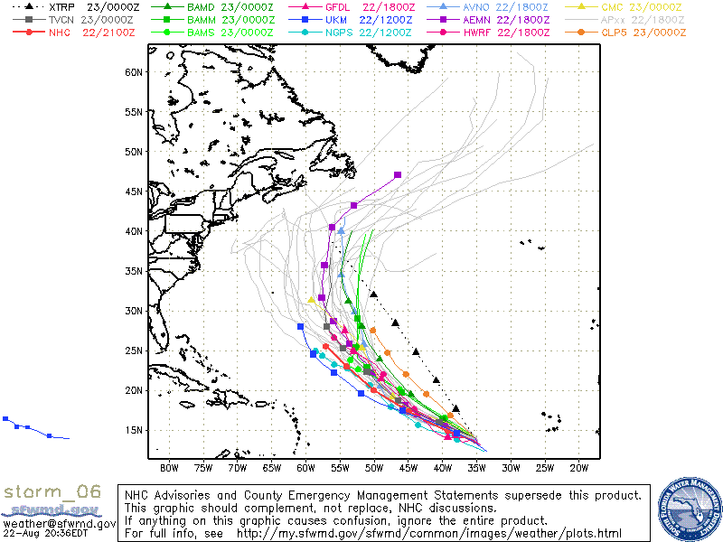
Models for Hurricane Danielle

Tropical Storm Earl
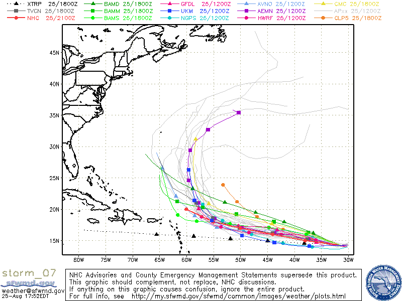
Tropical Depression Seven has been upgraded to Tropical Storm Earl. TS Earl has been gaining strength during the day and is forecast for gradual strengthening and be a hurricane in about two days. Earl has been on a somewhat westward direction and should continue this track for about 3 or 4 days. Earl has been taking the same track as Danielle and whether or not the cooling of the churned seas from Danielle will affect the strengthening is still up the air. The models do want to take Earl on a NW track in about 5 days. This is all going to depend on how strong Danielle will be for the next couple days. A strong Danielle will help keep the ridge and allow Earl to head northward. If Danielle stays as a minimal hurricane or tropical storm, the ridge might close up thus making a more W to WNW track. I feel the models have not grasped what Danielle strength will be, and the forecast might be off. I hope I am incorrect and Earl heads out to sea and with no one in his sights.
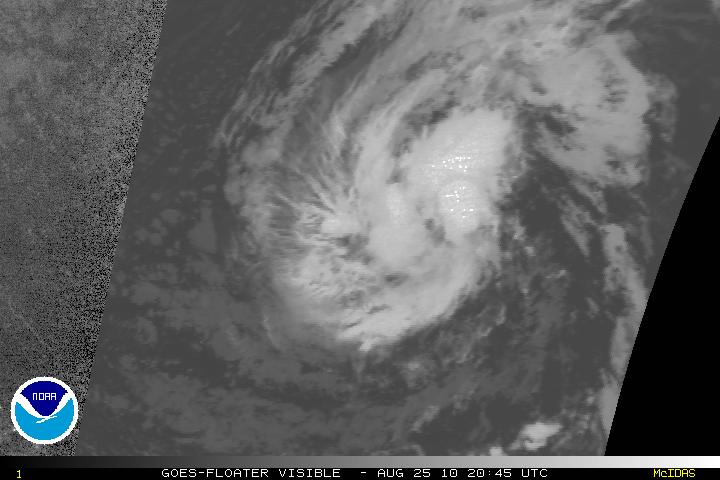
Visible satellite image of Earl
Models for Earl
Categories
Tropical Weather

Invest 96L

The latest tropical wave that has exited of the coast of Africa has now been designated as 96L. This system has been showing signs of organizing and is expected to become a least a tropical depression within the next few days. This wave is following Hurricane Danielle but it is far away enough so that the two don’t interact each others flow.

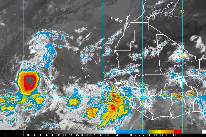
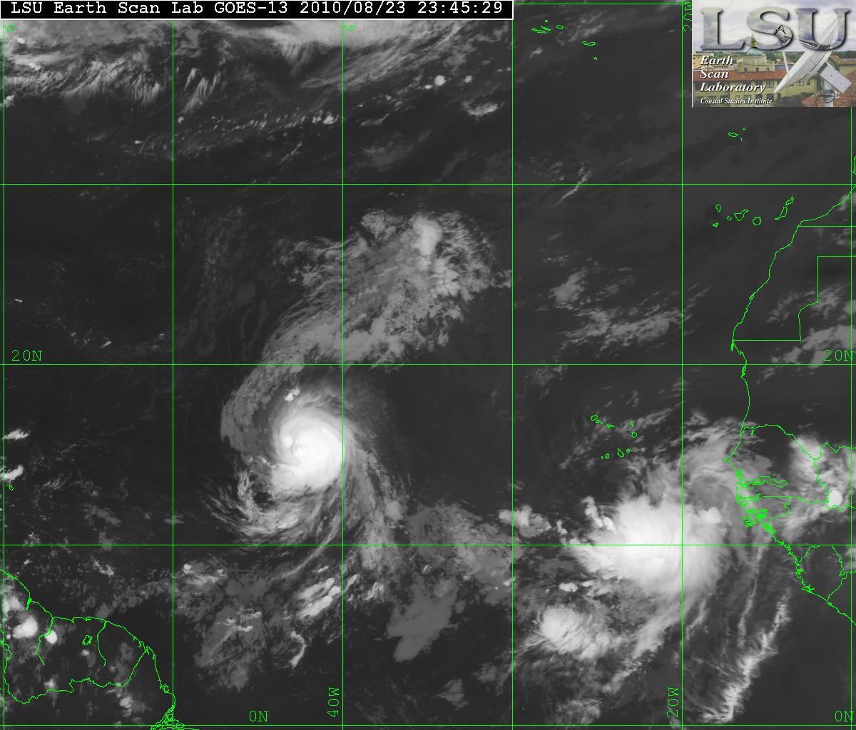
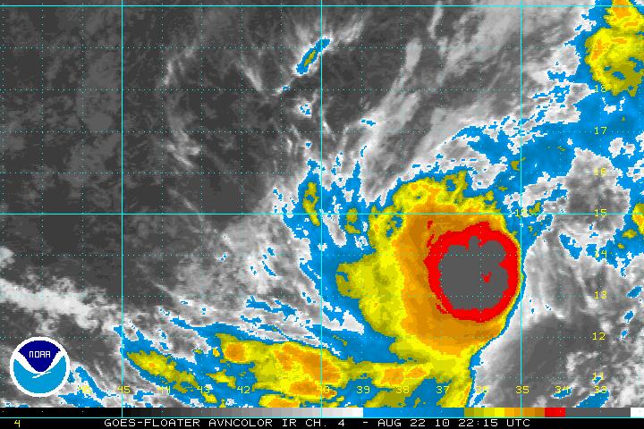
AVN satellite image of Hurricane Daniellle & Invest 96L
IR satellite image of Hurricane Danielle & Invest 96L
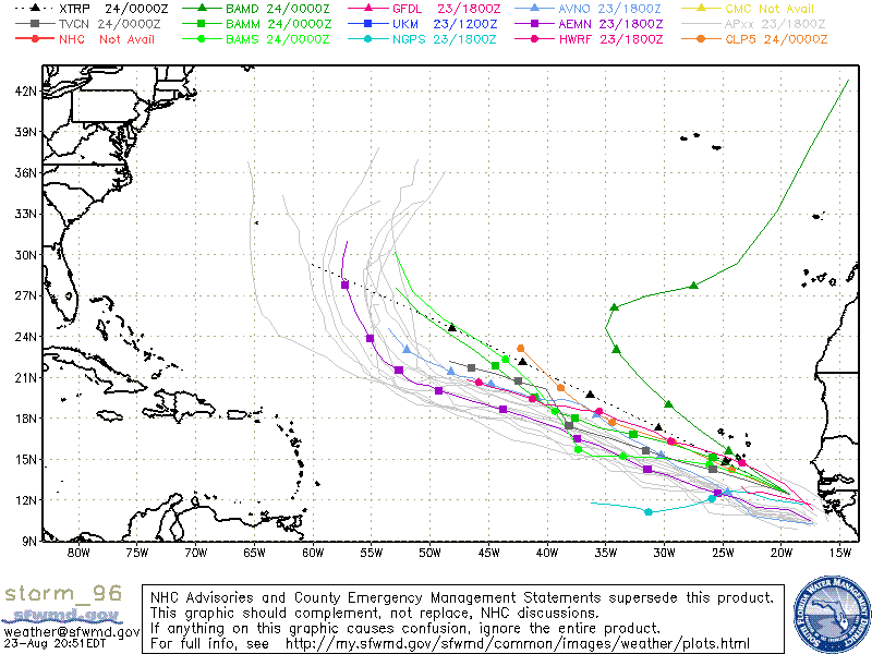
Models for 96L

Although the models seem to have 96L following the path that Hurricane Danielle – it is a little early to have that in stone. The forecast for Hurricane Danielle is simple. Danielle will be picked up by a large trof from the the east coast of the US due to a weakness in the ridge. That will allow Danielle to be head NW then NNW and away from the US coast and probably Bermuda. The caviate is that once Danielle is picked up by that weakness in the ridge, later the ridge MAY build back and that may not allow 96L to be picked up. It’s just to early to see what will happen. If it is not picked up, then the East coast of the US may be affected.

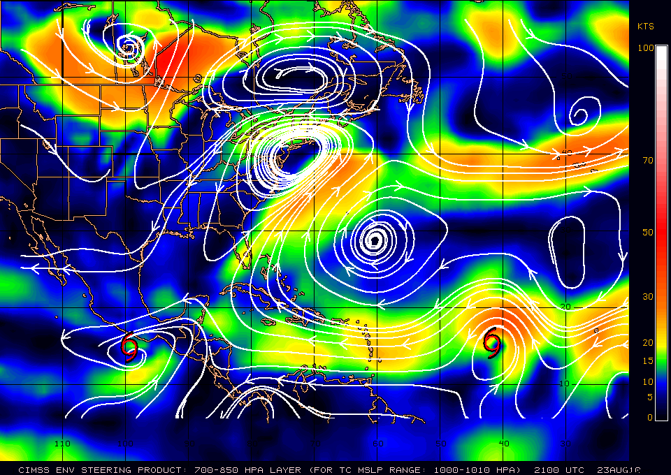
Steering Layer
Categories
Tropical Weather

Tropical Storm Danielle

The expectations of what was TD Six has now been upgraded to TS Danielle at 5:00PM. During the day today, a lot of strong thunderstorms with some very cold cloud tops…some down to -85°C, made the forecasters at the NHC to make the upgrade. The colder the cloud tops – the better for storm development. The visible satellite shows that Danielle is continuing to experience the moderate shear from the east and southeast. This will be relaxing within 24-48 hours and this will allow Danielle to intensify to at least minimal hurricane status. Later, some of the models want to bring Danielle to a major hurricane. This will only be for a short period of time as the forecast is for vertical shear will begin to erode the intensification.

AVN Satellite image
Visible Satellite image
Wind Shear

Although during the day today Danielle the movement was a bit northward, it has returned back to WNW and should stay that way for 48-72 hours. After that a break in the subtropical ridge will allow Danielle to head NW and away from the US coast. Depending upon how long Danielle continues the WNW movement, Bermuda may be affected.

Models for Danielle
Categories
Tropical Weather

Invest 95L

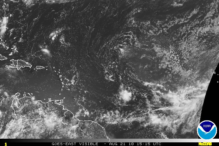
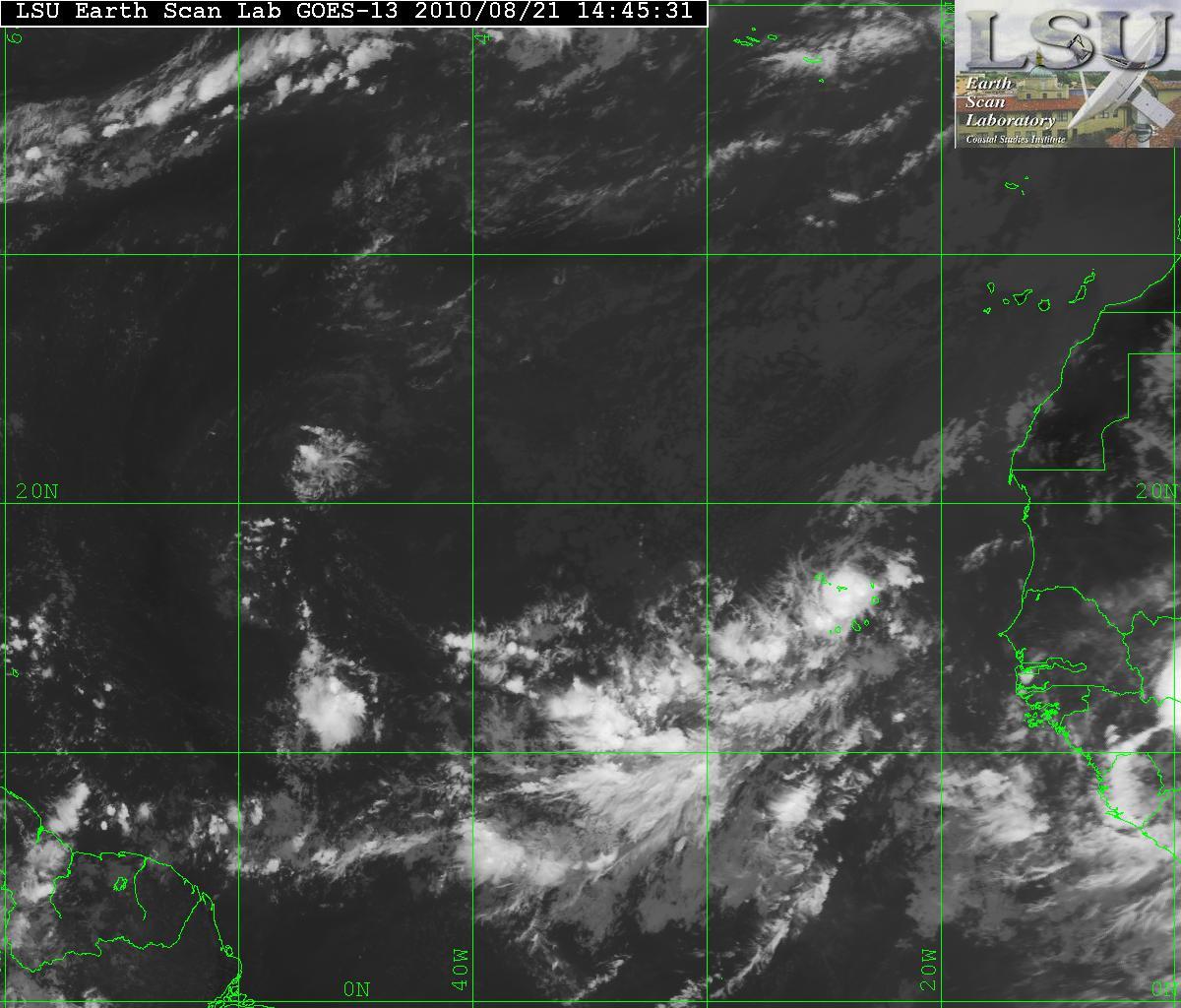
A wave that rolled off Africa a few day ago has been designated as Invest 95L. This is a system that has a very good chance to be a tropical depression within 48 hours. Invest 95L has very good cyclonic turning and it has a very moisture envelope.

(ADDENDUM – as of 5:00pm 8/21 Invest 95L developed enough to be classified and designated as Tropical Depression Six)

Satellite image of Invest 95L
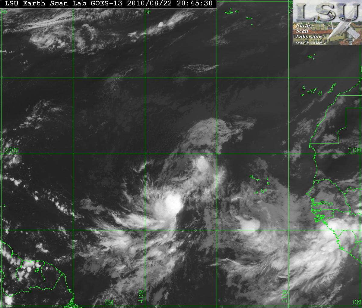
LSU satellite image of Invest 95L
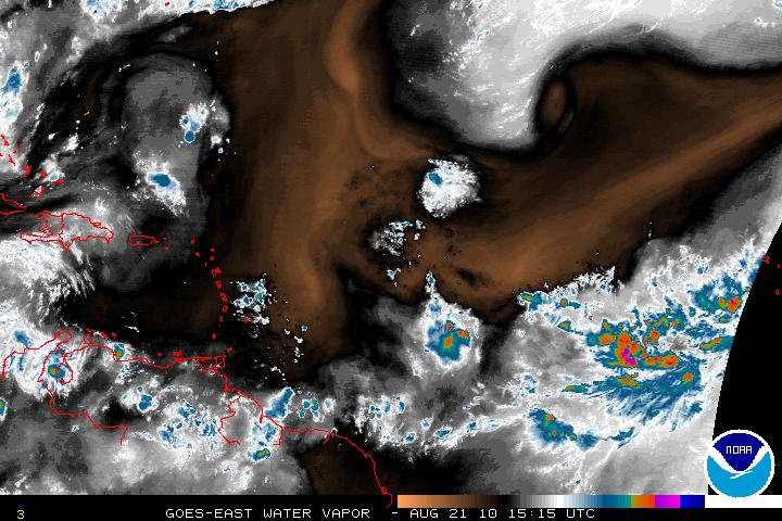
Water Vapor satellite image of 95L

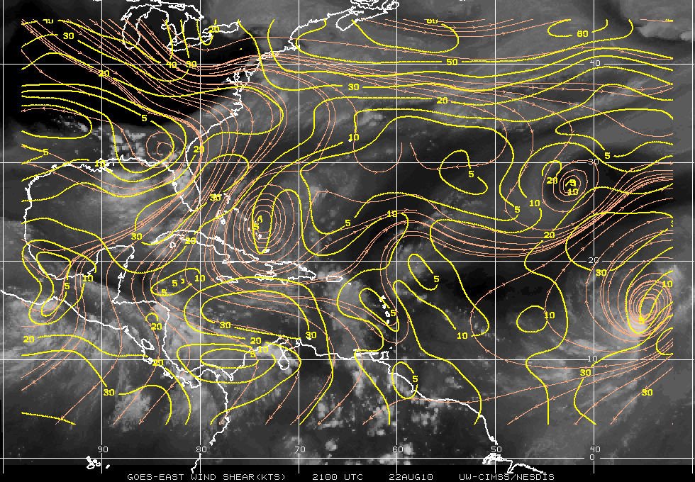
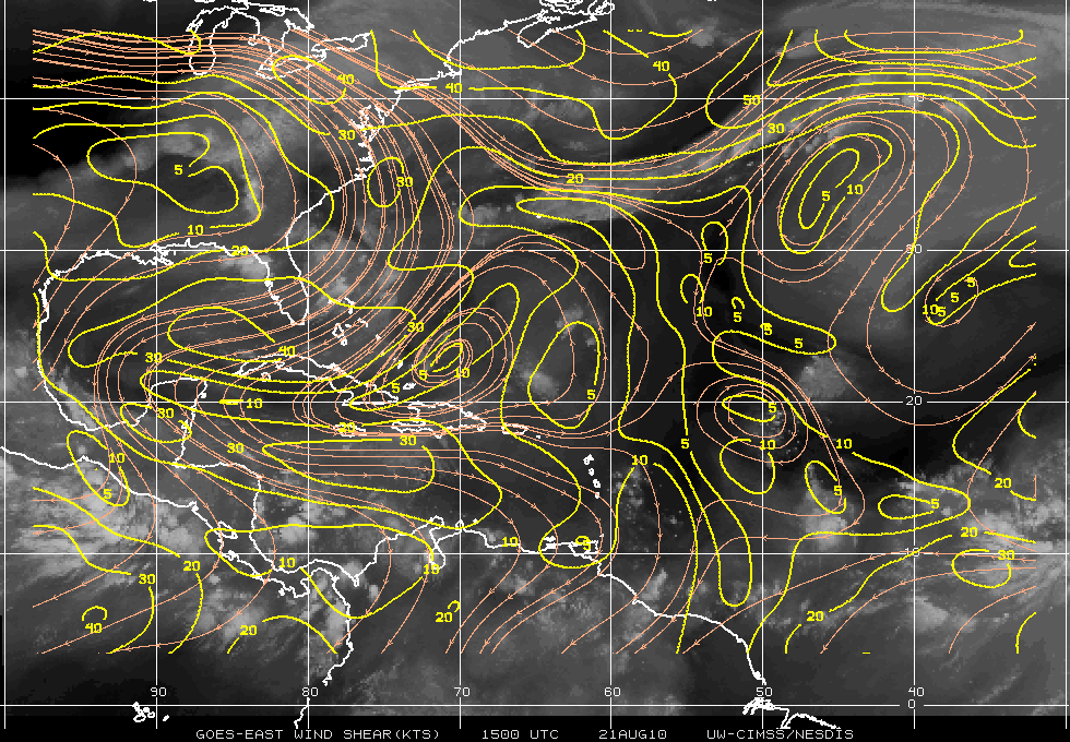
In the water vapor image above, you can see there is some dry air to the north of Invest 95L. The forward motion of 95L is W-WNW and this should allow the system to not be hindered by the dry air. Below is an image of Wind Shear analysis. The wind shear at the moment is not to bad for the system, but it is not allowing any development. The environment for 95L is going to be changing and the wind shear will be very low. Forecast is for better conditions overall.

Wind Shear

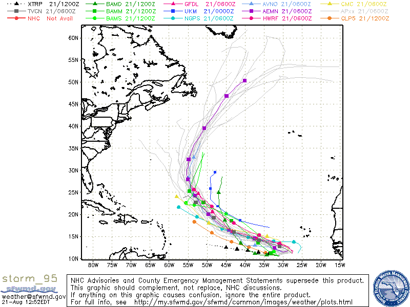
The forecast for 95L is that it will develop into a tropical depression by sometime Monday. All models do want the system to turn NW then N and eventually curve out to the sea and away from any land masses. The problem is exactly when it will do so.

Models

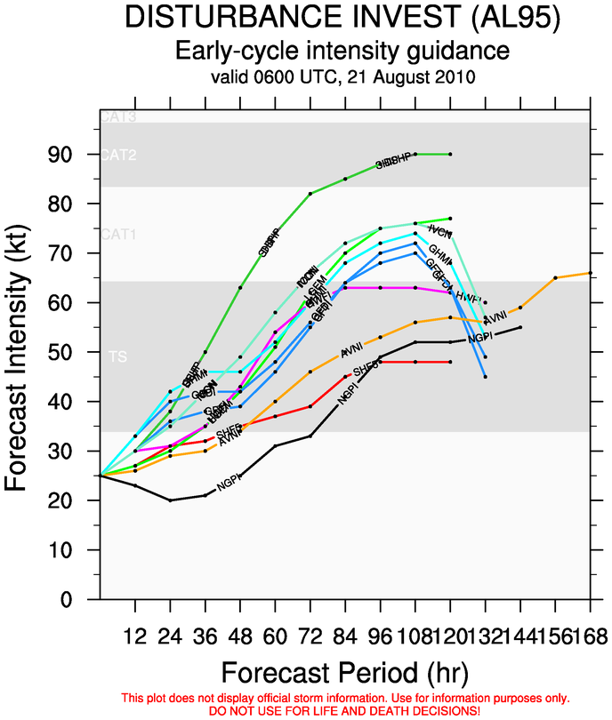
The intensity in the models seem to keep 95L in the yet to tropical storm range (at least for 48 -72 hours) for when it does develop. An outlier does want to have 95L into a hurricane but that is will have to be shown later on. Until the system fully develops, I would take the model intensity with a grain of salt.

Early intensity forecast
Categories
Tropical Weather

TD Five reborn?

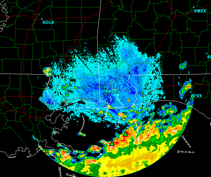
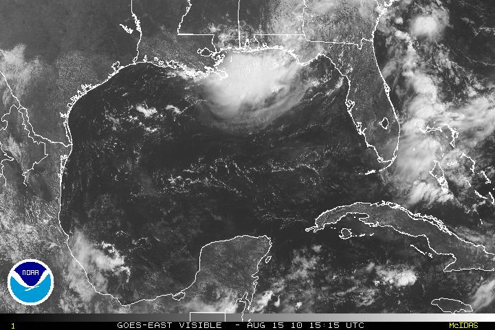
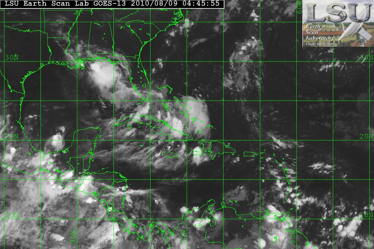
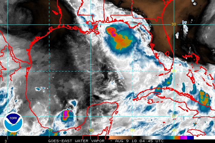
The remnants of Tropical Depression Five and had crossed into LA and moved across the Gulf states, now has a chance to redevelop as a depression again. The storm is headed south/south-westward and may develop as soon as Tuesday. Both satellite and Radar is showing a band of very intense thunderstorms.

Radar image of ex-TD Five
Satellite image of ex-TD Five

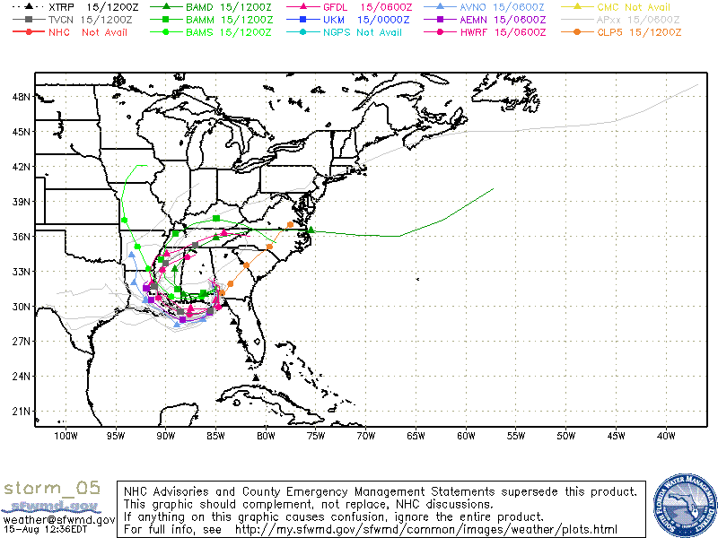
A few models are forecasting that the remnants of ex-TD Five will approach the Gulf coast and begin to develop to at least a tropical depression. If the storm is far enough into the warm waters, and enough time, it may have a chance to develop into a weak tropical storm. Shear is very low 5-15 knots and the regeneration of the storm should occur and if so landfall somewhere around Southeast Louisiana between late Tuesday or Wednesday.

Models of Ex-TD Five
Categories
Tropical Weather

Tropics Unusually Quiet…for now

With EX-Tropical Depression Five still hanging around the Gulf Coast and a few models want to bring it SW and back into the GOM for possible re-emergence and even worse, possible tropical redevelopment – I can’t say that TD#5 has dissipated. Hopefully that forecast will be bust.

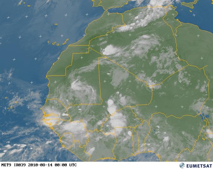
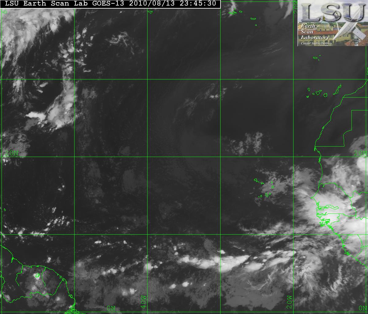
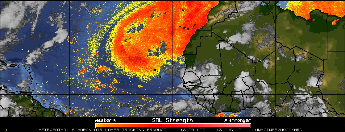
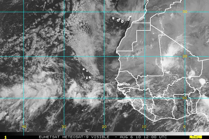
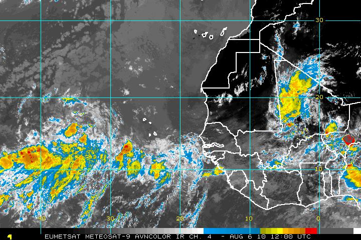
Although, the tropics are somewhat quiet, there are a few systems that will be coming off of Africa that still need to be watched. These waves are somewhat large and at least one may have a chance to develop. The wave further to the north, will probably have problems with the SAL and also it will probably recurve out to the north. The other wave, just to the east of the first wave, is forecast to to head WSW and will be closer to the ITCZ and away from the SAL.

MET 9 satellite image
Satellite image of west Africa
SAL

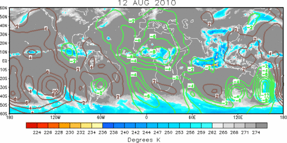
This second wave, once it exits of the coast, this may have a good chance to develop. The MJO (the green in the graphic) in the Eastern Atlantic is in a upward motion which should help in the development.

MJO graphic

For the next month or so, the tropics will be at their peak, so storms will start to roll off off like trains, hopefully though none will have the chance for any landfall.

Categories
Tropical Weather

Invest 94L

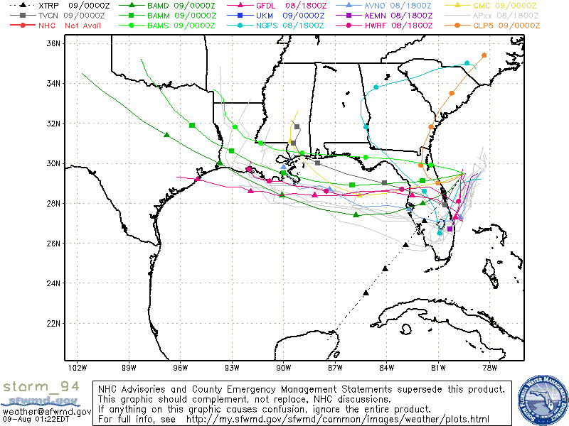
An area of low pressure has been designated as Invest 94L. This area is located off the eastern coast of Florida, near Jacksonville. Invest 94l is moving WSW and will continue to track this way for 12-24 hours. Although it is very difficult to see on satellite imagery it is roughly located at 29° N – 79° W. (Note in the satellite images, Invest 94L is not the large area of convection south of the panhandle of Florida)

Satellite image of Invest 94L
Water Vapor satellite image

Some models want to take Invest 94L westward over the state of Florida and then begin to develop in the NE GOM near the panhandle, then head WNW. Some models have it as nothing but a tropical depression, yet there is another wanting it to develop into a hurricane. Until Invest 94L has entered and into the Gulf – there is no way of knowing.

Models for Invest 94L
Categories
Tropical Weather

Invest 93L

Yesterday, the tropical wave that come off of Africa was designated as 93L. This system has a high chance of developing into a tropical depression within 24-72 hours. The upper level winds are low, the SST’s are warm therefore the atmospheric conditions are conducive for continuing development.

Visible Satellite image of 93L
AVN Satellite image of 93L

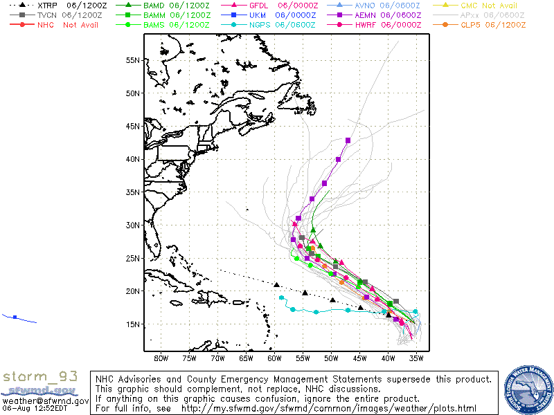
Most of the models tend to take 93L NW for a short period due to a weakness in the steering flow. Following that period, there is a little disagreement on how far west 93L will go before it will begin to turn NNW and then N. This system will probably not be threat to any land masses and will just be a shipping hazard.

Models for 93L
Categories
Tropical Weather

Ex-Tropical Storm Colin & Invest 92L…

There are several tropical systems to monitor.

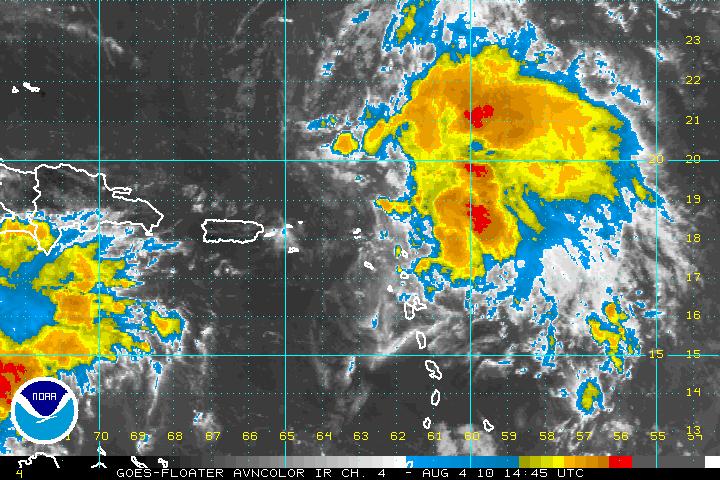
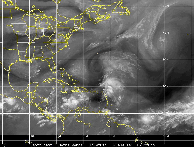
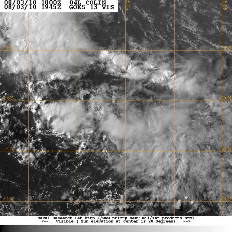
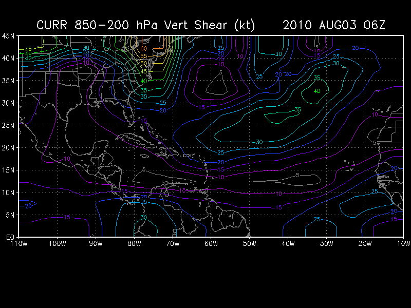
Ex -TS Colin who degenerated to an open wave yesterday is still struggling but is holding it’s own. Colin fell apart due to the wind shear and the remnants are just now north of Lesser Antilles Islands. Wind shear is very high, between 20-25 knots, yet the latest satellite imagery is showing the heavy thunderstorm activity has increased. The remains of Colin is in an area that is unfavorable for any re-development. Colin will soon be under an upper-level low with plenty of dry air and high wind shear.

AVN Satellite image
CIMSS Water Vapor satellite image

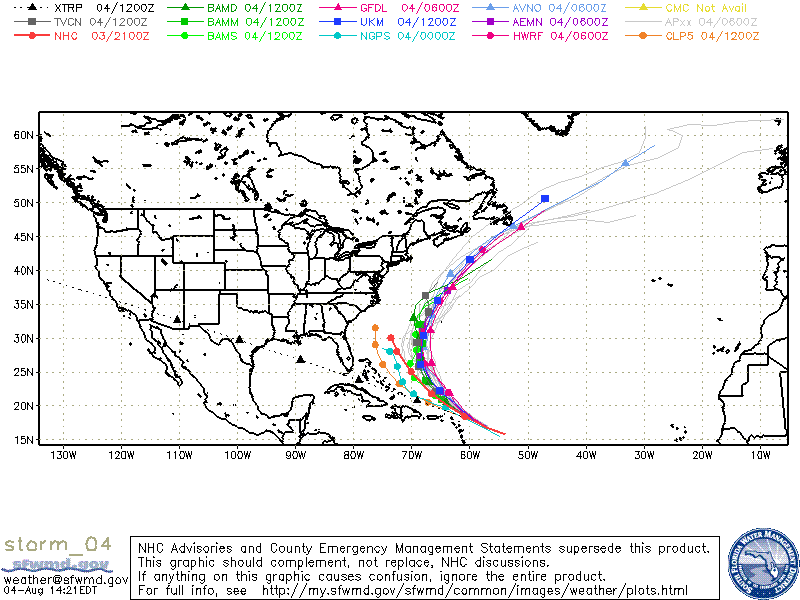
The latest SHIPS model forecast is a dropping of the wind shear from the 15-25 knots down to a 15-20 knot by sometime Thursday or Friday. The major models do predict that Colin will redevelop in the next 3- 4 days. What status Colin will be is still unclear. Tropical Storm is the highest it should attain but that is pushing it. A major trough of low pressure will be moving off the East coast of the U.S. and that trough will “pull” Colin to the Northwest and later out to sea. It may get close to Bermuda possibly sometime Saturday or Sunday. The reconnaissance plane has gone out late today and found that the remains of ex-Colin does not have a closed surface circulation, however they did find tropical force winds in the northeastern quadrant.

Models for ex-Colin

Invest 92L
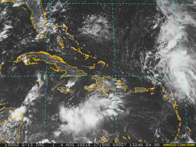
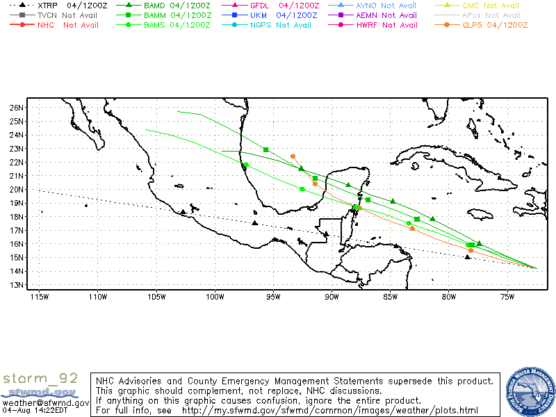
Invest 92L was designated late yesterday. Invest 92L is located in the Caribbean, south of eastern Cuba and Haiti around 16° N – 72° W moving westward at 15-20 mph. The wave is over warm water with very low wind shear. There is some indication that it could develop in the next few days but is is moving very fast and maybe not have enough time to develop into a tropical depression. If it keeps the westward track it should come ashore over Nicaragua/Honduras.

Visible Satellite image of 92L
Models for invest 92L

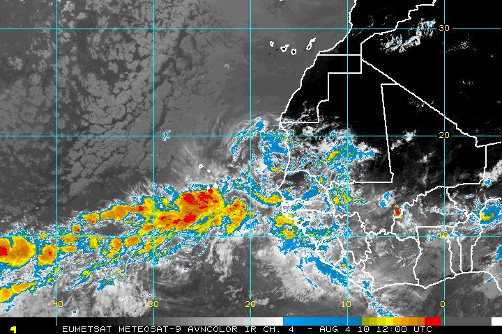
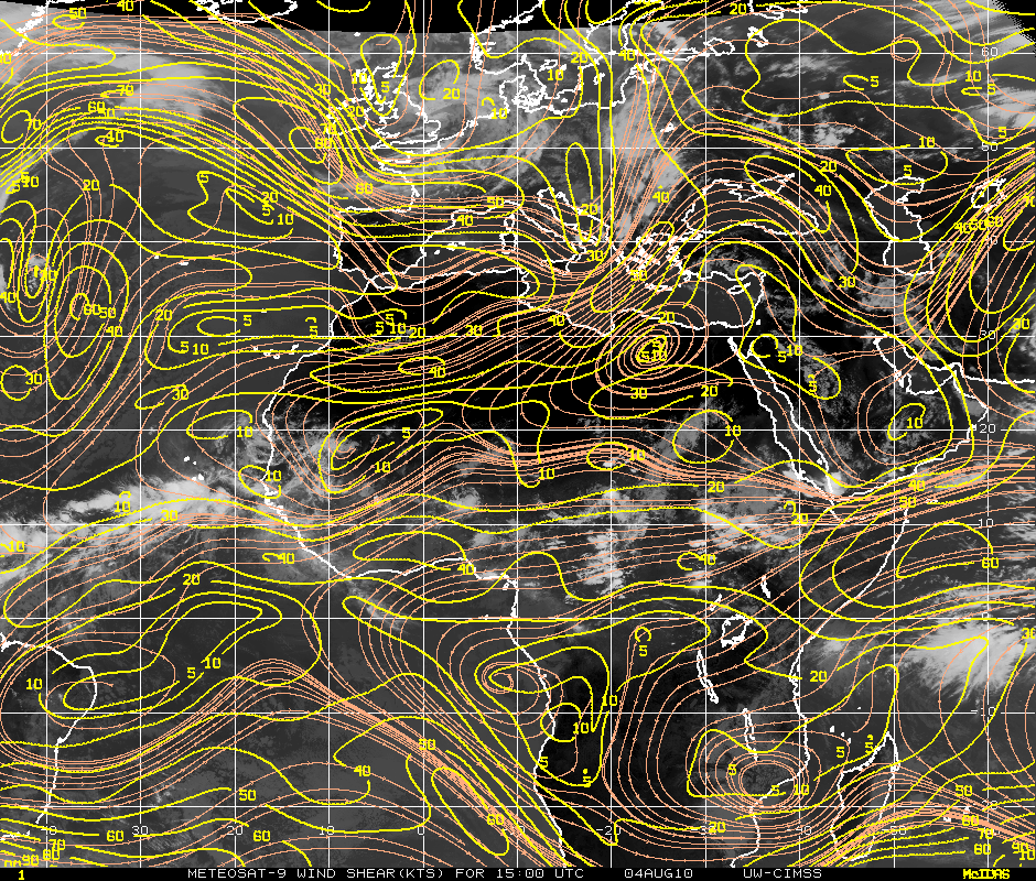
And last on the list is a new system that has just come of the coast of Africa. It has very good cyclonic turning as it heads westward. This system may have problems with both moderate amounts of SAL and as it heads westward it will encounter some wind shear of 20-30 knots.
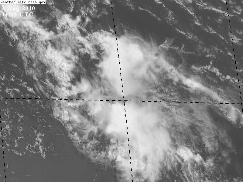
AVN Satellite image - New system off Africa
Wind Shear - Eastern Atlantic/Africa
Categories
Tropical Weather

Tropical Storm Colin

Invest 91L was reclassified as Tropical Depression Four yesterday morning and at 5:00 am today it became the third tropical storm of the season – Colin.

Although it is a tropical storm, it is very small in size. It is also very ragged in appearance. The SST’s in the area of TS Colin are in the 28° – 29° (C) range which is plenty enough for continued development but Colin’s biggest negative is the storm’s size. It makes Colin vulnerable to any mid to upper increases in either dry air entrainment or wind shear. There is some SAL but it is to the northwest of TS Colin and it is not affecting the storm right now.

Satellite image - Tropical Storm Colin

Currently, TS Colin looks very sickly due to some westerly vertical shear along with the rapid forward motion (24 MPH). There is also a question whether Colin has a closed circulation or not. It is a must for a tropical cyclone to have a closed center of circulation other wise it will be downgraded to an open wave.

Vertical Shear Map

The forecast (short term) is fairly simple. If Colin survives the day and/or can find a way to he must do it quickly. The next 24 – 36 hours are crucial for any further development. Beyond that time frame, Colin will start to encounter an increase in the upper level winds caused by a western Atlantic trough. Any further strengthening is not indicated at this time.

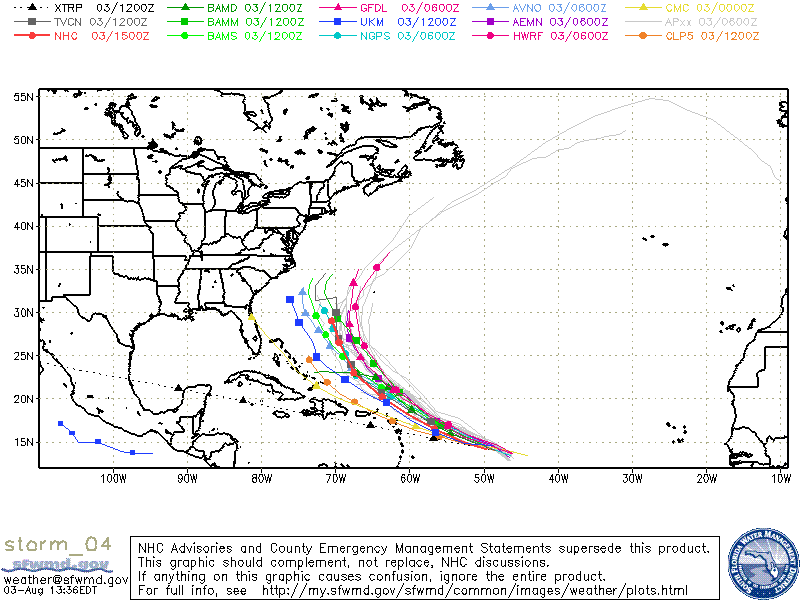
Long term forecast is very difficult. Colin is on the southern side of the low/mid Bermuda high. In 48-72 hours a weakness in that ridge due to mid/upper level near the southeastern coast of the US. This should cause Colin to steer on a WNW pattern and then turn to the the NW as it slows down. At that point, the forecast is very unclear. There is no model consensus at this time. The HWRF and the GFDL models are on the right side of the guidance envelope whereas the Canadian(CMC) and GFDN models are on the left. For this forecast period, the NHC has shifted the track southwest and to the left of the previous model track.

Latest Model Tracks

ADDENDUM:
As expected, Colin did not last long. As of 5:00pm the NHC dropped Colin from as TS to a remnant low and no longer putting out any advisories unless regeneration occurs. There is still a lot of vorticity so regeneration may happen in a 2-3 days.
Colin - now a remnant low